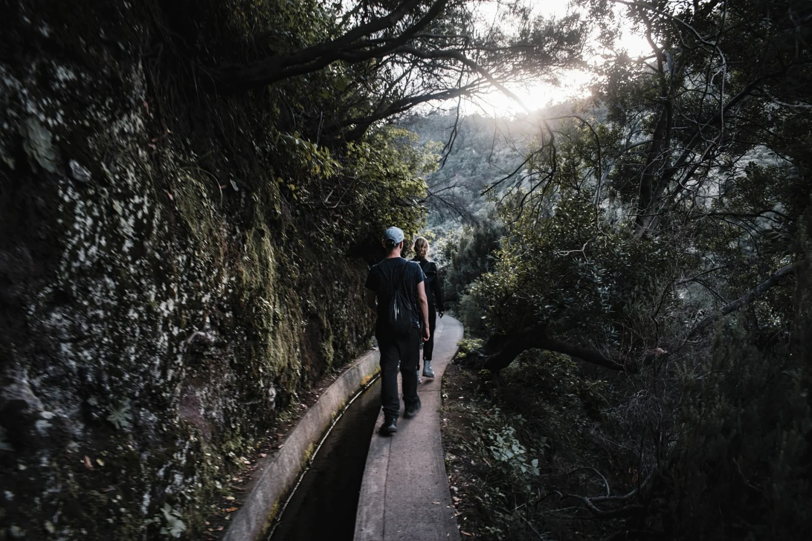
Ten walks through cloud forest, volcanic ridges and water channels that seem to float above the sea.
Madeira is often described as an island of levadas, but that only explains the lines on the map. It does not explain what walking beside one feels like.
A levada may begin as a narrow water channel through farmland, disappear into laurel forest, pass behind a waterfall and emerge on a ledge with the Atlantic far below. Other trails ignore the water entirely and climb through Madeira’s central peaks or cross the dry volcanic peninsula at Ponta de São Lourenço.
The island is compact, yet the walking changes quickly. Funchal can be warm and bright while Pico Ruivo is inside cold cloud. The north coast may be wet while the eastern peninsula is exposed to sun and wind. A short distance on the road can separate two completely different hiking days.
The ten routes below are not ranked from best to worst. Together they show the range of hiking in Madeira: easy viewpoints, long tunnel walks, high ridges, ancient forest and trails where the water seems to travel above the Atlantic.
“In Madeira, the path often follows the water — but the weather decides what the island reveals.”
Ten Madeira Hikes Compared
| Route | Distance | Difficulty | Best for | Useful base |
|---|---|---|---|---|
| Pico Ruivo from Achada do Teixeira | 5.6 km return | Moderate | High peaks and cloud inversion | Santana |
| Ponta de São Lourenço | 6 km return | Moderate | Volcanic cliffs and ocean | Machico / Caniçal |
| Levada do Caldeirão Verde | 17.4 km return | Moderate | Tunnels, forest and waterfall | Santana |
| 25 Fontes and Risco | 8.6 km return + option | Moderate | Classic Rabaçal levadas | Calheta / Ponta do Sol |
| Levada do Furado | 11 km one way | Moderate | Long forest traverse | Ribeiro Frio |
| Vereda do Fanal | 10.8 km one way | Moderate | Ancient laurel trees and mist | Porto Moniz / Seixal |
| Vereda dos Balcões | 3 km return | Easy | A short mountain viewpoint | Ribeiro Frio |
| Levada do Rei | 10.6 km return | Moderate | Dense forest and flowing water | São Jorge |
| Fajã do Rodrigues | 7.8 km return | Moderate | Long tunnels and waterfalls | São Vicente |
| Levada dos Cedros | 7.2 km one way | Moderate | Quiet old-growth forest | Fanal / Porto Moniz |
What Is a Levada?
Levadas are narrow water channels built to move water from Madeira’s wetter mountains and north-facing slopes toward farms, settlements and hydroelectric systems in drier parts of the island. Their maintenance paths later became one of Europe’s most distinctive hiking networks.
A levada walk is often relatively level, but “flat” does not mean effortless. Paths can be narrow, wet and exposed, with low tunnels, steep drops and long sections where turning around is the only escape. A headlamp is essential on tunnel routes, even when a phone flashlight seems adequate at the trailhead.
The forest surrounding many levadas is Laurissilva, a subtropical laurel forest recognised by UNESCO. Mist and rainfall are part of the ecosystem rather than a sign that the day has gone wrong.
Before you go: Madeira’s peaks can change from sunshine to cloud within minutes. Check the mountain forecast carefully before choosing a high route.
01 · Central Massif · PortugalPico Ruivo From Achada do Teixeira
| Distance | Time | Difficulty | Start / finish | Best for |
|---|---|---|---|---|
| 5.6 km return | About 1.5 hours | Moderate | Achada do Teixeira / Pico Ruivo | A first high-mountain day |
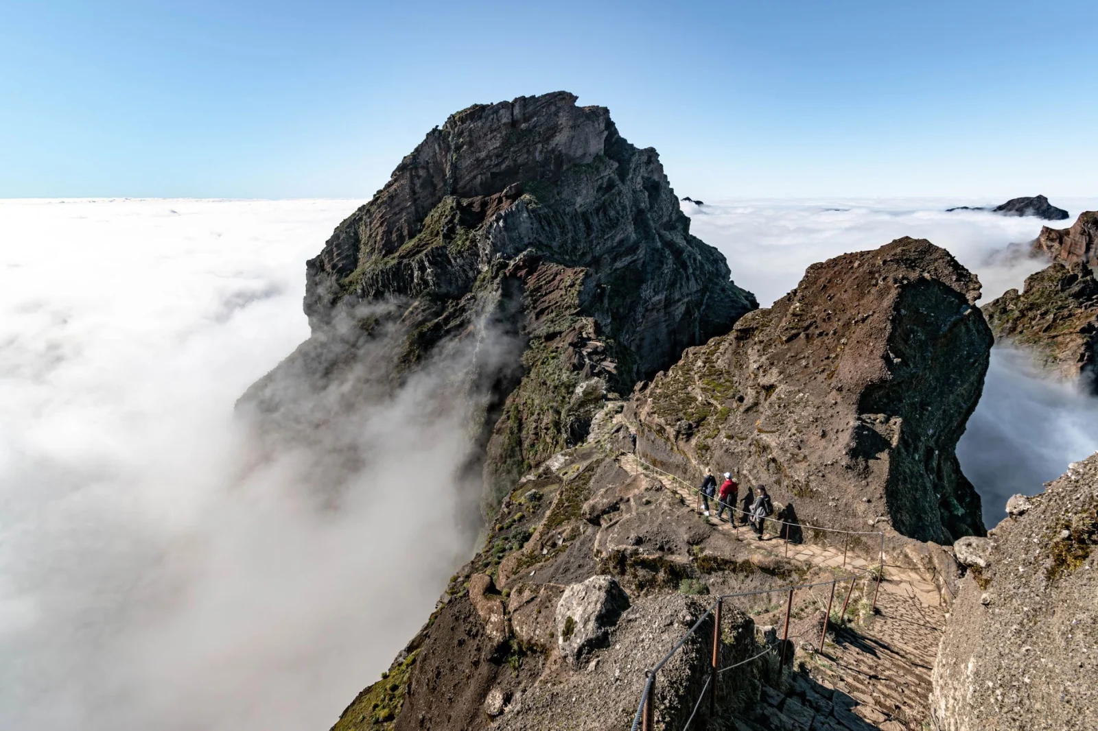
Pico Ruivo is the highest point in Madeira, but the approach from Achada do Teixeira is surprisingly direct. The official PR 1.2 trail covers 2.8 kilometres each way and follows a broad mountain path through the central massif.
The walk is short enough to fit into half a day, yet it still feels like a real summit. Shelters along the route hint at how quickly conditions can change, and the final climb opens views toward Madeira’s deeply cut valleys and neighbouring peaks.
Why It Belongs Here
This is the most accessible way to experience Madeira above the cloud layer. It delivers high-altitude scenery without committing to the much longer and more exposed Pico do Areeiro traverse.
How to Find a Quieter Moment
Book an early entry slot and arrive before the main tour traffic. Sunrise can be beautiful, but only when access, road conditions and visibility make the start safe.
Good to Know
- Carry a warm and windproof layer even when the coast is hot.
- Cloud can remove all views while leaving the route wet and exposed.
- The summit path is not a substitute for the currently restricted full PR1 traverse.
- Use the official Achada do Teixeira route rather than informal shortcuts.
02 · Ponta de São Lourenço · PortugalPonta de São Lourenço

| Distance | Time | Difficulty | Start / finish | Best for |
|---|---|---|---|---|
| 6 km return | About 2.5 hours | Moderate | Baía d’Abra / Casa do Sardinha | Cliffs and Atlantic views |
Ponta de São Lourenço looks as though it belongs to a different island. The forest disappears, the earth turns red and ochre, and the trail runs along a narrow volcanic peninsula between the calmer southern sea and the rougher northern coast.
The path rises and falls rather than climbing steadily. There is little shade, and wind can become the main difficulty even though the highest point on the official route is only about 126 metres.
Why It Belongs Here
It is Madeira’s best coastal hike and the clearest visual counterpoint to the green interior. The trail shows the island’s volcanic structure more openly than any levada walk.
How to Find a Quieter Moment
Choose the first available slot, especially in warmer months. The path feels much more spacious before the midday flow reaches the narrow sections.
Good to Know
- Carry more water than the modest distance suggests.
- Use sun protection; shade is extremely limited.
- Strong wind and heat can be more important than elevation.
- A swim at Cais do Sardinha depends on sea conditions and current access.
Madeira is also a useful contrast to the routes in our guide to Coastal Hikes in Europe: Cliffs, Villages and Empty Beaches.
03 · Caldeirão Verde · PortugalLevada do Caldeirão Verde
| Distance | Time | Difficulty | Start / finish | Best for |
|---|---|---|---|---|
| 17.4 km return | About 6.5 hours | Moderate | Queimadas / Caldeirão Verde | A long tunnel-and-waterfall hike |
The walk begins in Queimadas Forest Park beside a traditional thatched shelter, then quickly enters the humid interior of the island. The levada crosses steep slopes, squeezes through four rock tunnels and reaches a green amphitheatre where water falls from a high cliff into the pool below.
The gradient is gentle, but the distance is not. Narrow sections, darkness in the tunnels and repeated wet surfaces make the day feel more serious than a flat profile suggests.
Why It Belongs Here
Caldeirão Verde is the complete levada experience: historic water engineering, enclosed forest, tunnels, exposure and a waterfall at the end.
How to Find a Quieter Moment
Start with the earliest practical slot and keep a steady pace through the first kilometres. Queimadas becomes busy, but the long distance naturally spreads hikers out.
Good to Know
- Carry a proper headlamp; four tunnels are part of the route.
- Waterproof footwear helps on wet ledges and inside tunnels.
- Do not continue beyond the official open section when closures are posted.
- Allow enough daylight for the full return journey.
04 · Rabaçal · PortugalLevada das 25 Fontes and Risco
| Distance | Time | Difficulty | Start / finish | Best for |
|---|---|---|---|---|
| 8.6 km return, plus Risco option | About 3–4 hours | Moderate | ER105 / 25 Fontes | Waterfalls and a first levada experience |
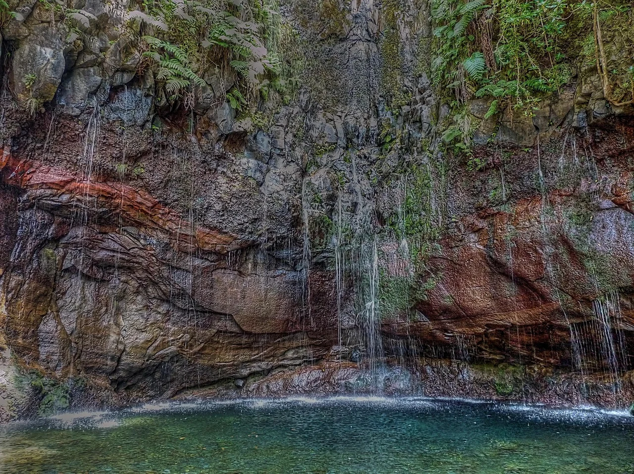
Rabaçal contains several official routes, but 25 Fontes remains the best-known. The trail descends from the Paul da Serra plateau, enters the Laurissilva forest and reaches a pool fed by a fan of small springs.
Levada do Risco shares the initial approach and adds a high waterfall seen from a broad ledge. Combining the two makes more sense than racing to 25 Fontes and immediately returning.
Why It Belongs Here
It is popular for a reason. The route offers water, forest and a clear destination without the long tunnel commitment of Caldeirão Verde.
How to Find a Quieter Moment
Book the earliest slot available or walk later in the day when the first tour groups have left. The narrowest sections feel much better outside peak arrival times.
Good to Know
- The official PR6 distance is 8.6 km return, but the road or shuttle connection can add walking.
- Some sections use one-way traffic management; follow current signs.
- The pool is a fragile place, not a swimming stop.
- Rabaçal weather can be much wetter than the south coast.
05 · Ribeiro Frio · PortugalLevada do Furado
| Distance | Time | Difficulty | Start / finish | Best for |
|---|---|---|---|---|
| 11 km one way | About 5 hours | Moderate | Ribeiro Frio / Portela | A full forest traverse |
Levada do Furado follows one of Madeira’s oldest public water channels from Ribeiro Frio toward Portela. The route spends hours inside Laurissilva forest, then opens views toward terraced farmland and the great rock mass of Penha d’Águia.
Unlike many famous levadas, this one is best understood as a journey. It changes valley, vegetation and perspective before descending toward Portela.
Why It Belongs Here
This is the route for hikers who want a full day of continuous walking rather than one famous endpoint. Its point-to-point shape makes the landscape feel larger.
How to Find a Quieter Moment
The trail is naturally calmer after the first section near Ribeiro Frio. Arrange transport in advance so the finish does not become a roadside problem.
Good to Know
- Plan a taxi, transfer or second car at Portela.
- The route reopened in July 2026 after repair work, showing why current status checks matter.
- Long wet sections can make the stated five hours optimistic for slower groups.
- Do not confuse this route with the short Balcões walk from Ribeiro Frio.
06 · Paul da Serra · PortugalVereda do Fanal
| Distance | Time | Difficulty | Start / finish | Best for |
|---|---|---|---|---|
| 10.8 km one way | About 4 hours | Moderate | Assobiadores / Fanal | Mist, old trees and open plateau |
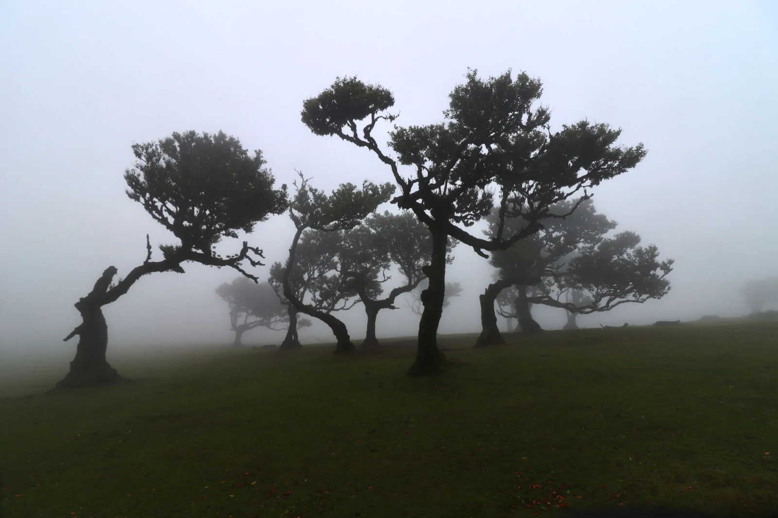
Fanal is often reduced to photographs of twisted trees in fog. The PR13 trail gives those trees a landscape. It crosses the Paul da Serra side of the Laurissilva forest before reaching a small volcanic crater and a grove of centuries-old Til trees.
The route can feel open and bright or enclosed by mist within the same hour. This is one of the few Madeira hikes where poor visibility can add atmosphere — provided navigation and wind remain manageable.
Why It Belongs Here
Fanal is less about one viewpoint than mood, forest structure and the experience of walking through changing cloud.
How to Find a Quieter Moment
Walk the full route rather than driving directly to the famous trees. The car-accessible grove can be busy while the trail remains quiet.
Good to Know
- The official route is linear; arrange transport at Fanal.
- Mist can be beautiful but also makes path finding harder.
- Cattle may be present on the plateau; give animals space.
- Stay on the trail to protect roots and wet ground around the old trees.
07 · Ribeiro Frio · PortugalVereda dos Balcões
| Distance | Time | Difficulty | Start / finish | Best for |
|---|---|---|---|---|
| 3 km return | About 1.5 hours | Easy | Ribeiro Frio / Balcões | Families and a lighter weather day |
Vereda dos Balcões follows Levada da Serra do Faial from Ribeiro Frio to a viewpoint above the Ribeira da Metade valley. On a clear day, Pico do Areeiro, Pico das Torres and Pico Ruivo line the horizon.
The walk is short and straightforward, making it useful after a late arrival, before another route or on a day when the higher peaks are unsuitable.
Why It Belongs Here
Balcões proves that a short walk can still explain Madeira’s scale. Forest, levada and central-mountain views appear in a route almost anyone can fit into the itinerary.
How to Find a Quieter Moment
Go early in the morning or late in the afternoon. The viewpoint is compact, so even a small group can make it feel crowded.
Good to Know
- The view depends heavily on cloud height.
- Keep food away from birds and do not encourage feeding.
- The path can still be damp and slippery despite its easy rating.
- Combine it with Ribeiro Frio rather than rushing through as a roadside stop.
08 · São Jorge · PortugalLevada do Rei
| Distance | Time | Difficulty | Start / finish | Best for |
|---|---|---|---|---|
| 10.6 km return | About 3.5 hours | Moderate | São Jorge / Ribeiro Bonito | A lush north-coast levada |
Levada do Rei begins in a landscape shaped by farming, then becomes progressively greener as it approaches Ribeiro Bonito. Vegetation closes over the water channel, small cascades cross the path and the forest begins to feel almost tropical.
The turnaround point is not a dramatic summit or a single tall waterfall. It is a dense natural sanctuary where water and vegetation have taken over the valley.
Why It Belongs Here
This is one of the best routes for understanding how a levada connects inhabited slopes with Madeira’s protected forest interior.
How to Find a Quieter Moment
The route is generally less pressured than 25 Fontes. A morning start still improves parking and gives more time to visit the old water mill at São Jorge afterward.
Good to Know
- Expect wet overhangs and narrow sections.
- The return follows the same path, so allow space when meeting other hikers.
- Northern weather can remain damp even when Funchal is sunny.
- The route is moderate because of surface and exposure, not steep climbing.
09 · São Vicente · PortugalLevada Fajã do Rodrigues
| Distance | Time | Difficulty | Start / finish | Best for |
|---|---|---|---|---|
| 7.8 km return | About 3.5 hours | Moderate | Fajã da Amã / Ribeira do Inferno | Tunnels and a more adventurous levada |
Fajã do Rodrigues follows the mountainside above São Vicente and enters a series of tunnels before reaching the Ribeira do Inferno valley. The longest tunnels make darkness part of the experience rather than a brief interruption.
Waterfalls, narrow ledges and echoing passages give the route a more adventurous character than its distance suggests.
Why It Belongs Here
This is a strong choice for hikers who have already tried an easy levada and want something more enclosed and unusual without climbing into the central peaks.
How to Find a Quieter Moment
The route receives fewer first-time visitors than 25 Fontes or Caldeirão Verde. Start early enough to move through the tunnels without pressure from groups in both directions.
Good to Know
- A headlamp is mandatory in practice, not optional.
- Protect the head in low tunnel sections.
- Expect water underfoot and falling from the tunnel walls.
- This is a poor route for anyone uncomfortable with prolonged darkness or narrow ledges.
10 · Fanal · PortugalLevada dos Cedros
| Distance | Time | Difficulty | Start / finish | Best for |
|---|---|---|---|---|
| 7.2 km one way | About 3 hours | Moderate | Fanal / Curral Falso | A quieter forest route |
Levada dos Cedros begins at Fanal and follows a 17th-century water channel through mature Laurissilva forest. The path stays close to tall trees and the steep Ribeira da Janela valley before finishing at Curral Falso.
Compared with the famous waterfall routes, this hike is quieter and more subtle. The main attraction is the forest itself: trunks, roots, water and changing green light.
Why It Belongs Here
It offers the calmest version of Madeira’s levada landscape and pairs naturally with Fanal without repeating the same experience.
How to Find a Quieter Moment
This is already one of the quieter official routes. Avoid turning the walk into a rushed transfer; the forest rewards slow stops more than fast mileage.
Good to Know
- The route is linear and finishes on ER209 at a different point.
- Some steep connecting paths make the moderate rating appropriate.
- Wet leaves and roots can be slippery.
- Transport planning matters more than food or café stops on this route.
What About Pico do Areeiro to Pico Ruivo?
The Pico do Areeiro–Pico Ruivo traverse is Madeira’s most famous mountain walk, but it is also the route most likely to make an old article misleading. As of July 2026, official information still limits access from Pico do Areeiro to the Pedra Rija viewpoint rather than presenting the complete traverse as normally open.
Treat PR1 as a live-status route. Check the official trail map and reservation portal shortly before your trip, and do not build the entire holiday around a reopening date. Pico Ruivo remains accessible by PR 1.2 from Achada do Teixeira.
Official Madeira trail-status page ↗Which Madeira Hike Should You Choose?
For a first levada
Choose Levada do Rei or 25 Fontes. Both explain the relationship between forest and water without requiring the long tunnels of Caldeirão Verde.
For mountain views
Choose Pico Ruivo from Achada do Teixeira. Balcões is the shorter alternative when the summit forecast is poor.
For the coast
Choose Ponta de São Lourenço. It is the island’s clearest break from the wet green interior.
For a long day
Choose Caldeirão Verde or Levada do Furado. Both require more commitment than their moderate elevation profiles suggest.
For fewer people
Choose Levada dos Cedros, Levada do Rei or Fajã do Rodrigues.
For atmosphere
Choose Fanal in moving cloud — but only when navigation and wind remain safe.
Where to Stay for Hiking in Madeira
Funchal
Best for restaurants, transport and a first visit. Day tours and transfers are easy to arrange, but most major hikes require a substantial drive.
Santana
The strongest base for Caldeirão Verde, Balcões, Levada do Rei and Pico Ruivo. The north side is wetter and quieter than Funchal.
São Vicente
A good compromise for Fajã do Rodrigues, Encumeada and access to both the north coast and central mountains.
Calheta or Ponta do Sol
Useful for Rabaçal, Paul da Serra and the sunnier southwest. These bases work especially well when hiking is combined with coastal time.
Machico or Caniçal
The most convenient base for Ponta de São Lourenço and eastern trails, with quicker airport access than the western side.
The Best Time for Hiking in Madeira
Spring
Waterfalls and forest are often at their greenest. Weather remains changeable, and high routes can be cold even when the coast feels warm.
Summer
The mountains can provide relief from heat, but exposed routes such as São Lourenço become hot and dry. Start early and carry more water.
Autumn
Warm sea temperatures, softer light and fewer visitors make early autumn attractive. Atlantic systems become more relevant later in the season.
Winter
Madeira remains a hiking destination, but heavy rain, wind and closures can disrupt plans. A flexible itinerary with lower alternatives works better than a fixed list.
The island does not have one forecast: Check the coast, trailhead and highest point separately. Madeira’s ridges, north coast and south coast can experience very different conditions on the same day.
Do You Need a Car?
A car gives the greatest flexibility, but it does not solve every route. Several of Madeira’s best walks are linear, so a transfer or taxi is still needed at the finish. Parking at famous trailheads can also fill early.
- Use official or licensed transfers for Pico Ruivo, Caldeirão Verde and point-to-point levadas.
- Confirm the return pickup before entering a long tunnel route.
- Do not assume mobile coverage will be strong enough to arrange transport at the finish.
- Public buses can support selected routes, but schedules rarely align perfectly with long hiking days.
What to Pack for Hiking in Madeira
- A real headlamp for tunnel routes, plus spare battery or backup light.
- Waterproof shell even when Funchal begins dry.
- Light warm layer for Pico Ruivo, Paul da Serra and exposed viewpoints.
- Shoes with grip for wet stone, roots and narrow levada edges.
- Sun protection and extra water for Ponta de São Lourenço.
- Offline map, reservation confirmation and current trail-status screenshot.
- Small first-aid kit and blister care.
- A compact dry bag or waterproof pouch for electronics.
For a broader checklist that applies beyond Madeira, see our guide to packing for a longer day outside.
Madeira Hiking Safety
Do not enter a closed trail
Closures usually follow fire, landslide, erosion, falling rock or damaged infrastructure. A barrier is not a suggestion.
Use a headlamp in tunnels
Phone lights are weak, awkward and dependent on the same battery used for maps and emergency calls.
Respect exposed levada edges
Some flat routes include serious drops. Stop in a wider place when passing or taking photographs.
Plan for wet surfaces
Water may cross the path even during dry weather. Moss, leaves and polished rock remain slippery.
Turn around before the weather becomes dramatic
Cloud and rain are normal; falling rock, strong wind, flooding water and poor visibility are reasons to retreat.
Frequently Asked Questions
Do Madeira hikes require reservations?
Yes. In 2026, all classified PR trails require an advance reservation through SIMplifica, including free registrations for exempt visitors.
How much do Madeira hiking trails cost?
The general 2026 fee is usually €4.50 per classified route for visitors over 12. PR1 and combined multi-trail products use different prices, so confirm the current fee when booking.
What is the best levada walk in Madeira?
Caldeirão Verde is the most complete long levada experience. Levada do Rei is a calmer first choice, while 25 Fontes is the classic waterfall route.
What is the easiest hike in Madeira?
Vereda dos Balcões is the easiest route in this guide. It is short, clearly marked and still reaches a major viewpoint.
Can beginners hike in Madeira?
Yes, but difficulty labels should be read carefully. A level levada can still be narrow, wet, dark or exposed.
Do I need a headlamp?
Yes for Caldeirão Verde, Fajã do Rodrigues and other tunnel routes. Carry one even when tunnels are not the main attraction.
Can I hike Pico do Areeiro to Pico Ruivo?
Only when the full PR1 route is officially open and available for reservation. Current restrictions have limited access from Pico do Areeiro, while Pico Ruivo remains reachable from Achada do Teixeira.
Is Madeira good for hiking without a car?
It is possible with organised transfers, taxis and selected buses. Linear routes still require careful finish-point planning.
What month is best for hiking in Madeira?
There is no single perfect month. Spring is green, early autumn is warm and quieter, and winter works with flexibility. High wind and heavy rain can affect any season.
Final Thoughts
Hiking in Madeira is not one type of walking. Pico Ruivo belongs to the high Atlantic mountains. São Lourenço is dry and volcanic. Fanal is shaped by mist, while the levadas follow water through valleys that roads barely reveal.
Begin with one classic route, then choose a contrast. Walk 25 Fontes and follow it with São Lourenço. Pair Balcões with Pico Ruivo. Save a quieter levada such as Levada do Rei or Levada dos Cedros for the day when the famous trailhead feels too busy.
Reserve the route, check its live status and leave space for the island to change the plan. Madeira is compact enough to offer another trail — and varied enough that the alternative may become the best day of the trip.