Ten walks where the trail stays close to the sea, from Portuguese fishing paths and Mediterranean coves to Welsh headlands and Sweden’s rocky shore.
A coastal hike changes the usual rhythm of walking. The horizon stays open, villages arrive by harbour rather than road, and the weather can turn before there is a forest or mountain hut to hide in.
Europe’s coast paths range from short cliff-top walks to journeys that take several weeks. Some pass beaches reached only by foot. Others link fishing villages, old customs posts, terraced vineyards and railway towns that happen to sit beside the sea.
The phrase “empty beaches” needs a little honesty. No well-known European coast is guaranteed to be empty in July or August. But walk outside the main holiday weeks, begin beyond the first car park or choose a section between famous stops, and the coastline often becomes quieter surprisingly quickly.
The ten routes below were chosen for variety rather than a strict ranking. They include Atlantic cliffs, Mediterranean limestone, northern beaches and routes that work as either a single day or a longer walking holiday.
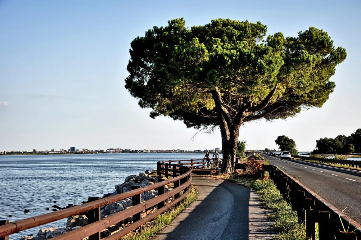
A coastal hike changes the usual rhythm of walking. The horizon stays open, villages appear at sea level, and the trail rarely climbs far from the sound of the water.
Coastal Hikes in Europe at a Glance
| Route | Country | Best format | Why go |
|---|---|---|---|
| Fishermen’s Trail | Portugal | Multi-day | Wild Atlantic cliffs and fishing paths |
| Seven Hanging Valleys | Portugal | Day hike | Golden limestone and sea arches |
| Camí de Cavalls | Menorca, Spain | Day or multi-day | Coves, stone walls and island variety |
| Camí de Ronda | Costa Brava, Spain | Day or 2–3 days | Villages, coves and constant ups and downs |
| Cinque Terre Blue Trail | Italy | Half or full day | Terraced vineyards and famous villages |
| Calanques | France | Day hike | White limestone above turquoise inlets |
| GR34, Brittany | France | Day or multi-day | Headlands, surf beaches and fishing harbours |
| Pembrokeshire Coast Path | Wales | Day or multi-day | Remote cliffs, coves and wildlife |
| Causeway Coast Way | Northern Ireland | 2–3 days | Basalt coast, beaches and historic sites |
| Bjäre Peninsula | Sweden | Day or multi-day | Rocky shore, meadows and fishing villages |
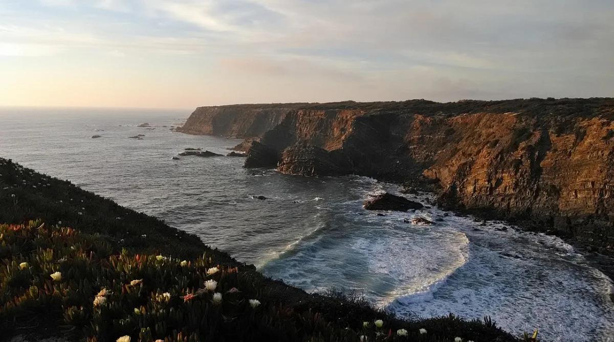
01 · Alentejo CoastFishermen’s Trail, Portugal
The Fishermen’s Trail follows Portugal’s southwest edge with the Atlantic almost permanently in view. The path was shaped by local access to beaches and fishing grounds rather than by a desire to create the easiest possible walking route.
That history explains its character. The trail runs on narrow cliff paths, through dunes and across long stretches of soft sand. Whitewashed villages provide the pauses; between them, the landscape is exposed, windy and often wonderfully spare.
The official route now contains 13 stages and covers 226.5 kilometres. Individual stages reach up to about 22.5 kilometres, and the route is intended for walking between September and June. Summer heat and the sensitivity of the dune environment make the cooler months the more responsible choice.
The section to choose
For a first taste, choose two or three stages around Porto Covo, Vila Nova de Milfontes, Zambujeira do Mar or Odeceixe. Farther south, the coast around Carrapateira, Vila do Bispo and Cabo de São Vicente feels harsher and more exposed.
What makes it different
This is not simply a path above pretty beaches. The sand turns ordinary distances into real effort, while cliff erosion requires constant attention. The reward is an Atlantic journey where the route often feels inseparable from the working coast.
Good to know
- The trail is for walkers only.
- Wild camping is not permitted.
- Large sections are sandy, so daily distances feel longer than they look.
- Stay well back from unstable cliff edges.
- Carry water between villages and protect yourself from sun and wind.
02 · AlgarveSeven Hanging Valleys Trail, Algarve, Portugal
The Seven Hanging Valleys Trail compresses the geology of the Algarve into one manageable day: golden cliffs, sinkholes, natural arches, sea caves and small beaches hidden below the path.
The official route runs for 5.7 kilometres between Praia de Vale Centeanes and Praia da Marinha. It is linear, so walking out and back creates a day of roughly 11.4 kilometres unless transport is arranged at the other end.
The scenery is immediate, but the route is less gentle than its modest distance suggests. The trail repeatedly crosses shallow valleys and descends toward beaches before climbing back to the cliff top. There is little shade and the exposed limestone becomes punishing in summer heat.
The best way to walk it
Start early at Praia da Marinha or Vale Centeanes, walk the complete route and return by taxi or local transport. An out-and-back hike works outside the hottest months, but many walkers underestimate the second half.
When it feels quieter
The beaches and car parks can be crowded in high summer. The walk is more rewarding in spring, autumn and mild winter weather, when low light gives the cliffs more shape and the coastal path feels less like a queue between viewpoints.
Municipality of Lagoa: Sete Vales Suspensos ↗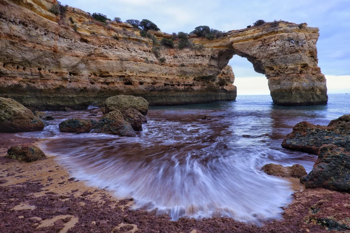
03 · MenorcaCamí de Cavalls, Menorca, Spain
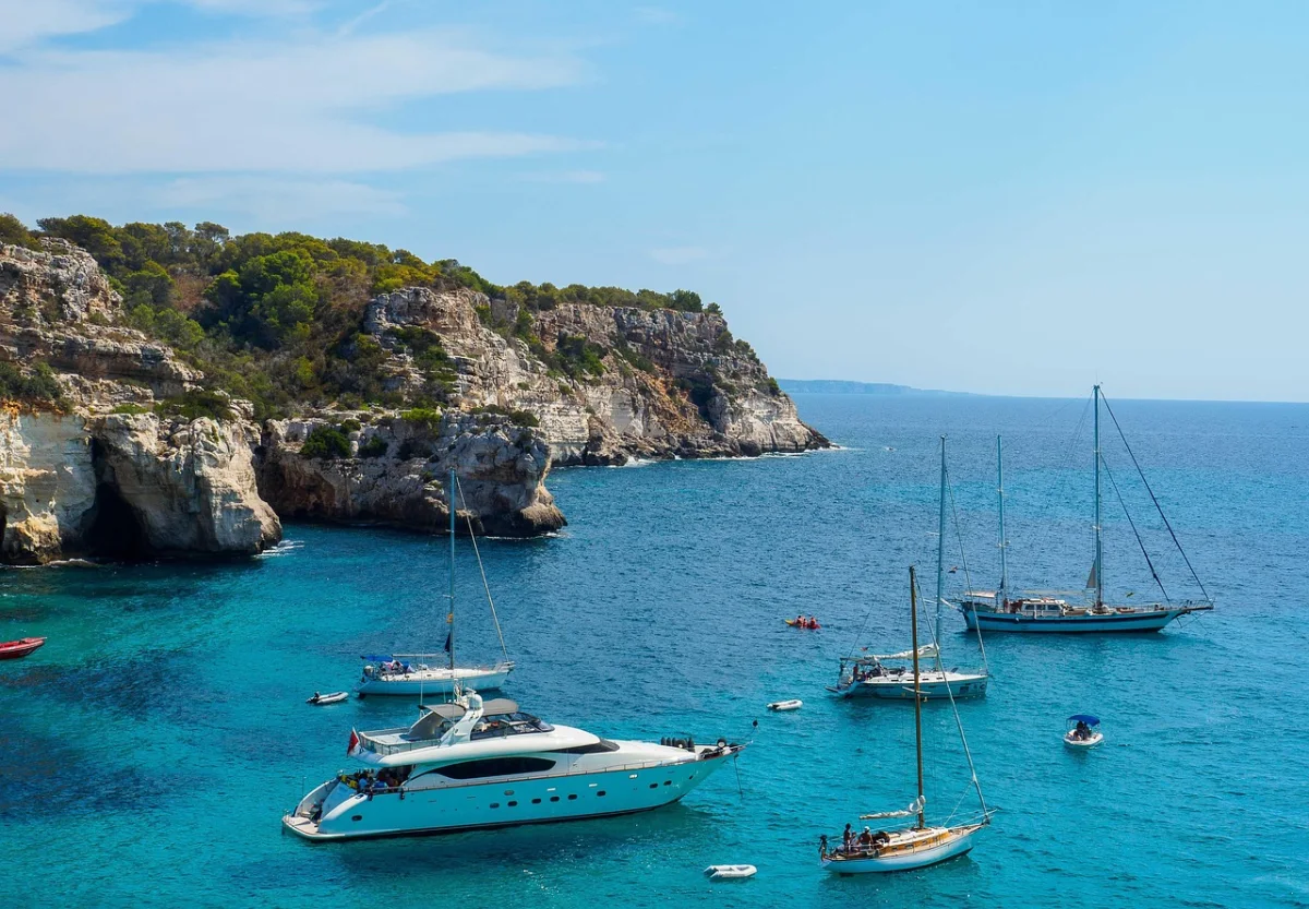
Menorca’s Camí de Cavalls circles the island for approximately 185 kilometres. It is a single route, but it rarely feels like the same coast for long.
The north is rougher, darker and more exposed, with reddish rock, headlands and long sections between services. The south brings pine woods, limestone coves and water that can look almost artificial in clear weather. Near towns, the path brushes resorts and harbours; elsewhere, it reaches beaches that still require a proper walk.
The section to choose
For a dramatic day, walk the northern section from Binimel·là toward Cala del Pilar. The official stage passes an undeveloped stretch of coast and coves including Cala Pregonda, Cala Barril and Cala en Calderer. The terrain is classified as difficult despite the relatively short distance.
For an easier outing, the Punta Nati to Ciutadella section follows a flatter, stony coast past small inlets and the natural rock bridge of Pont d’en Gil before reaching the old harbour.
How to make a longer trip
The full island circuit is commonly divided into eight to thirteen stages. Accommodation is not located directly at every stage boundary, so organised transfers or careful taxi planning can simplify the journey.
Good to know
- There is limited shade on many sections.
- Some remote stages have no water or food services.
- The north and south coasts can experience very different wind and sea conditions.
- Avoid relying on a swim as the only cooling plan; access and waves vary by cove.
04 · Costa BravaCamí de Ronda, Costa Brava, Spain
The Camí de Ronda is less a single uninterrupted footpath than a coastal idea: old patrol routes, village lanes and cliff paths joined along the Costa Brava.
The strongest sections move constantly between heights and sea level. One moment the path crosses a rocky headland; the next it drops by steps into a cove, enters a fishing village and climbs again through pines.
A practical route
A well-established linear itinerary runs 43 kilometres from Sant Feliu de Guíxols to Begur and can be divided into two or three days. It passes beaches, coves and towns including Platja d’Aro, Palamós, Calella de Palafrugell and Tamariu.
For a shorter introduction, walk between Calella de Palafrugell, Llafranc and Tamariu, or choose the quieter Cap de Creus side of the coast near Cadaqués.
Why the distance is deceptive
The route has no major mountain pass, yet repeated stairs and short climbs accumulate. A 15-kilometre day can feel substantial when the path repeatedly falls to sea level and rises over the next headland.
When to go
Spring and autumn provide the best balance of open services, manageable temperatures and quieter coves. The trail can be walked year-round, but storms, wet rock and strong tramuntana winds still require route changes.
Spain.info: Camí de Ronda on the Costa Brava ↗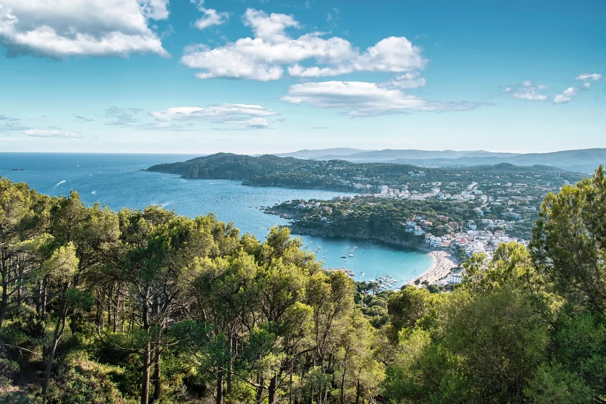
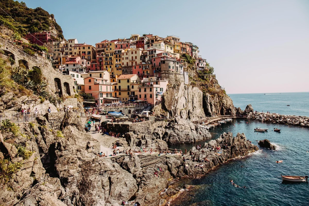
05 · Cinque TerreCinque Terre Blue Trail, Italy
Cinque Terre is the least convincing place in this guide to promise an empty beach. It earns its place for a different reason: few European routes bind walking, villages and a cultivated coastal landscape so tightly together.
The Blue Trail follows sections of the Ligurian coast between the five villages. The classic stretch between Vernazza and Monterosso is only 3.7 kilometres, yet it includes steep stairways, narrow passages and more than 200 metres of climbing.
The section to choose
Walk from Monterosso to Vernazza early in the day, then continue by train or add the Vernazza–Corniglia section if it is open and conditions are suitable. The first climb quickly lifts the trail above the sea, while vineyards and dry-stone terraces show how much labour was required to create this landscape.
How to escape the busiest line
The coastal trail is iconic, but higher paths through sanctuaries and inland villages provide a fuller and often quieter view of the national park. A route through Reggio and Soviore reconnects Vernazza and Monterosso without staying on the most crowded coastal section.
Current access matters
Cinque Terre trail rules and openings change with landslides, maintenance and visitor pressure. In 2026, the park again introduced one-way walking from Monterosso toward Vernazza during selected high-attendance dates. Check the live trail network and card requirements before travelling.
Cinque Terre National Park: Vernazza–Monterosso trail ↗Cinque Terre National Park: Live trail network ↗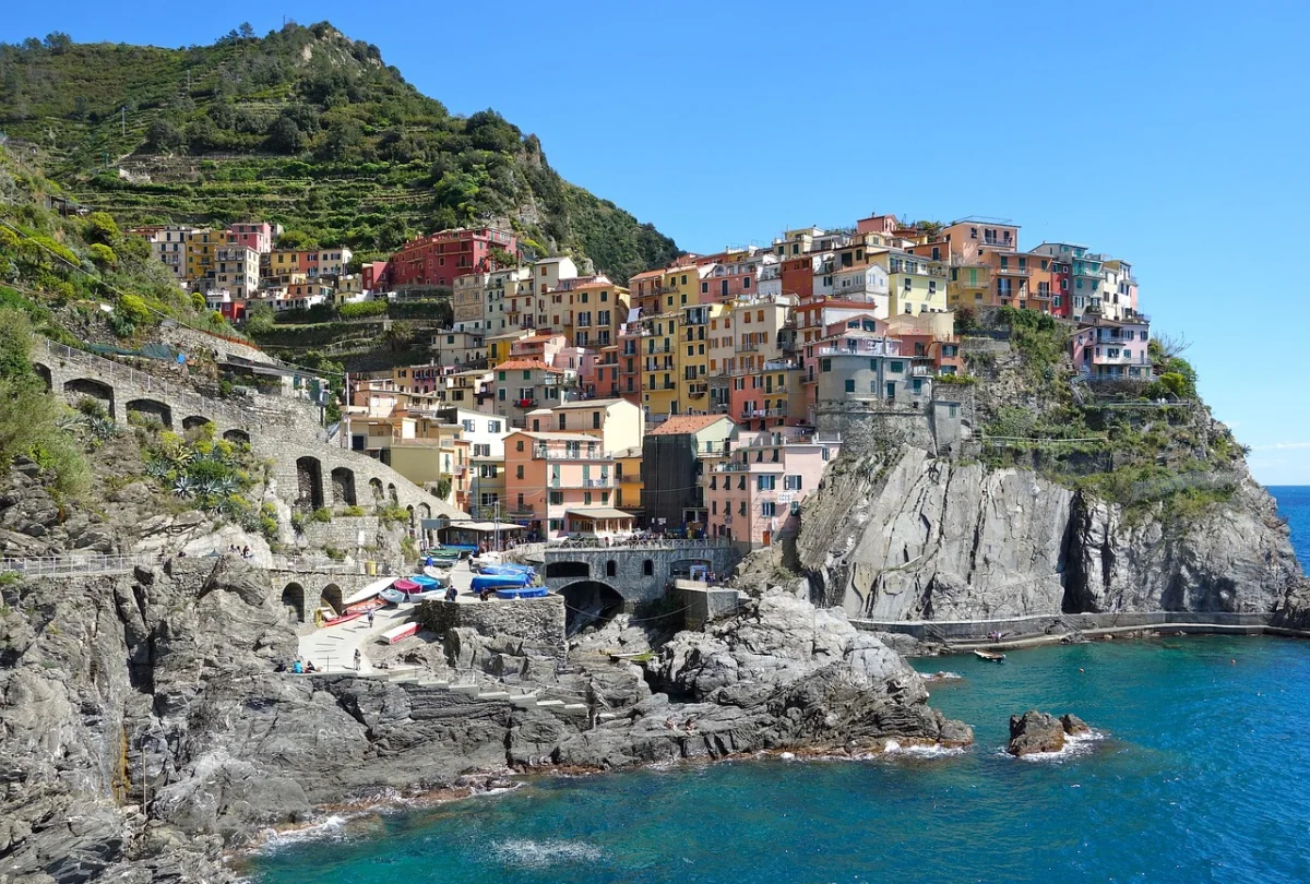
06 · ProvenceThe Calanques Between Marseille and Cassis, France
The Calanques look like a Mediterranean fantasy drawn with unusually severe lines: white limestone ridges dropping into narrow turquoise inlets, with Marseille on one side and Cassis on the other.
The paths are rocky, exposed and often much harder than photographs suggest. Descents into the coves can require careful movement on polished limestone, while the return climb arrives in full sun.
The section to choose
For a manageable day, approach Calanque de Sugiton from Luminy. For a longer and more serious outing, combine Port-Miou, Port-Pin and En-Vau from Cassis. The complete coastal crossing is a demanding undertaking, not a casual beach walk.
Summer is complicated
Fire risk controls access to the park and nearby forest massifs during the dry season. Roads and trails may be restricted or closed, and high-season access to Sugiton can require a reservation. The safest plan is to check official access status on the morning of the hike.
Why shoulder season is better
Spring and autumn bring cooler rock, clearer walking conditions and less pressure on the coves. Even then, strong mistral winds can transform an otherwise sunny day into a poor choice for exposed terrain.
Marseille Tourism: Accessing the Calanques ↗City of Marseille: Current access regulations ↗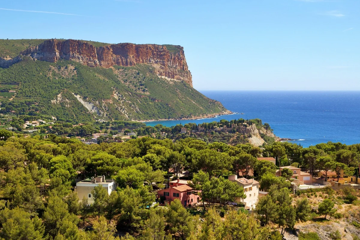
07 · Crozon PeninsulaGR34 on Brittany’s Crozon Peninsula, France
Brittany’s GR34 follows more than 2,000 kilometres of coast, which makes calling it a single hike almost meaningless. The better question is which piece of it to choose.
The Crozon Peninsula provides one of the strongest answers. The trail curves around headlands, pine-backed coves, surf beaches and fishing villages, with weather arriving visibly from the Atlantic.
The section to choose
Base yourself in Morgat or Camaret-sur-Mer and walk sections toward Cap de la Chèvre, Pointe de Dinan and the beaches of La Palue. The path repeatedly changes character, moving from wooded slopes to exposed cliffs and open moorland.
Why it feels different from the Mediterranean
The sea is not a calm blue background. Tides reshape beaches, wind controls the day and brief showers can arrive almost horizontally. This gives the route energy, but also makes waterproof layers and realistic timing essential.
A route for slower travel
The GR34 works particularly well as a series of day hikes from one base. You can use local transport or taxis, return to the same village and still experience a different coastline each day.
Brittany Tourism: GR34, the customs officers’ path ↗Brittany Tourism: Brest and the Crozon Peninsula ↗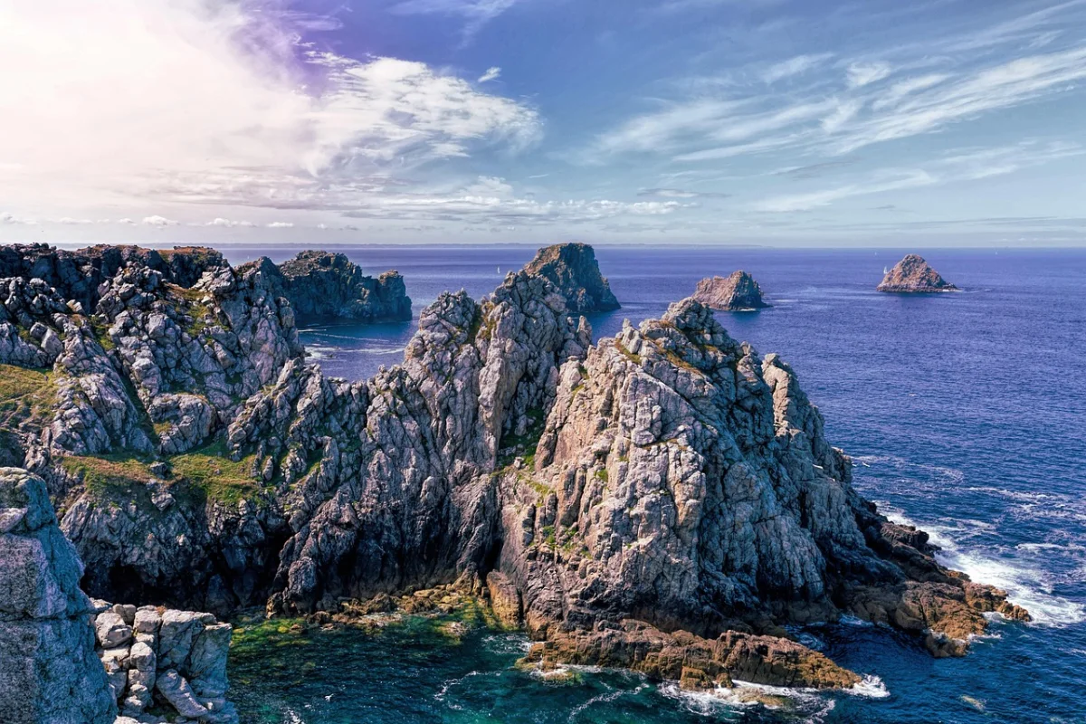
08 · PembrokeshirePembrokeshire Coast Path, Wales
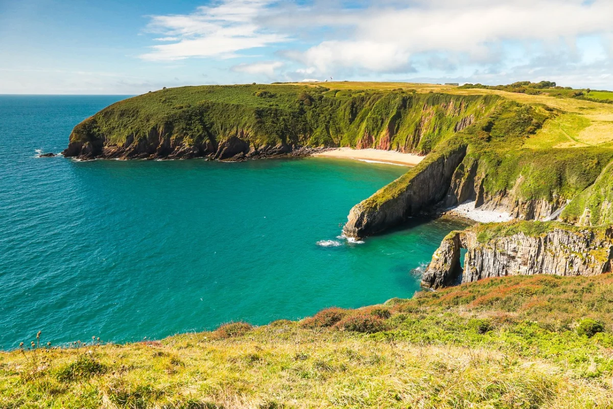
The Pembrokeshire Coast Path runs for 299 kilometres through Britain’s only fully coastal national park. It includes cliffs, beaches and estuaries, but the repeated climbing is what many first-time visitors remember.
The complete trail is commonly planned over about twelve days. Its total ascent and descent make it a serious long-distance walk despite the absence of high mountains.
The section to choose
Porthgain to Whitesands is one of the strongest day sections. The route covers roughly 16 kilometres and passes high cliffs, remote coves and St David’s Head, with long stretches where buildings disappear from view.
Grey seals may be visible below the path, while seabirds and porpoises reward anyone willing to stop looking at the next hill.
Why public transport matters
Pembrokeshire’s seasonal coastal buses make linear day walks possible without returning along the same route. Timetables are not frequent enough to improvise carelessly, so confirm the final bus before starting.
Good to know
- Wind and rain can make exposed sections significantly harder.
- Some parts become very muddy in winter.
- Military range closures affect selected southern sections.
- The path often descends to coves and climbs immediately back to the cliffs.
09 · Causeway CoastCauseway Coast Way, Northern Ireland
The Causeway Coast Way follows Northern Ireland’s north coast between Portstewart and Ballycastle. It connects beaches, cliff paths, harbour towns and some of the country’s best-known historic and geological sites.
The route is low in altitude, with its highest point only a little above 140 metres. That makes it approachable, but not uniformly easy. Wind, wet grass, road sections and the total distance still matter.
The section to choose
The central stretch around Portrush, Dunluce Castle, Portballintrae, the Giant’s Causeway and Ballintoy provides the greatest concentration of scenery. Walking only between the famous landmarks can be busy; the longer links between them reveal quieter beaches and working coastal communities.
How to walk it
The complete route is commonly divided into two or three days. Public transport can support shorter linear walks, although weekend and seasonal timetables require advance planning.
Why it belongs on the list
The route offers a rare combination: a coast path that feels like a journey, yet never becomes so remote that accommodation and food require expedition logistics.
Causeway Coast & Glens Borough Council: Walking ↗Causeway Coast Way official route site ↗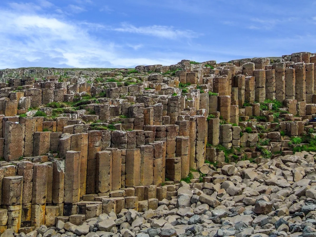
10 · Bjäre PeninsulaThe Bjäre Peninsula, Sweden
Southern Sweden is not the first place most travellers imagine when planning a coastal hiking holiday. That is part of the attraction.
The Skåneleden route around the Bjäre Peninsula combines fishing villages, coastal meadows, woodland and rocky shores. The cliffs of Hovs Hallar provide the strongest drama, while Båstad and Torekov give the route comfortable places to begin or finish.
The section to choose
Walk from Båstad to Hovs Hallar, then continue to Torekov as a two-day trip or use transport to divide the stages. The route becomes rougher around the cliffs, with stone beaches and steep sections that feel more exposed than the modest elevations suggest.
What makes it Scandinavian
The landscape is quieter and less theatrical than the Algarve or Cinque Terre. Coastal grassland, low light, small harbours and broad views create a slower type of beauty. In late summer, swimming can still be part of the day; in spring and autumn, the same coast becomes a place for wind, birds and long lunches indoors.
Good to know
Swedish access rights make the outdoors unusually open, but they do not remove the need to respect private homes, grazing animals, protected areas and fire restrictions.
Skåneleden: Coastal hike on the Bjäre Peninsula ↗Skåneleden: Båstad to Hovs Hallar ↗
Which Coastal Hike Should You Choose?
For a First Multi-Day Coastal Walk
Choose the Camí de Ronda or Causeway Coast Way. Both provide regular villages, accommodation and clear stage options without requiring a long commitment.
For the Wildest Atlantic Feeling
Choose the Fishermen’s Trail, western Pembrokeshire or the Crozon Peninsula. These routes place weather and exposure at the centre of the experience.
For Swimming and Walking
Menorca, the Costa Brava and the Algarve offer the easiest combination, especially outside the busiest summer weeks. Check sea conditions before assuming every cove is safe for swimming.
For a Short, Spectacular Day
The Seven Hanging Valleys Trail and the Vernazza–Monterosso section deliver strong scenery in a relatively small distance. Both become much harder in heat and crowds.
For Fewer International Visitors
The Bjäre Peninsula, selected GR34 sections and the longer links on the Causeway Coast provide a quieter alternative to Europe’s headline Mediterranean trails.
The Best Time for Coastal Hiking in Europe
Spring
Spring is one of the strongest periods for Portugal, Spain, southern France and Italy. Temperatures are manageable, flowers cover exposed slopes and beaches are quieter. Atlantic routes may still be wet and windy.
Summer
Northern routes in Wales, Northern Ireland, Brittany and Sweden become more reliable. Mediterranean walks can be dangerously hot and crowded, with additional fire restrictions in places such as the Calanques.
Autumn
Early autumn is excellent across much of Europe. Sea temperatures may remain comfortable in the south, while crowds fall. Shorter daylight, storms and reduced transport schedules become more important later in the season.
Winter
Portugal, southern Spain and selected Mediterranean routes can provide mild walking days. High waves, erosion, closed services and slippery rock still require conservative route choices.
Coastal Hiking Safety: What Changes Beside the Sea
Cliff Erosion
Do not stand at the edge simply because the grass or path appears solid. Coastal cliffs can fail without warning, and informal shortcuts often move closer to unstable ground.
Tides
Some beaches, estuaries and low paths become impassable at high tide. Check tide times when the route description identifies a tidal section, and never rely on crossing wet rocks around a headland.
Wind
A moderate forecast can feel much stronger on an exposed headland. Crosswinds affect balance, while offshore wind makes swimming and inflatable equipment especially dangerous.
Heat and Shade
Many Mediterranean coastal paths have almost no shade. Begin early, carry more water than the distance alone suggests and avoid planning the hardest climb for the middle of the day.
Escape Routes
A path beside villages can still contain long sections without road access. Know where the next inland exit is and whether it leads to transport, accommodation or only another remote road.
What to Pack for a Coastal Day Hike
- Shoes with grip for loose rock, sand and wet steps.
- Windproof and waterproof outer layer.
- Sun protection, including a hat that stays secure in wind.
- Enough water for exposed sections without services.
- Offline map and current route information.
- Small first-aid kit and blister supplies.
- Swimwear only when the route and sea conditions make swimming realistic.
- A dry bag or waterproof pouch for electronics.
- Light insulating layer for Atlantic and northern coasts.
- Tide information when the route includes beaches or estuaries.
Frequently Asked Questions
What Is the Best Coastal Hike in Europe?
For a complete multi-day experience, Portugal’s Fishermen’s Trail is difficult to beat. For a single day, the Seven Hanging Valleys Trail, the Calanques and selected sections of Pembrokeshire provide very different but equally memorable options.
Which Coastal Trail Is Best for Beginners?
The Causeway Coast Way and easier sections of the Camí de Cavalls are the most approachable choices in this guide. Beginners should still check daily distance, surfaces and transport rather than judging difficulty only by elevation.
Can You Hike Europe’s Coasts Without a Car?
Yes. Cinque Terre has excellent rail access, while Pembrokeshire, the Causeway Coast, Costa Brava and parts of Brittany have buses or trains that support linear walks. Frequency may be limited outside summer.
Are Coastal Hikes Easier Than Mountain Hikes?
Not necessarily. Coastal routes may remain low in altitude but accumulate large amounts of ascent through repeated descents to coves and climbs over headlands. Sand, wind and heat also increase effort.
Which Route Has the Quietest Beaches?
Remote sections of the Fishermen’s Trail, northern Menorca, western Pembrokeshire and Brittany offer the best chance of finding uncrowded beaches. Timing matters more than the route name: walk outside weekends and peak summer.
Can I Camp Along These Trails?
Rules differ by country and protected area. The Fishermen’s Trail explicitly prohibits wild camping, while other routes restrict camping to designated sites. Confirm local rules rather than relying on general national assumptions.
Do I Need Hiking Boots?
Light hiking shoes or trail shoes work on many dry sections, but grip and stability matter more than footwear category. Cinque Terre requires appropriate hiking footwear, and rugged routes such as the Calanques or Pembrokeshire are poor places for smooth-soled sandals.
Final Thoughts
The best coastal hikes in Europe are not simply mountain walks with the sea added to the view. They have their own logic.
Portugal’s fishing paths make sand and wind part of the challenge. Menorca and the Costa Brava connect coves with old routes between settlements. Cinque Terre shows a coast shaped by centuries of cultivation, while the Calanques reduce the landscape to white rock and blue water.
Farther north, Brittany, Pembrokeshire, the Causeway Coast and southern Sweden trade Mediterranean colour for weather, wildlife and a greater sense of space.
Choose the season as carefully as the route. Check access, tides and wind, then walk beyond the first viewpoint. The beach may not be completely empty, but the trail often becomes quieter long before the coast runs out.