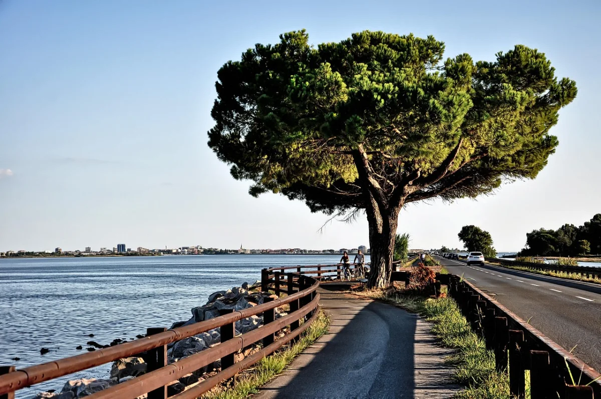
Eight stages, two countries and one of Europe’s most satisfying changes of landscape—from the Salzach River and the Hohe Tauern to old railway tunnels, Friulian towns and the Adriatic lagoon.
The Alpe-Adria Cycle Route is one of the rare long-distance bike journeys whose story is easy to understand before you have ridden a single kilometre: begin in Salzburg, cross the Alps and finish with your front wheel beside the Adriatic Sea.
The classic itinerary covers roughly 410 to 415 kilometres and is normally divided into eight stages. Distances vary slightly between official tracks, local variants and accommodation choices, but the overall structure remains consistent. You follow the Salzach into the mountains, climb through the Gastein Valley, cross the main Alpine ridge by train, descend through Carinthia and then enter Italy for the former Pontebbana railway path through the Canal Valley. The final days cross the Friulian plain through Udine, Palmanova and Aquileia before reaching Grado.
This is not a completely flat rail trail. The Austrian half includes sustained climbing, particularly before Bad Gastein and on the approach from Villach toward the Italian border. However, the train through the Tauern Tunnel removes the most difficult part of the Alpine crossing, while the Italian mountain stage is predominantly downhill. For reasonably active cyclists, the route is challenging enough to feel like a journey without requiring racing fitness.
The guide below uses the traditional eight-stage plan. Faster riders can combine stages, while travellers who prefer long lunches, sightseeing or shorter days should allow nine or ten cycling days.
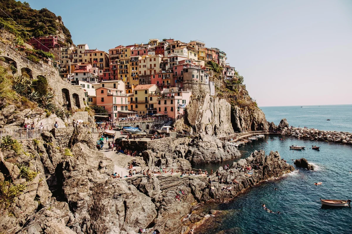
A route that starts beside Salzburg’s river paths and ends by the Adriatic works best when you plan it as a journey, not a race against daily distances.
Official Alpe-Adria Cycle Route overview ↗The Classic Eight-Stage Itinerary
The following distances are deliberately rounded. Treat them as planning figures rather than a substitute for the current official GPX track, because minor route changes and hotel locations can alter the daily total.
| Stage | Route | Distance | Character |
|---|---|---|---|
| 1 | Salzburg to Bischofshofen | About 55 km | River riding, Hallein, Golling and Werfen |
| 2 | Bischofshofen to Bad Gastein | About 52–55 km | The main climbing day |
| 3 | Bad Gastein to Spittal an der Drau | About 55–60 km + train | Tauern Tunnel and a long descent |
| 4 | Spittal an der Drau to Villach | About 40 km | Easy riding beside the Drau |
| 5 | Villach to Tarvisio | About 37 km | A steady climb to Italy |
| 6 | Tarvisio to Venzone | About 57–65 km | Railway tunnels and viaducts |
| 7 | Venzone to Udine | About 50–57 km | Foothills, villages and the Friulian plain |
| 8 | Udine to Grado | About 58–60 km | Palmanova, Aquileia and the lagoon |
01 · Salzburg · AustriaStage 1: Salzburg to Bischofshofen
The route begins with a gentle departure rather than an immediate mountain test. From Salzburg’s historic centre, the cycle path follows the Salzach south through a broad valley where the mountains gradually move closer.
The first day commonly passes Hallein, Golling and Werfen. Hallein provides an early cultural stop linked to the region’s salt history, while the approach to Werfen brings one of the stage’s defining views: Hohenwerfen Castle standing above the valley beneath the Tennengebirge.
Most of the day feels approachable, but it should not be treated as a completely effortless warm-up. The route trends gradually upward, and luggage weight becomes noticeable during the later kilometres. Riders arriving in Salzburg on the same morning should also account for time spent collecting a rental bike, fitting panniers and navigating out of the city.
Where to Stop
- Hallein for coffee, bakeries and a first break beside the Salzach.
- Golling for lunch or a shorter first-stage overnight.
- Werfen for castle views and a memorable stop beneath the mountains.
- Bischofshofen for the traditional stage finish and good onward transport connections.
Practical Stage Advice
Use this day to adjust the bicycle rather than trying to set a fast average speed. Small saddle, handlebar or pannier problems are easier to solve before the longer climb toward Bad Gastein.
SalzburgerLand: Alpe-Adria Cycle Path ↗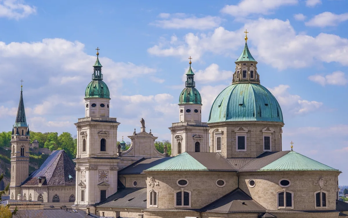
02 · Gastein Valley · AustriaStage 2: Bischofshofen to Bad Gastein
This is the stage that determines how difficult the Alpe-Adria feels. The route continues through St. Johann im Pongau and Schwarzach before turning into the Gastein Valley, where the climbing becomes more sustained.
Dorfgastein and Bad Hofgastein provide useful places to pause before the final approach to Bad Gastein. The spa town is built on steep slopes around a waterfall, so the last kilometres can feel harder than the elevation profile suggests. Reaching your accommodation may involve an additional climb through town.
Strong touring cyclists will normally complete the stage without difficulty, but casual riders should begin early and avoid treating the first half as a race. An e-bike makes this section much more accessible, although battery management matters: use lower assistance levels in the easier valley sections and save capacity for the final climb.
Why Bad Gastein Is Worth the Effort
Bad Gastein is more than a convenient overnight stop. Its Belle Époque buildings, steep streets and central waterfall create one of the most distinctive stage finishes on any European cycle route. Arriving early leaves time to walk through the centre without the bicycle.
A Gentler Alternative
Riders who want shorter stages can divide the journey in St. Johann, Dorfgastein or Bad Hofgastein. This is often a better decision than beginning the trip with two demanding days and discovering too late that the luggage, heat or bike fit is causing problems.
Official route and stage planning ↗03 · Tauern · AustriaStage 3: Bad Gastein to Spittal an der Drau
The third stage contains the route’s most unusual logistical feature. Cyclists continue through Böckstein and cross the main Alpine ridge by train through the Tauern Tunnel to Mallnitz-Obervellach.
The train transfer is part of the classic route, not a shortcut for riders who have failed to climb a pass. It converts what would otherwise be a major Alpine obstacle into a short rail journey and allows a broad range of cyclists to complete the route.
After Mallnitz, the character changes immediately. The route descends through the Möll Valley, passing mountain scenery associated with the Hohe Tauern before gradually losing altitude toward Möllbrücke and Spittal an der Drau.
Using the Tauern Train with a Bicycle
Check the current ÖBB timetable and bicycle-carriage information shortly before travelling. Service patterns, engineering works and loading arrangements can change. Arrive with enough time to purchase the correct ticket and follow staff instructions rather than planning a tight connection.
The tunnel transfer is short, but the complete stage is not. The descent is rewarding and can encourage higher speeds, particularly with a loaded bike. Keep enough distance from other riders and do not assume that every bend, crossing or surface transition is designed like a closed railway path.
ÖBB: Tauern motorail and current operating information ↗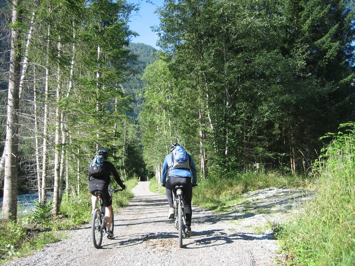
04 · Carinthia · AustriaStage 4: Spittal an der Drau to Villach
After the climbing and tunnel logistics of the previous days, the ride to Villach functions as a recovery stage. The route follows the broad Drau Valley for roughly 40 kilometres, largely on cycle paths and quiet roads.
This is a good day to begin later, stop for a longer lunch or deal with practical tasks such as washing cycling clothes and checking brake pads. Riders with extra energy can add a short detour, but there is no need to turn every easier stage into a test.
Villach is one of the most useful overnight stops on the route. It has a major railway station, bicycle services, supermarkets and a compact centre. It is also a sensible place to join or leave the Alpe-Adria if you do not have time for the complete Salzburg-to-Grado journey.
Should You Add a Rest Day in Villach?
A rest day makes sense when you are travelling with children, using a heavily loaded touring bike or combining the route with additional cycling before Salzburg. The lakes around Villach provide optional side trips, while the city itself is large enough to make a non-cycling afternoon easy.
Visit Villach: Alpe-Adria Cycle Path ↗05 · Tarvisio · ItalyStage 5: Villach to Tarvisio
The fifth stage follows the Gail Valley toward Arnoldstein and the Austrian-Italian border. Although the distance is shorter than most other days, the route gains elevation and should not be dismissed as an easy transition.
After several days of travelling through Austria, the border crossing creates a clear sense of progress. Tarvisio sits in a multilingual corner close to Austria and Slovenia, and the food, architecture and rhythm of the route begin to feel different.
This is also the final stage before the famous long descent through the Canal Valley. Riders often become impatient to reach the railway path, but Tarvisio is worth an overnight stay rather than a hurried lunch stop.
Optional Detour to the Fusine Lakes
The Laghi di Fusine are among the most attractive side trips near Tarvisio, but adding them increases the distance and climbing. Treat the lakes as a deliberate extension or rest-day ride rather than assuming they sit directly beside the official through-route.
Border and Navigation Advice
Carry identification and keep offline navigation available even though the route is signed. Signage styles change across the border, and temporary works can redirect cyclists away from the expected line.
Official Alpe-Adria stage overview via Villach ↗06 · Canal Valley · ItalyStage 6: Tarvisio to Venzone
For many cyclists, this is the day they remember most clearly. South of Tarvisio, the route uses long sections of the former Pontebbana railway through Val Canale and Canal del Ferro.
The path passes old stations, tunnels, bridges and viaducts while gradually descending beside the Fella River. Towns and villages such as Malborghetto, Ugovizza, Pontebba, Chiusaforte and Resiutta provide natural places to stop.
Because the profile trends downhill, the stage can feel almost effortless compared with the Gastein Valley. That does not mean it should be rushed. Former railway stations have been reused as cafés and rest points, and the changing valley deserves more than a high average speed.
Tunnels and Lighting
Take front and rear lights even for a summer daytime ride. Some tunnels are long enough to become dark and cool, while sunglasses can make the transition from bright sunlight more difficult. A light layer is useful when the weather is warm outside but the tunnel air is noticeably colder.
Why Finish in Venzone?
Venzone is a compact walled town reconstructed after the 1976 earthquake. Its size makes it ideal for a cycling stop: accommodation, dinner and an evening walk can all be reached without adding another transport problem at the end of the day.
PromoTurismoFVG: Tarvisio to Venzone stage ↗07 · Friuli · ItalyStage 7: Venzone to Udine
The seventh day leaves the narrow mountain corridor and moves toward the Friulian plain. The transition is gradual: the route first passes Gemona del Friuli and lower hills before the landscape opens toward Udine.
This stage is less theatrical than the railway descent, but it is important to the route’s overall rhythm. You are no longer simply descending from the Alps; you are entering a different cultural and agricultural landscape.
Gemona is the most obvious early stop. Later sections pass villages and secondary roads where navigation deserves attention. Do not assume that every junction will feel as unmistakable as the old railway line.
An Evening in Udine
Udine is one of the best places on the route for a longer evening. After several mountain towns, the city brings arcaded streets, Venetian-influenced squares and a much wider choice of restaurants. Secure bicycle storage matters more here than in a small rural guesthouse, so confirm it when booking.
PromoTurismoFVG: Venzone to Udine stage ↗08 · Grado · ItalyStage 8: Udine to Grado
The final stage is almost entirely flat, but it contains enough cultural stops to fill a complete day. Leaving Udine, the route crosses the plain toward Palmanova, the fortified town whose geometric star shape is best understood from above but whose gates and central square are equally impressive from a bicycle.
The next major stop is Aquileia, one of the most important Roman archaeological areas in northern Italy. The basilica and its mosaic floor make this more than a convenient coffee break. Allow enough time to lock the bicycle securely and visit at least part of the site.
From Aquileia, the final kilometres move toward the lagoon. The mountains have disappeared behind you, the air changes and the route reaches Grado across a flat coastal landscape. Finishing beside the Adriatic gives the journey a clear physical conclusion that many long-distance routes lack.
Do Not Rush the Last Day
The easy profile encourages riders to combine sightseeing with a fast finish. In practice, Palmanova, Aquileia and the approach to the lagoon can make this one of the longest days in terms of elapsed time. Leave Udine early if you want to arrive in Grado with enough daylight for a swim, dinner and photographs.
PromoTurismoFVG: Complete Italian Alpe-Adria route ↗Grado tourism: Cycling in and around Grado ↗How Difficult Is the Alpe-Adria Cycle Route?
The route is often described as accessible because it uses cycle paths, quiet roads and a train through the highest part of the Alps. That description is fair, but it can create the wrong expectation.
A cyclist still needs to complete eight consecutive days, manage luggage, cope with changing weather and climb for long periods in the Austrian section. The route is easier than crossing a major Alpine pass entirely under your own power, but harder than a flat river route such as the Danube Cycle Path.
You Are Ready for the Route If…
- You can comfortably ride 50 to 65 kilometres on two consecutive days.
- You have practised riding with the luggage you intend to carry.
- You can repair a puncture or have a clear assistance plan.
- You are comfortable braking and cornering on long descents.
- You can continue riding in light rain and cooler mountain conditions.
Who Should Consider an E-Bike?
An e-bike is useful for less experienced riders, mixed-ability couples and anyone who wants to enjoy the route without making the Gastein climb the central challenge.
Choose a model with enough battery capacity for a long climbing day and confirm charging arrangements at every overnight stop. Range estimates displayed on the handlebar are not guarantees; weight, gradient, wind, temperature and assistance level all matter.
What Type of Bike Is Best?
Touring or Trekking Bike
This is the most straightforward choice. A rear rack, stable handling, comfortable position and tyres wide enough for occasional gravel make a trekking bike well suited to the route.
Gravel Bike
A gravel bike works well for experienced riders who pack lightly. Use durable tyres rather than an aggressive racing setup, and make sure the gearing is low enough for the Austrian climbing stages.
Road Bike
The route can be completed on a road bike, but narrow high-pressure tyres are less forgiving on unpaved sections, rough transitions and wet surfaces. A wider endurance setup is more practical than a pure race bike.
E-Bike
E-bikes are common on the route. The main practical concerns are battery range, charging, total bicycle weight and transport. Confirm that trains, shuttles and accommodation can handle the specific bike, particularly if it is unusually heavy.
Tyres and Gearing
For most riders, puncture-resistant tyres around 35 to 45 millimetres wide provide a good balance of comfort and efficiency. Lower gearing is more valuable than maximum speed. A heavily loaded bicycle can make a moderate gradient feel much steeper after several hours.
Best Time to Cycle from Salzburg to Grado
The usual season runs from late spring into early autumn, but no single month guarantees ideal conditions across the entire route.
May and Early June
The valleys are green and the Italian plain may still be comfortable, but the Austrian mountains can be cold and wet. Confirm that the Tauern transfer, accommodation and seasonal services are operating.
Late June
Late June often provides long daylight and a good balance between open services and manageable heat. It is one of the strongest periods for the complete route.
July and August
These months provide the most reliable tourism infrastructure but also bring more cyclists, higher accommodation demand and potentially intense heat in Friuli. Begin the Udine-to-Grado stage early and plan extra water stops.
September
September can offer cooler air, quieter paths and excellent riding. Days are shorter, mountain mornings are colder and transport schedules may change later in the month.
Navigation and Signposting
The Alpe-Adria is well established and signed, but no long-distance route should be ridden with signposts as the only navigation method.
- Download the current official GPX track before departure.
- Keep the route available offline on a phone or GPS device.
- Carry a power bank and the correct charging cables.
- Check official route notices for diversions and construction.
- Do not follow an old GPX track blindly when local signs indicate a closure.
Navigation is easiest on the old railway stage and more important through towns, roadworks and the transition from Venzone toward Udine.
Booking Accommodation
The traditional stage towns make planning simple, but they also concentrate demand. Bad Gastein, Villach, Tarvisio and Grado can become expensive or fully booked during summer weekends.
What to Confirm Before Booking
- Secure overnight bicycle storage.
- Whether an e-bike battery can be charged safely.
- The earliest breakfast time or availability of a packed breakfast.
- Laundry or drying options after rain.
- Late check-in rules if the stage takes longer than expected.
- Whether the property is far above or outside the stage town.
A hotel advertised as being in Bad Gastein or Udine may add several steep or urban kilometres to the route. Check the exact map location rather than booking only by town name.
Luggage: Carry It Yourself or Use a Transfer?
Self-supported panniers provide flexibility and make the trip feel like a complete journey. They also increase climbing effort, braking distance and the time required to organise each morning.
Luggage transfer is useful for families, first-time cycle tourists and riders using lighter bicycles. The disadvantage is that you become tied to a fixed stage plan and must have bags ready at the required time.
A compromise works well: carry rain gear, valuables, tools, water and one change of clothing on the bike while sending the main bag ahead.
Practical Packing List
- Helmet and cycling gloves.
- Front and rear lights for tunnels and poor visibility.
- Waterproof jacket and a light insulating layer.
- Two water bottles or equivalent carrying capacity.
- Spare inner tubes or tubeless repair equipment.
- Tyre levers, pump and a basic multi-tool.
- Chain lubricant and a small cloth.
- Power bank, charging cables and offline maps.
- Sunscreen and sunglasses.
- Compact first-aid supplies.
- Identification, payment cards and some cash.
- A strong lock for town and sightseeing stops.
Avoid packing for every imaginable emergency. The route passes regular towns and services. Reliability, waterproof organisation and a comfortable total weight matter more than carrying a miniature workshop.
Food and Water Along the Route
The Alpe-Adria is not a remote wilderness route. Bakeries, supermarkets, cafés and restaurants appear regularly, but opening hours can be limited in smaller villages and on Sundays.
Carry enough food to complete the stage even when the planned café is closed. A simple combination of sandwiches, fruit, bars and an emergency snack is normally sufficient.
Water planning becomes especially important on hot Italian stages. Refill whenever the opportunity is convenient rather than waiting until both bottles are almost empty.
How to Return from Grado
The return journey requires more planning than the arrival in Salzburg because Grado does not have a central railway station.
Option 1: Bicycle Bus or Bus Connection
Seasonal bicycle buses may connect Grado with Udine or other railway points. Capacity, operating days and bicycle reservations can change, so verify the exact service before beginning the trip.
Option 2: Private Bicycle Shuttle
A private shuttle is the simplest solution for a group or for riders returning directly toward Austria. It is more expensive but avoids repeated loading, limited bicycle spaces and tight train connections.
Option 3: Ride to a Railway Station
Some cyclists continue by bike toward Cervignano-Aquileia-Grado station and use regional trains from there. Check the current route, traffic conditions and bicycle rules before deciding that this is the easiest option.
Option 4: Extend the Trip
A longer itinerary can continue toward Trieste or connect with other Friuli Venezia Giulia cycle routes. This turns the arrival in Grado into a stage rather than the end of the journey.
Visit Villach: train, bus and shuttle return information ↗How to Shorten the Route
The railway network makes several shorter versions possible.
- Begin in Villach and ride approximately four stages to Grado.
- Begin in Tarvisio for the predominantly downhill Italian mountain section.
- Finish in Villach if the Austrian Alpine half is your main interest.
- Use trains to skip a stage when weather, illness or mechanical problems intervene.
The Tarvisio-to-Grado section is particularly suitable for less experienced touring cyclists because it combines the former railway descent with flatter stages across Friuli.
Is the Alpe-Adria Suitable for Families?
The complete route can work for cycling families with experience of multi-day distances, but the answer depends more on the children’s riding background than on age alone.
The Austrian climbing stages, mixed surfaces, road crossings and long daily distances make the full eight-day itinerary unsuitable as a first family cycle tour.
Families new to cycle touring should consider the Italian section from Tarvisio to Grado, divide it into shorter stages or use an e-bike and luggage transfer. The railway path south of Tarvisio is attractive for families, but tunnels still require lights and careful group riding.
Frequently Asked Questions
How Many Days Do You Need?
Eight cycling days form the classic itinerary. Strong riders can complete the route in six or seven days, while nine or ten days allow more sightseeing and shorter stages.
Which Direction Is Better?
Salzburg to Grado is the preferred direction. The main climbing arrives early, the Italian railway section trends downhill and the Adriatic provides a satisfying finish.
Can You Ride the Route Without an E-Bike?
Yes. A reasonably fit cyclist with appropriate gearing can complete the route on a touring, trekking or gravel bike. Training with luggage is more important than owning a particularly fast bicycle.
Is the Entire Route Traffic-Free?
No. Large sections use dedicated cycle paths, but the route also includes quiet roads, town streets, crossings and short connections where normal traffic is present.
Is Camping Practical?
Campsites can be incorporated into the trip, but they do not always align neatly with the classic stage towns. Wild camping rules differ between Austria and Italy and should not be assumed to permit informal overnight stays.
Can You Rent a Bike in Salzburg and Leave It in Grado?
One-way rental is possible only through selected tour operators or specialist rental arrangements. Confirm the return location, battery charger, repair support and luggage equipment before booking transport or accommodation.
What Is the Most Beautiful Stage?
Tarvisio to Venzone is the most distinctive cycling stage because of the old railway tunnels, bridges and long descent. Bad Gastein to Spittal offers the strongest sense of crossing the Alps, while Udine to Grado provides the most satisfying cultural and geographical finish.
Can You Ride Only the Italian Section?
Yes. Tarvisio to Grado is a strong four-day journey of roughly 180 kilometres, depending on the selected track and overnight stops. It removes the hardest Austrian climb while retaining the railway path, historic towns and coastal finish.
Three Ways to Plan the Journey
The Classic Eight-Day Route
1. Salzburg to Bischofshofen
2. Bischofshofen to Bad Gastein
3. Bad Gastein to Spittal an der Drau
4. Spittal an der Drau to Villach
5. Villach to Tarvisio
6. Tarvisio to Venzone
7. Venzone to Udine
8. Udine to Grado
A More Relaxed Ten-Day Route
Divide the climbing stage before Bad Gastein, add a rest or short day in Villach, and split either Tarvisio–Venzone or Udine–Grado. This version provides more time for Palmanova, Aquileia and the towns along the old railway.
A Four-Day Italian Route
1. Tarvisio to Venzone
2. Venzone to Udine
3. Udine to Grado, split with an overnight near Palmanova or Aquileia if preferred
4. A final relaxed day in Grado or onward transport
Final Thoughts
The Alpe-Adria succeeds because the landscape never remains the same for long. Salzburg’s river paths become Alpine valleys, the hardest climb ends in the unusual train journey through the Tauern ridge, Carinthia provides a long transition and the old Pontebbana railway carries riders into Italy through tunnels and over viaducts.
The final days are not simply an easier run to the coast. Venzone, Udine, Palmanova and Aquileia give the route cultural weight, while the lagoon approach to Grado provides a finish that feels earned.
Plan the transport before the hotels, train with the luggage you will actually carry and leave enough space in the schedule for weather or mechanical problems. The route is most enjoyable when it is treated as a journey between regions rather than a list of daily distances to complete.