The Dolomites are no longer a destination where you can expect to have every famous viewpoint to yourself. At Lake Braies, Seceda, Tre Cime and Lake Sorapis, the busiest summer days can involve full car parks, crowded trails and queues for the same photographs.
That does not mean a peaceful Dolomites hiking trip is impossible.
The region covers many separate valleys and mountain groups, yet most visitors concentrate on a relatively small number of headline locations. Walk beyond those places and the experience can change quickly: quieter paths, less pressured mountain huts and enough space to stop without blocking a stream of hikers.
The eight destinations in this guide are not secret. Some still become busy on sunny weekends, particularly around easily accessible huts and viewpoints. However, they generally offer more room and a slower atmosphere than the Dolomites’ most famous trails.
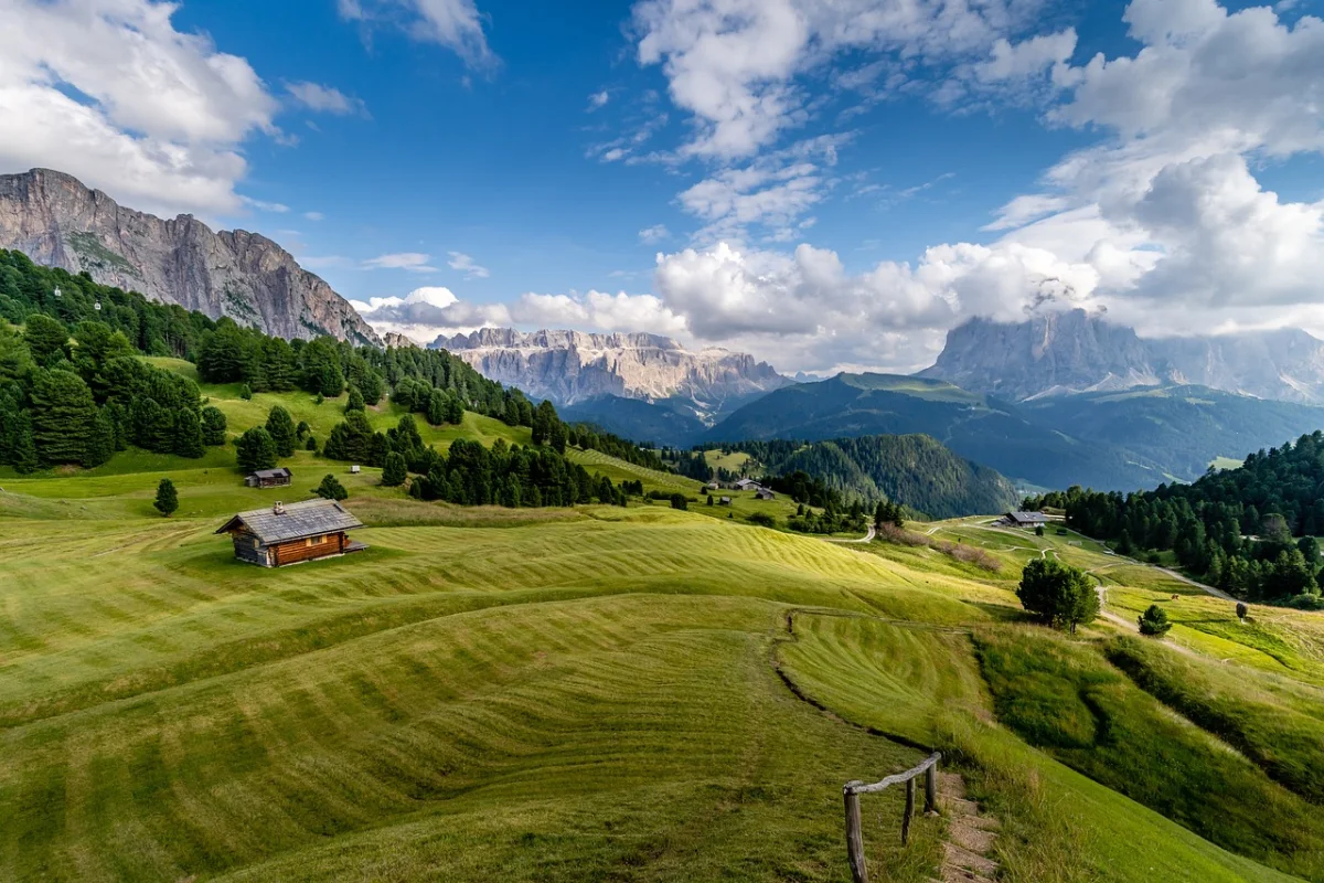
The quieter Dolomites are rarely secret. They simply begin beyond the first car park, cable car or famous viewpoint.
Quieter Dolomites Hikes Compared
| Hike or valley | Area | Typical effort | Best for |
|---|---|---|---|
| Val Venegia and Baita Segantini | Pale di San Martino | Moderate half-day or full-day walk | Open valley scenery |
| Sass de Putia circuit | Passo delle Erbe | Around 4 hours | A complete mountain circuit |
| Val Canali and Rifugio Treviso | Pale di San Martino | Easy to moderate | Forests, huts and flexible routes |
| Fuciade Basin | Passo San Pellegrino | Easy | Families and relaxed walking |
| Val Duron | Val di Fassa | Flexible half-day or full-day walk | Long meadows and mountain huts |
| Val Contrin | Alba di Canazei | Moderate | Marmolada scenery without the main crowds |
| Mondeval Plateau | Passo Giau | Moderate | High plateaus and archaeology |
| Rifugio and Lake Coldai | Val di Zoldo | Moderate | Civetta and rugged mountain scenery |
01 · Pale di San MartinoVal Venegia and Baita Segantini
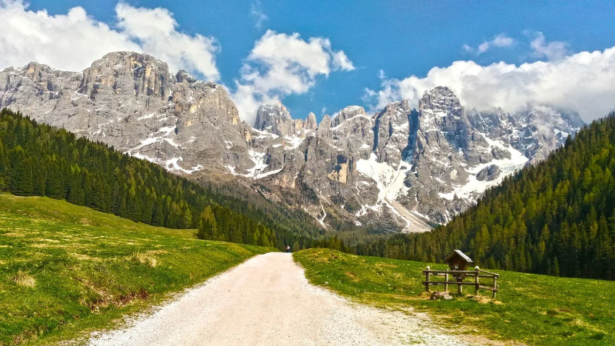
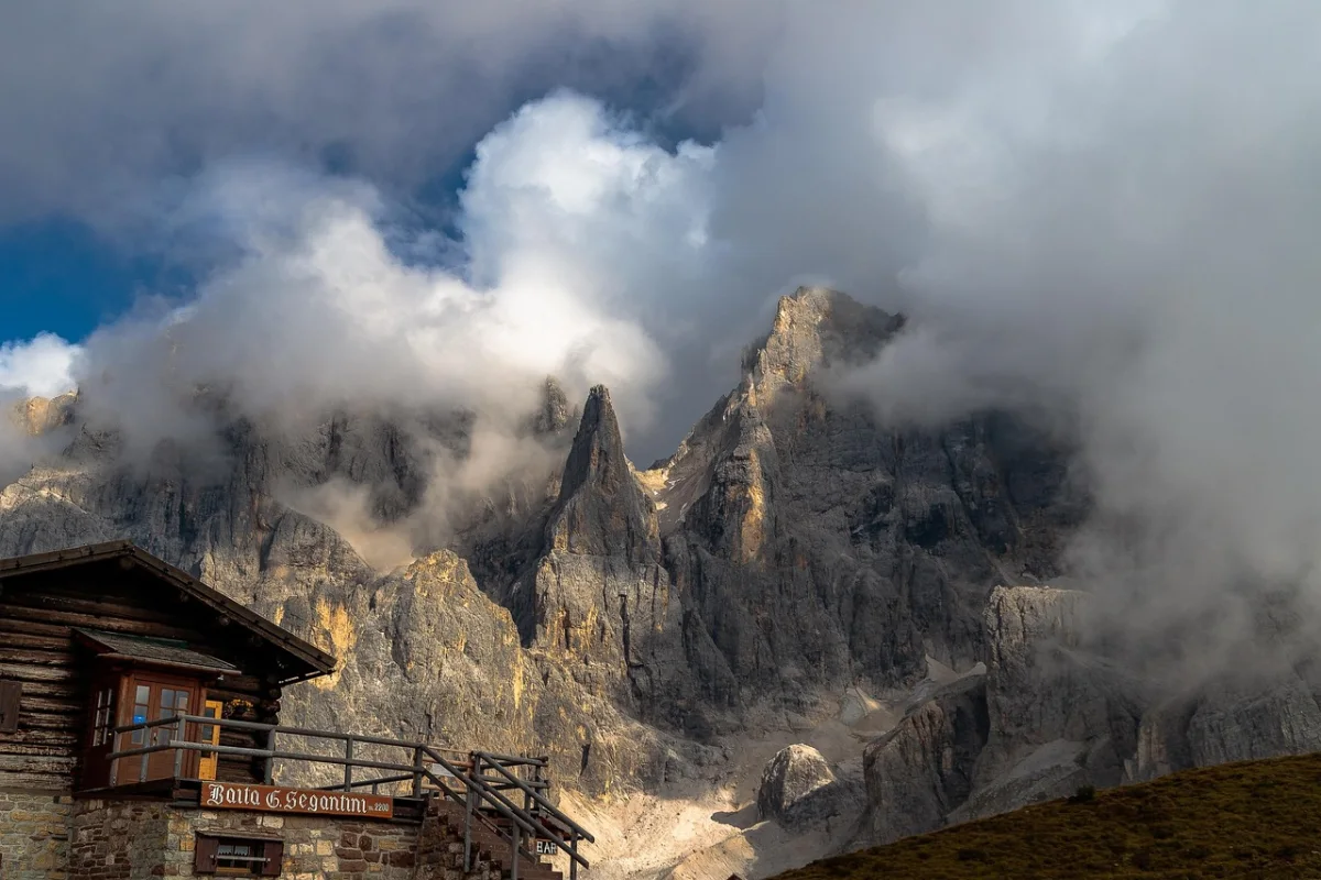
Val Venegia is a broad glacial valley beneath the Pale di San Martino. Its landscape feels open from the beginning, with streams, grazing land and increasingly dramatic views toward Cimon della Pala and the surrounding rock towers.
The standard route passes Malga Venegia and Malga Venegiota before climbing toward Baita Segantini at approximately 2,200 metres. A longer circuit can continue toward Passo Rolle, Capanna Cervino and Malga Juribello before returning to the starting area.
A commonly described circuit covers approximately 12 kilometres with around 500 metres of elevation gain and takes about four hours. Much of the lower route follows a broad track, while the climb toward Baita Segantini provides the main effort.
Route information for Val Venegia and Baita Segantini ↗Why It Feels Quieter
Baita Segantini itself is well known and can attract photographers, cyclists and walkers. The difference is that the surrounding valley provides enough space for visitors to spread out.
Many people arrive near the upper viewpoint from Passo Rolle and leave quickly. Walking through the complete valley creates a slower experience and allows you to spend more time away from the busiest access points.
Starting early or visiting in September makes the contrast even stronger.
How to Plan the Walk
There are several possible starting points and route variations. A simple outing follows the valley to one of the mountain dairies and returns along the same track.
For a more substantial day, continue to Baita Segantini and complete the wider circuit. The high point is exposed to sun, wind and rapidly changing weather, so carry an extra layer even when the lower valley feels warm.
Who Is It Best For?
Val Venegia is ideal for hikers who want:
- big scenery without exposed climbing;
- a route that can be shortened easily;
- mountain huts and dairy stops;
- a mixture of forest, meadows and open high terrain;
- an alternative to the busier central Dolomites.
The lower valley is suitable for a relaxed family outing, while the full circuit is better for walkers comfortable with a longer mountain day.
02 · Passo delle ErbeThe Sass de Putia Circuit from Passo delle Erbe
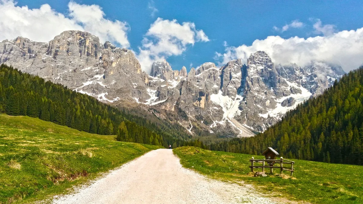
Passo delle Erbe, also known as Würzjoch or Ju de Börz, lies beneath the distinctive Sass de Putia mountain on the northern edge of the Puez–Odle Nature Park.
The area is less internationally famous than Seceda or Alpe di Siusi, but the scenery is immediately impressive. Broad meadows surround the mountain, while the circuit moves between its steep rock walls, high passes and quieter grazing land.
The standard Sass de Putia circuit is approximately 12.9 kilometres long, takes around four hours and gains about 639 metres. It reaches its highest point at the Peitlerscharte or Forcella de Putia, at roughly 2,357 metres.
Official Sass de Putia circuit information ↗What the Route Is Like
From Passo delle Erbe, the walk begins on a broad track through meadows beneath the mountain’s northern face.
The route then becomes steeper and rockier as it climbs toward Forcella de Putia. After crossing the pass, it descends through grassland and continues past mountain huts and the Peitlerwiesen meadows before returning around the northern side of the mountain.
This is a genuine mountain circuit rather than a short viewpoint walk. There are no major technical sections on the standard loop, but the ascent to the pass is steep enough to require reasonable fitness and stable conditions.
The optional climb to the main summit is a different objective. It includes exposed, cable-protected terrain and should not be treated as an automatic extension of the circuit.
Official Sass de Putia route and difficulty details ↗Why It Feels Quieter
The route requires more effort than a cable-car-assisted viewpoint, which naturally reduces the number of casual visitors.
The trail also wraps around an entire mountain. Even when the pass and huts are busy, long sections of the circuit feel open and uncrowded.
Passo delle Erbe can be reached by seasonal public transport, allowing hikers to avoid parking pressure when the service is operating.
Official transport information for Passo delle Erbe ↗A Shorter Alternative
You do not need to complete the full circuit to enjoy the area.
A shorter walk from the pass follows the meadows at the base of Sass de Putia before returning to the starting point. One official circular option covers approximately 5.3 kilometres with 284 metres of ascent and takes around one hour and 40 minutes.
Official short Passo delle Erbe circular trail ↗
03 · Val CanaliVal Canali and Rifugio Treviso
Val Canali lies on the southern side of the Pale di San Martino. It combines dense forest, clear mountain streams and enormous rock walls, but receives less international attention than Tre Cime, Cortina or Val Gardena.
The valley works particularly well because it does not force every visitor onto one fixed route. You can take a gentle walk around the lower valley, visit the nature park centre, continue toward Rifugio Treviso or use the hut as the starting point for a more demanding mountain tour.
The Walk to Rifugio Treviso
The shortest recognised approach begins near Malga Canali and follows trail 707 through the forest.
Rifugio Treviso stands at approximately 1,630 metres and can be reached in about 40 minutes from the Malga Canali parking area. The ascent is described by the hut as easy, although the path still climbs steadily through mountain terrain.
Official Rifugio Treviso access information ↗For a longer experience, begin lower in Val Canali and connect the lake, forest paths and valley floor before continuing toward the hut.
Why It Feels Quieter
Val Canali attracts local hikers and hut visitors, but the valley is not organised around one globally recognised photograph.
That changes the rhythm of the day. Visitors tend to walk, stop at a hut or continue toward a pass rather than gathering at one platform or lake shore.
Rifugio Treviso can become busy during peak periods, but the wider valley still provides several directions in which to explore.
Options Beyond the Hut
Experienced hikers can continue toward Passo Canali, Bivacco Minazio or Rifugio Pradidali. These are serious mountain routes involving substantially more elevation, distance and, on some variations, exposed or technically demanding terrain.
The simple walk to Rifugio Treviso should not be confused with these longer traverses. The hut’s route information describes some connections as demanding and suitable only for properly prepared hikers.
Official longer route information from Rifugio Treviso ↗Who Is It Best For?
Val Canali is a strong choice for:
- hikers who want a flexible day;
- mixed groups with different fitness levels;
- visitors staying around San Martino di Castrozza or Primiero;
- anyone seeking a forest walk with a genuine mountain-hut destination;
- photographers who prefer natural valley scenery to organised viewpoints.
04 · FuciadeFuciade from Passo San Pellegrino
The Fuciade Basin is one of the easiest ways to experience a quieter side of the Dolomites.
The route begins near Passo San Pellegrino and follows a gentle track through forest and open grazing land toward Rifugio Fuciade. The basin is surrounded by the Costabella group, with views toward the Pale di San Martino and Col Margherita.
The standard summer walk is approximately 3.5 kilometres in one direction, gains only about 100 metres and normally takes between 40 minutes and one hour. The path is broad, gently graded and suitable for pushchairs in appropriate conditions.
Official Fuciade information ↗Why It Feels Quieter
Fuciade is not empty, especially around lunchtime when the mountain hut becomes the main attraction. However, the approach feels less pressured than the trails surrounding the Dolomites’ famous lakes and cable-car viewpoints.
The wide basin also creates room to continue beyond the main hut. A short additional walk across the pastures is often enough to leave the busiest section behind.
Keep It Easy or Continue Higher
For a relaxed outing, walk to the hut, have lunch and return along the same route.
Stronger hikers can continue toward the Costabella area or connect with sections of the Alta Via 2. These extensions enter more demanding mountain terrain and may include historical routes and protected sections.
Official hiking options from Fuciade ↗The easy nature of the first section should not encourage visitors to continue indefinitely without checking the route ahead.
Who Is It Best For?
Fuciade is ideal for:
- families with younger children;
- travellers looking for an easier day;
- visitors recovering after a long mountain hike;
- photographers interested in meadows and traditional huts;
- hikers who want lunch to be part of the route rather than an afterthought.
It is also a good choice when higher trails are hidden by cloud but valley conditions remain suitable.
05 · Val DuronVal Duron from Campitello di Fassa
Val Duron extends eastward from Campitello di Fassa between the Sassopiatto and Catinaccio mountain groups.
The lower approach climbs through forest, but once the valley opens near Rifugio Micheluzzi, the character changes completely. A broad track follows the Duron stream between meadows, grazing animals and scattered mountain huts.
The terrain beyond Rifugio Micheluzzi is relatively gentle, allowing hikers to choose their own distance rather than committing to one fixed summit.
How to Reach the Valley
You can walk from Campitello or use the seasonal taxi shuttle to Rifugio Micheluzzi when it is operating.
The shuttle covers the steeper initial section, which is closed to general traffic. From the hut, the track continues through the open valley toward Passo Duron.
Official Val Duron shuttle information ↗Walking the complete approach from Campitello creates a more demanding day. Using the shuttle turns Val Duron into a relatively gentle high-valley walk.
Why It Feels Quieter
Campitello and nearby Canazei are busy resorts, but much of that activity concentrates around the Sella passes, cable cars and major panoramic routes.
Val Duron stretches over a long area without one compulsory viewpoint. Visitors naturally separate as some stop at Rifugio Micheluzzi, others continue to Baita Lino Brach and stronger hikers head toward Passo Duron or Rifugio Alpe di Tires.
The middle of the valley can therefore feel surprisingly calm, especially outside lunchtime and peak weekends.
Longer Hiking Options
Passo Duron provides a natural objective for a longer walk. Beyond it, experienced hikers can connect toward Alpe di Siusi and the Alpe di Tires mountain hut.
Another more demanding branch leads toward Passo de Ciaréjoles, Rifugio Antermoia and Lake Antermoia. These routes require considerably more climbing and should be planned as full mountain days.
Official English Val Duron shuttle and access information ↗Who Is It Best For?
Choose Val Duron when you want:
- a long valley rather than a summit;
- several huts along the way;
- the freedom to turn around at any point;
- open walking terrain after the initial ascent;
- an alternative to the busiest Sella viewpoints.
06 · Val ContrinVal Contrin from Alba di Canazei
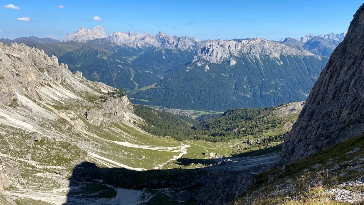
Val Contrin begins above Alba di Canazei and extends beneath Marmolada, Gran Vernel, Cima Ombretta and Colac.
Although it lies close to some of the busiest parts of Val di Fassa, the valley feels more enclosed and purposeful than the roadside viewpoints around the Sella passes. The trail leads through forest before opening into pastures beside the Contrin stream.
Rifugio Contrin and Malga Contrin provide the natural destinations for a moderate day hike.
The Standard Route
From Alba di Canazei, trail 602 climbs toward the valley and reaches Rifugio Contrin in approximately two and a half hours.
The first section gains height through the forest. The middle of the route becomes gentler as the valley opens, before a final climb toward the hut.
Official Rifugio Contrin information ↗A seasonal shuttle may operate between Alba and Baita Locia Contrin. From there, the remaining walk to the hut is approximately 3.4 kilometres with 280 metres of ascent and takes about one hour and 15 minutes.
Official Val Contrin shuttle information ↗Why It Feels Quieter
Marmolada attracts large numbers of visitors around Lake Fedaia, Malga Ciapela and the main lift infrastructure. Val Contrin reveals the same mountain group from a less commercial angle.
The valley is closed to ordinary vehicle traffic, and reaching its central section requires either walking or using the limited shuttle. That removes much of the short-stop sightseeing traffic.
The result is still a popular hiking route, but one where most visitors have arrived specifically to walk.
History Along the Route
Val Contrin was used as a military position during the First World War, and remains of trenches and defensive structures can still be found in the wider area.
The landscape therefore combines grazing land and mountain-hut culture with a more difficult historical layer.
Official historical and hut information for Val Contrin ↗Longer Options
From Rifugio Contrin, demanding routes continue toward Passo Ombretta, Rifugio Falier and the southern side of Marmolada.
These extensions are long mountain tours rather than casual additions. One official itinerary linking Contrin and Falier is explicitly described as demanding and recommended as a two-stage route.
Official Contrin–Falier itinerary ↗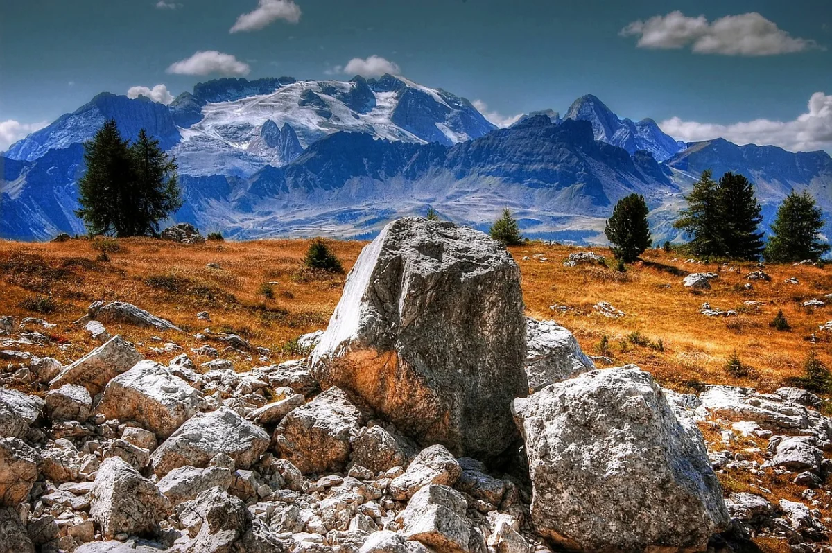
07 · MondevalThe Mondeval Plateau from Passo Giau
Passo Giau is not quiet. It is one of the Dolomites’ most recognisable road passes and attracts drivers, cyclists and photographers throughout the summer.
The atmosphere changes once you walk away from the roadside viewpoint and cross toward the Mondeval Plateau.
This high landscape lies between Lastoi de Formin, Croda da Lago and Monte Cernera. It offers broad views, scattered water, grazing land and an archaeological site connected to one of the most important prehistoric discoveries in the Dolomites.
The Mondeval Man
In 1987, archaeologists discovered the burial of a Mesolithic hunter beneath a large boulder at approximately 2,150 metres.
The remains are around 7,500 years old and are now preserved with the burial objects at the Vittorino Cazzetta Museum in Selva di Cadore.
Official Mondeval Man information ↗The archaeological context gives the hike a different character. Mondeval is not simply another panoramic plateau; it is evidence that people were moving through and using these high landscapes thousands of years ago.
The Route from Passo Giau
From Passo Giau, follow the marked trail toward Col Piombin and Forcella Giau. Once across the pass, the Mondeval Plateau opens below.
The route can continue toward the archaeological site, Lake delle Baste or Forcella Ambrizzola, depending on available time and conditions. Official regional information describes the Passo Giau approach as a recognised alternative to the longer ascent from Santa Fosca.
Official Mondeval route background ↗The terrain is not technically extreme, but it is exposed and high. Fog can make navigation more difficult, while the open plateau provides little shelter from storms.
Why It Feels Quieter
Many visitors at Passo Giau remain close to the road or walk only a short distance toward the most immediate viewpoints.
Crossing Forcella Giau requires more time and effort. Once on the far side, the road disappears from view and the landscape feels considerably more remote.
For the quietest experience, begin early and avoid returning at the same time as the main late-afternoon photography crowd.
Who Is It Best For?
The Mondeval Plateau suits hikers who enjoy:
- open high-altitude landscapes;
- routes with cultural and historical interest;
- photography without relying on one famous composition;
- moderate mountain walking;
- combining a hike with a museum visit in Selva di Cadore.
08 · Val di ZoldoRifugio Coldai and Lake Coldai from Val di Zoldo
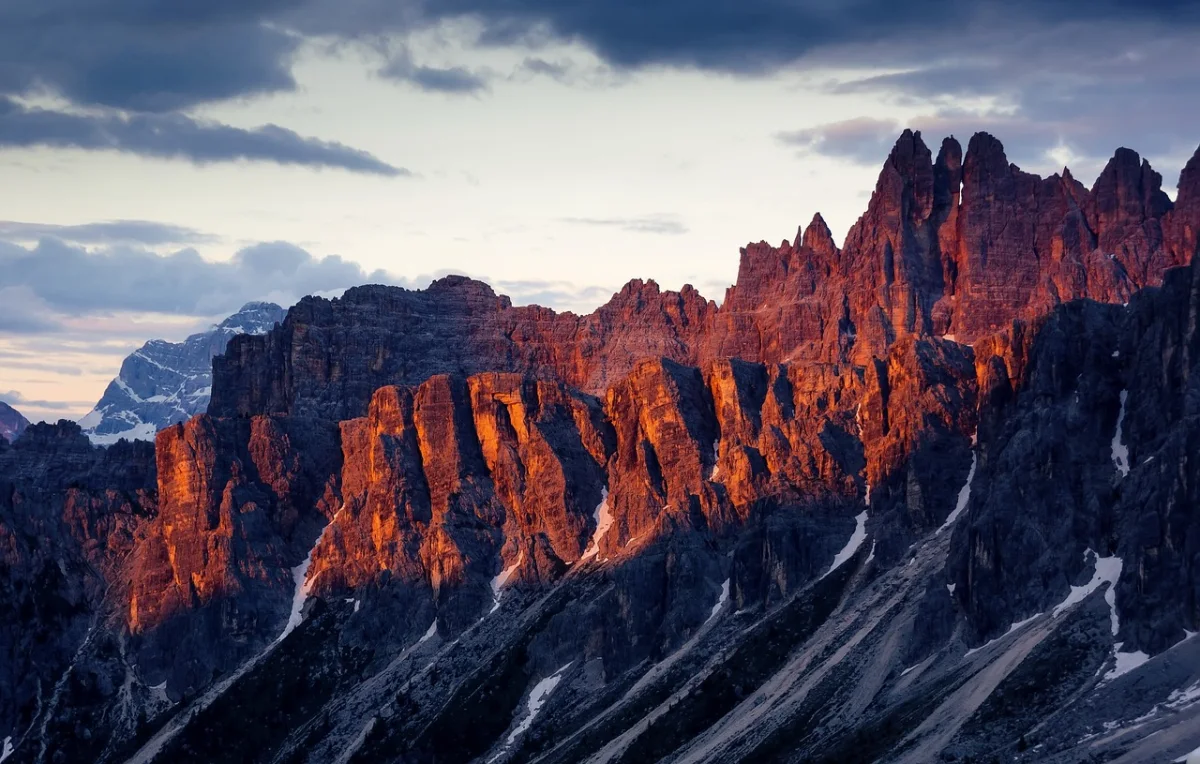
Val di Zoldo lies beneath Monte Pelmo and the enormous Civetta massif. The valley receives hikers, climbers and Italian holidaymakers, but it has a different atmosphere from the more internationally promoted resorts.
One of its strongest day hikes leads toward Rifugio Coldai and the small Alpine lake beyond the hut.
Rifugio Coldai stands at approximately 2,135 metres near the northern end of the Civetta group. The lake lies around 15 minutes beyond it, beneath the mountain’s rock walls.
Official Rifugio Coldai information ↗The Standard Approach
From Palafavera, the usual route follows trails toward Casera di Pioda and then climbs to Rifugio Coldai.
The hut estimates approximately two hours for the ascent from Palafavera. A similar approach can be made from Piani di Pezzè above Alleghe.
Official access routes to Rifugio Coldai ↗Some lift-assisted versions are possible when the local summer lifts are operating. One regional route describes a return hike of approximately four and a half hours with 845 metres of ascent and descent.
Official Val di Zoldo hiking route information ↗Why It Feels Quieter
Lake Coldai is not unknown, and the hut can be busy during peak hiking hours. However, the approach requires sustained effort and does not attract the same volume of short-stop visitors as road-accessible lakes.
Val di Zoldo also offers many alternative trails around Pelmo, Moiazza and the wider Civetta group. Visitors are distributed across a larger network rather than funnelled toward one internationally famous location.
The wider Zoldano Ring is promoted as a 70-kilometre route through less-travelled parts of the valley, demonstrating how much quieter terrain exists beyond the main day hike.
Official Zoldano Ring information ↗Important Route Choice
Do not follow every route shown on a map simply because it reaches the same lake.
The hut specifically warns that the Ru de Porta route from Piani di Pezzè includes protected sections and is not recommended for families or inexperienced hikers. The standard paths through Casera di Pioda are the more appropriate choice for most visitors.
Official Rifugio Coldai route safety information ↗Who Is It Best For?
Lake Coldai is best for:
- reasonably fit hikers;
- visitors who prefer rugged mountain scenery;
- travellers staying in Val di Zoldo or Alleghe;
- hikers looking for a substantial day without via ferrata;
- anyone interested in exploring the less-publicised Belluno Dolomites.
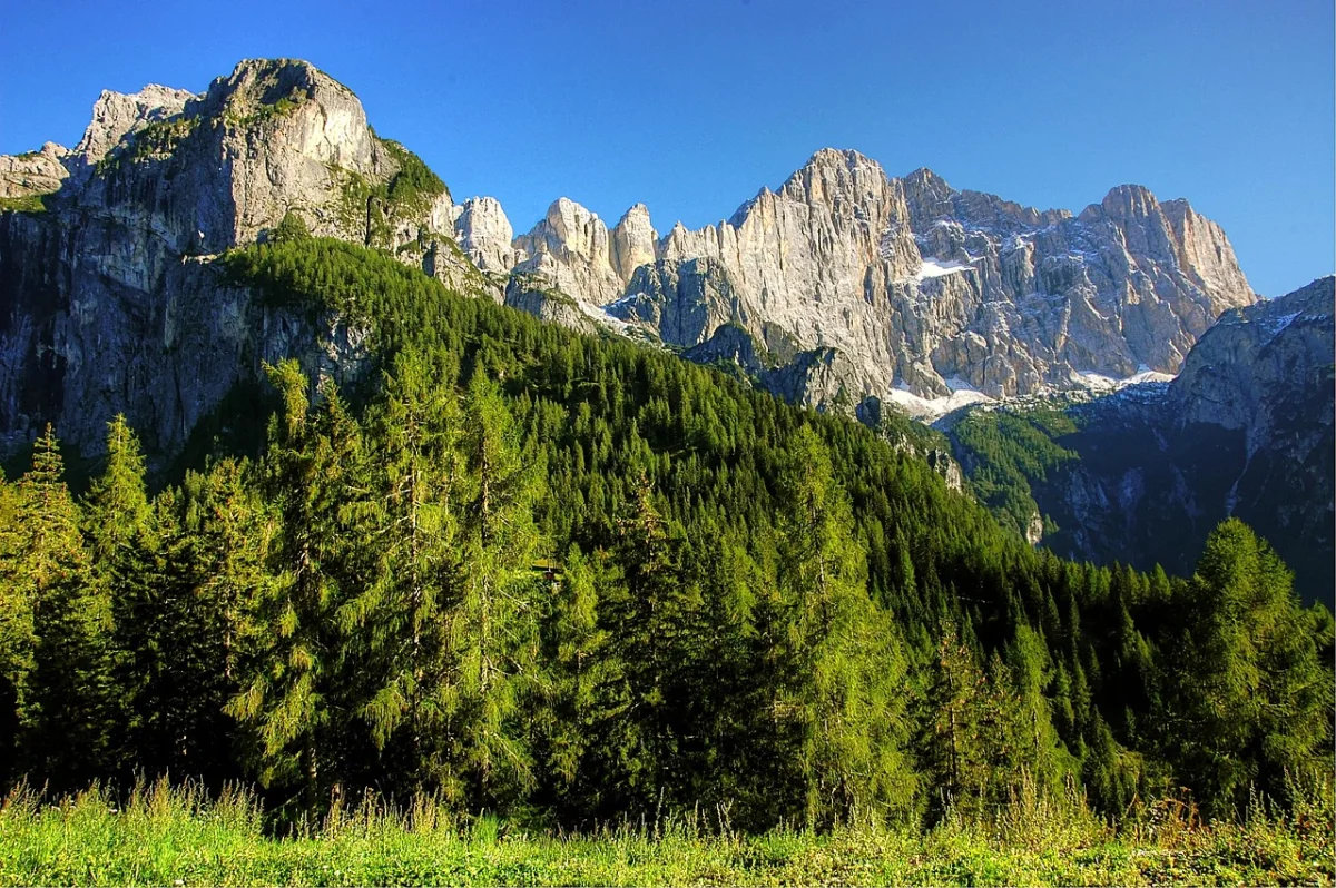
How to Find Quieter Trails in the Dolomites
Choosing a less famous destination helps, but timing and route selection often matter just as much.
Start Beyond the First Viewpoint
Crowds are usually most concentrated near cable-car stations, car parks, lakeside platforms and mountain huts.
Walking another 20 or 30 minutes can make a large difference. Most casual visitors stop at the first obvious objective, while longer trails distribute hikers across a wider area.
Stay in a Less Famous Valley
Base yourself in places such as Val di Zoldo, Primiero, San Martino di Castrozza, Campitello or Selva di Cadore rather than commuting every day from the biggest resort.
This reduces driving and makes it easier to begin walking before day visitors arrive.
Walk Early, but Not Only at Sunrise
Starting early remains one of the most reliable strategies, especially on routes with small car parks.
However, late afternoon can also be peaceful on shorter trails. Many day visitors leave between 15:00 and 17:00, while evening light can improve the scenery.
Only use this approach when the route is short, the forecast is stable and you have enough daylight for the return.
Avoid Building the Trip Around Weekends
Famous locations are busiest during weekends with stable weather. Less famous valleys can also become popular with regional visitors on Saturdays and Sundays.
Plan easier walks, travel days or village activities for the weekend, then use weekdays for the most important hikes.
Visit in June or September
Late June and September often provide a better balance between open infrastructure and reduced visitor numbers.
High snow can remain into early summer, while some lifts and huts close during September. Check each route individually rather than assuming that the entire region follows one season.
Do Not Search Only for “Hidden Gems”
A genuinely unknown trail may be quiet because it is poorly maintained, difficult to reach or unsuitable for ordinary hikers.
The better strategy is to choose established but less internationally promoted routes. These still have marked paths, mountain huts and reliable information without concentrating every visitor in the same place.
Are the Dolomites Ever Truly Empty?
On a clear August weekend, probably not.
The Dolomites are a major European mountain destination, and many accessible routes attract both international visitors and local hikers. Expecting complete isolation can lead to disappointment.
A quieter experience is still realistic when you:
- avoid the five or six most promoted locations;
- begin before the main arrival period;
- walk farther than the first hut or viewpoint;
- stay in one region instead of driving between attractions;
- choose longer valley routes where hikers naturally spread out.
The aim is not necessarily to see nobody. It is to have enough space to hear the landscape, choose your own pace and stop without feeling that you are standing in a queue.
Frequently Asked Questions
Which Part of the Dolomites Is the Least Crowded?
The Belluno Dolomites, Val di Zoldo, parts of the Pale di San Martino and smaller valleys outside the main Sella circuit generally offer more opportunities for quieter hiking.
No entire region is empty, and popular local routes may still become busy during peak weekends.
Is Val Gardena Too Crowded for Hiking?
Val Gardena is busy, but it is large enough to contain quieter routes.
Seceda and the easiest Alpe di Siusi access points receive the most concentrated traffic. Longer routes through Vallunga, Puez and the outer parts of the nature park can feel very different.
Is Passo Giau Crowded?
The roadside viewpoints at Passo Giau can be extremely busy during good weather.
The Mondeval route becomes quieter after crossing away from the road, particularly beyond Forcella Giau. Parking and traffic remain reasons to start early.
What Is a Quiet Alternative to Tre Cime?
Val Canali, Val Venegia and Val di Zoldo offer similarly dramatic rock scenery without reproducing the exact Tre Cime landscape.
The Sass de Putia circuit is another strong alternative for hikers who want a complete route around a distinctive Dolomite mountain.
What Is a Quiet Alternative to Seceda?
Passo delle Erbe and the Sass de Putia meadows provide open grassland beneath dramatic rock walls.
Val Venegia offers another excellent combination of broad meadows and sharp Pale di San Martino peaks.
Can You Explore Quieter Dolomites Trails Without a Car?
Some can be reached by seasonal buses and shuttles, but a car provides more flexibility in the lesser-known valleys.
Passo delle Erbe has public transport options, while Val Duron and Val Contrin may have seasonal shuttle services. Always verify current operating dates and the final return time before relying on them.
Which Quiet Dolomites Hike Is Best for Families?
The walk to Fuciade is the easiest option in this guide.
The lower sections of Val Venegia, Val Duron and Val Canali can also work well for families because the route can be shortened without missing the main scenery.
Which Route Is Best for Experienced Hikers?
The Sass de Putia circuit and Lake Coldai provide the strongest complete mountain days among these eight options.
Experienced hikers can extend several other routes, but difficulty can increase sharply beyond the main valley paths and huts.
Final Thoughts
Avoiding crowds in the Dolomites does not require discovering an unnamed trail or giving up the landscapes that make the region special.
Val Venegia and Val Canali provide enormous Pale di San Martino scenery without depending on one famous viewpoint. Passo delle Erbe offers a complete mountain circuit, while Fuciade, Val Duron and Val Contrin create slower days built around meadows and huts.
The Mondeval Plateau combines open terrain with thousands of years of human history. Lake Coldai introduces the more rugged atmosphere of Val di Zoldo and the Civetta group.
None of these places is guaranteed to be empty. That is not the point. The reward is a Dolomites trip with more walking than waiting, more space between groups and more time to experience each valley as a landscape rather than another stop on a checklist.