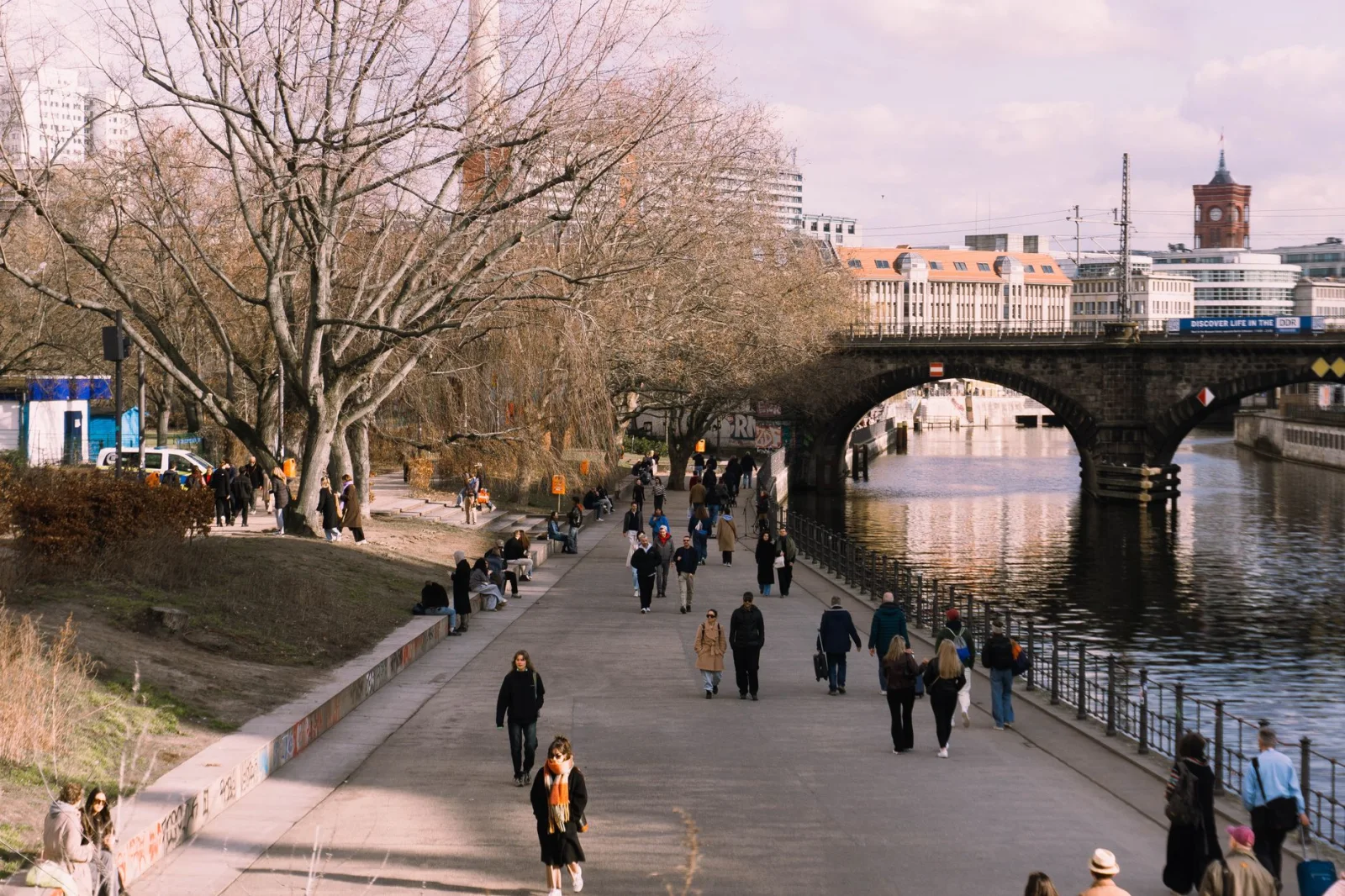
Budapest does not reveal itself from one square. It appears gradually: in the distance across the Danube, on the climb toward Buda Castle, beneath the façades of Pest and in streets that grow louder as evening approaches.
By the end of the day, the number on the step counter may be surprisingly high. Yet the distance rarely feels empty. A bridge changes the angle of the city. A market interrupts the route. One neighbourhood gives way to another before the next famous building comes into view.
Europe’s best cities for walking work in much the same way. Their monuments provide direction, but the space between them provides the journey. The useful question is not simply whether the centre is compact. It is whether the city continues to reward the walker after the obvious sights have been crossed off.
The ten cities below are not ranked by a walkability score. Some are flat and efficient; others are steep, cobbled and tiring. They were chosen because a full day on foot can become a coherent travel experience, with public transport available when the legs have had enough.
“A walkable city is not simply a place where the attractions stand close together. It is a place where the distance between them remains interesting.”
Walkable Cities in Europe at a Glance
| City | A good continuous walk | Day and terrain | What changes | Shortcut and trade-off |
|---|---|---|---|---|
| Budapest | Parliament–Danube–Castle–Jewish Quarter | 12–16 km · Flat Pest; steep Buda | Grand riverfront to intimate streets | Tram 2 or metro — Distances accumulate |
| Vienna | Ring–Naschmarkt–Grätzel–Canal | 10–14 km · Mostly flat | Imperial core to lived-in districts | U-Bahn — Elegance can feel uniform |
| Prague | Old Town–Letná–Vinohrady–Žižkov | 10–14 km · Hilly; cobbles | Medieval centre to parks and working districts | Tram — Crowds around the core |
| Edinburgh | Old Town–Arthur’s Seat–Stockbridge | 10–15 km · Steep; some rough paths | Stone closes into open volcanic ground | Bus or tram — Wind and slippery stone |
| Lisbon | Baixa–Alfama–Graça–Chiado | 8–12 km · Very hilly | Ordered squares to tangled lanes and viewpoints | Tram, metro or funicular — Heat and polished paving |
| Florence | Duomo–Oltrarno–Arno–city hills | 8–14 km · Flat centre; hill finish | Museum streets to olive-green edges | Bus downhill — Central congestion |
| Bologna | Piazza Maggiore–University–San Luca | 10–15 km · Flat then sustained climb | Medieval lanes under a continuous roof | Bus from San Luca area — Long final ascent |
| Copenhagen | The Harbour Circle | 13 km · Flat | Royal centre to houseboats, swim zones and new districts | Harbour bus — Wind and exposed waterfront |
| Ljubljana | Castle–river–Tivoli–Trnovo | 8–12 km · Mostly flat; one hill | Compact old town to parks and local quarters | City bus or Kavalir — The centre ends quickly |
| Salzburg | Old Town–Mönchsberg–Kapuzinerberg | 8–12 km · Two short, steep climbs | Baroque streets to wooded city mountains | Lift or city bus — Steps and wet forest paths |
What Makes a City Worth Walking?
Compactness helps, but it is not enough. A city can place every landmark within two kilometres and still produce a dull walk between them. Another can require fifteen kilometres and several climbs, yet keep changing its scale, sound and view often enough that the day feels shorter than the map suggests.
A useful walking city also permits correction. A tram line, metro station, harbour bus or funicular should be close enough to turn an ambitious route into a sensible one. Using public transport for the final return is not a failure of the walk. It is often what allows the interesting part to remain long and the exhausted part to disappear.
The routes suggested here are frameworks rather than turn-by-turn itineraries. They connect districts and landscapes that make sense together, but they leave space for the bakery, side street, small museum or long lunch that changes the day.
01 · Danube · HungaryBudapest, Hungary
A City Best Understood by Crossing the River
Good Day: 12–16 km · Terrain: Flat + hill · Days: 3–4 · Best Reset: Tram 2
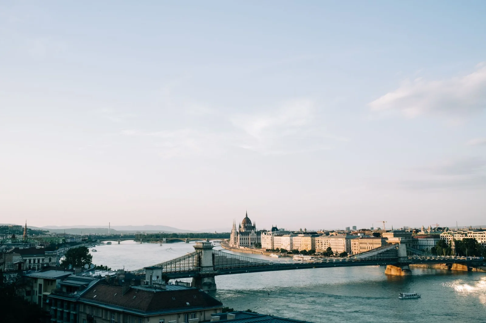
Budapest is divided so clearly by the Danube that crossing the river feels less like moving between attractions than changing cities. Pest is broad, active and mostly level. Buda rises almost immediately, turning the skyline that framed the morning into a view below your feet.
A strong first day begins near the Parliament building and follows the Pest embankment toward the Chain Bridge. The river keeps the route legible: Buda Castle remains across the water, Gellért Hill waits farther south and the bridges divide the day into natural sections. Cross to Buda, climb through the Castle District and allow enough time to walk streets that do not contain a famous viewpoint. The quieter lanes make the panorama feel less staged when it returns.
The best continuation is not necessarily another monument. Descend, cross the river again and let Pest become smaller: St. Stephen’s Basilica, the streets around Deák Ferenc tér, the Jewish Quarter and the courtyards and cafés that grow busier toward evening. A route that looked excessively long in the morning becomes a record of the city’s changing character.
Budapest’s weakness is also part of the experience. Distances between the baths, City Park, Castle Hill and the central riverfront are greater than a first-time visitor expects. The useful compromise is to walk the meaningful sections and use tram 2, the metro or a bridge bus as punctuation. Margaret Island offers a flatter recovery walk on another day, with a running path and long green interior away from the traffic of both banks.
Official Budapest city map ↗ · Margaret Island ↗
02 · Neighbourhoods · AustriaVienna, Austria
The City Does Not End at the Ring
Good Day: 10–14 km · Terrain: Mostly flat · Days: 3–4 · Best Reset: U-Bahn
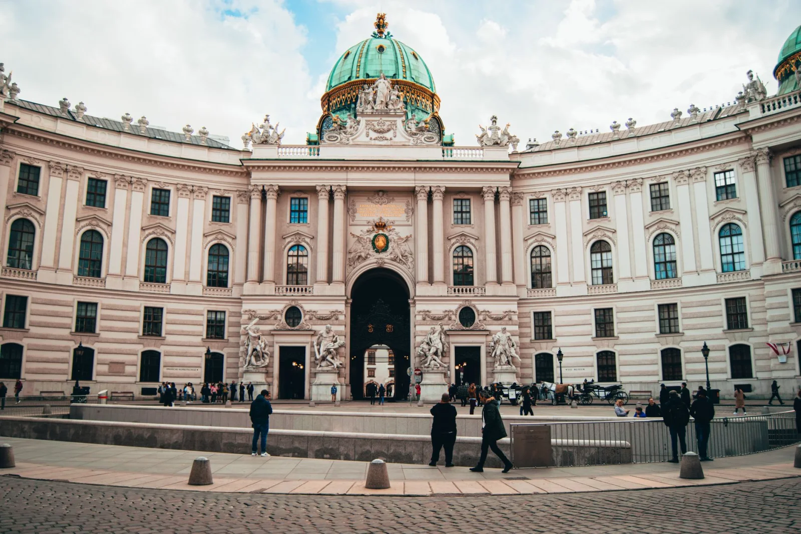
Vienna’s monumental centre encourages an efficient circuit: opera, Hofburg, museums, cathedral, coffee. The danger is that the Ring becomes a decorative boundary and everything beyond it is treated as a different trip.
The more revealing walk begins with the famous sequence and then refuses to stop. From the Ring, continue toward Karlsplatz and Naschmarkt, then enter the Gußhausviertel or Freihausviertel, where museums, hidden parks, restaurants and ordinary residential streets replace the ceremonial scale. Another branch crosses the Danube Canal into Karmeliterviertel, a neighbourhood within walking distance of the centre but with a different rhythm and history.
Vienna is unusually forgiving to walkers. The terrain is mostly level, pavements are broad and the public transport network makes it easy to finish in a district without planning a return on foot. The official city guide maintains themed walks through neighbourhoods as well as the expected routes around imperial Vienna. Farther out, the city’s marked hiking network extends for more than 240 kilometres into vineyards, woods and the Lobau.
The trade-off is subtle. Vienna’s order can make a long walk feel less dramatic than Lisbon or Edinburgh. Its pleasures are cumulative: a courtyard, a market stall, a change in façade, a park entered without ceremony. The city rewards attention more than urgency.
Walk through Vienna ↗ · Vienna neighbourhood itinerary ↗ · City hiking routes ↗
03 · Parks & districts · CzechiaPrague, Czechia
Leave the Old Town Without Leaving the Walk
Good Day: 10–14 km · Terrain: Hills + cobbles · Days: 3 · Best Reset: Tram
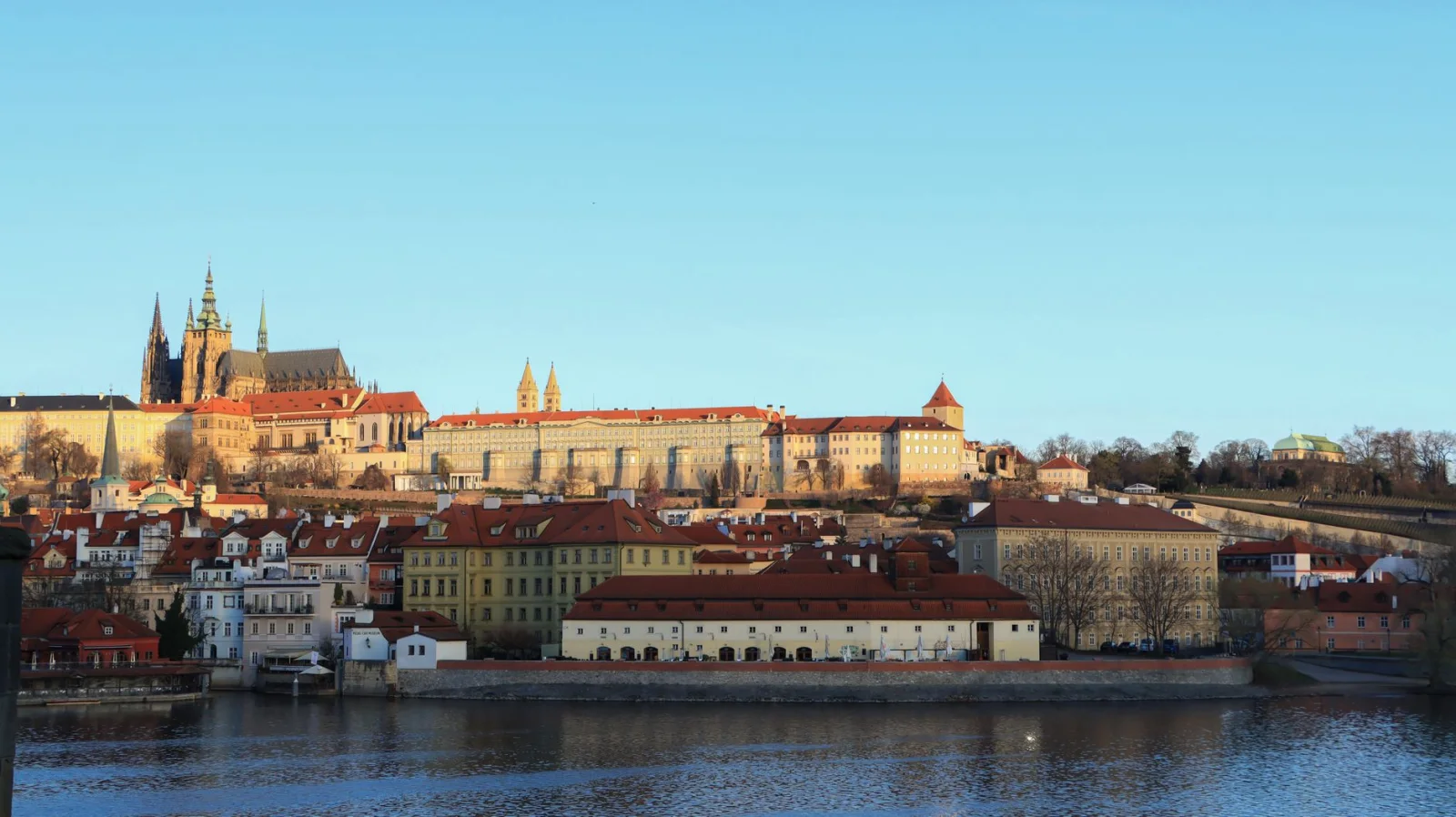
Prague’s centre can make a walker impatient. The streets are beautiful, the river gives the route shape and the next tower is always close, but the densest visitor flow compresses the experience into a narrow line between Old Town Square, Charles Bridge and the castle.
The city becomes easier to understand after leaving that line. From the river, climb toward Letná for the broad view back across the bridges. Continue through parks and residential streets, or cross east toward Vinohrady and Žižkov, where hills, courtyards, pubs and twentieth-century architecture replace the medieval stage set. Prague City Tourism publishes self-guided walks specifically designed to reach Karlín, Holešovice, Vršovice, Žižkov and quieter villa districts.
One useful route connects Vyšehrad with the riverfront and continues toward Karlov and Vinohrady. Another uses Prague’s chain of parks and gardens on the left bank, avoiding some of the busiest streets while repeatedly opening new views over the city. Neither requires abandoning the landmarks. They place the landmarks at a distance, where the skyline becomes visible again.
Cobbles and hills make the kilometres more tiring than they look. Rain can polish the stone and summer crowds slow the central sections. Prague’s trams are therefore part of a good walking plan: use one to skip the least interesting return, not the neighbourhood that made the walk worthwhile.
Official Prague walking routes ↗ · Self-guided city walks ↗
04 · Old Town & hills · ScotlandEdinburgh, Scotland
A City With a Mountain in the Middle
Good Day: 10–15 km · Terrain: Steep + rough · Days: 3 · Best Reset: Bus / tram
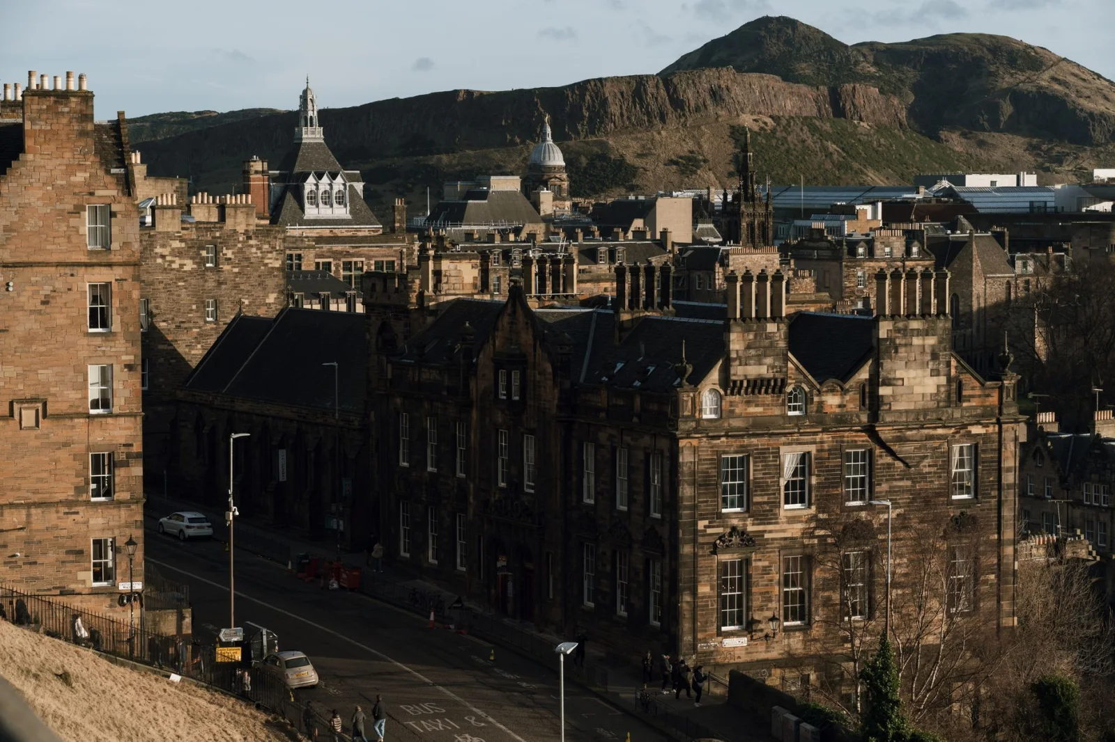
Edinburgh changes scale more abruptly than most capitals. A narrow close opens onto a bridge. The bridge reveals railway lines far below. Minutes later, the street reaches Holyrood Park and the city gives way to an extinct volcano.
Begin in the Old Town, but do not make the Royal Mile the entire walk. Descend toward Holyrood, then choose a route through the park. Arthur’s Seat offers the highest view, while lower paths around Salisbury Crags provide much of the drama with less climbing. The official guidance is clear that paths can be rough; this is an urban walk that temporarily becomes a real hill walk.
After the open ground, return through the New Town and continue downhill to Stockbridge. Its cobbled streets, Georgian architecture, independent shops and village-like centre stand only about a fifteen-minute walk from Princes Street. The Water of Leith can extend the day toward Dean Village or farther to Leith, turning a collection of famous districts into one continuous journey.
Edinburgh’s weather is not background information. Wind on the high ground, rain on polished stone and early winter darkness can change the route quickly. Carry a layer even when the day begins gently, and be willing to replace the summit with a lower circuit. The city remains rewarding when the hill says no.
Arthur’s Seat walking guidance ↗ · Stockbridge neighbourhood guide ↗
05 · Viewpoints & hills · PortugalLisbon, Portugal
Let the Hills Edit the Itinerary
Good Day: 8–12 km · Terrain: Very hilly · Days: 3–4 · Best Reset: Tram / metro
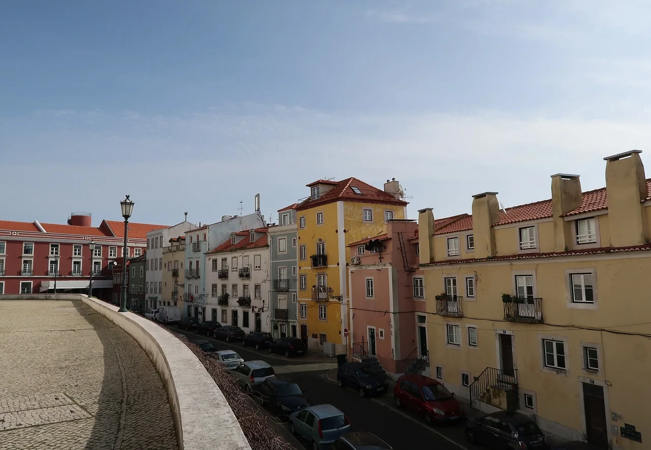
Lisbon is compact only when measured from above. On the ground, a short line crosses a valley, climbs a staircase, turns onto polished paving and reaches a viewpoint that makes the detour feel inevitable.
A satisfying day begins in the ordered geometry of Baixa and then loses that order in Alfama. The oldest neighbourhood is built from lanes, alleys and steep inclines that should be discovered slowly. Continue toward Graça, where the city drops away toward the Tagus and the earlier route becomes visible as a whole. From there, descend through Mouraria or return toward Chiado and the evening streets of Bairro Alto.
Lisbon’s viewpoints are not merely stops. They structure the walk, providing a reason to climb and a place to reconsider the next section. The official tourism site describes Alfama as a neighbourhood that must be discovered on foot and Graça as a place where daily life, historic quarters and the river can be read from above.
The practical problem is fatigue disguised as distance. Eight kilometres in Lisbon can feel longer than thirteen in Copenhagen. Smooth calçada paving becomes slippery in rain, summer heat gathers on exposed slopes and a final climb can turn pleasure into obligation. Use the tram, metro or funicular for one direction. Walking every hill is not a more authentic visit; choosing the right hills is.
Alfama neighbourhood ↗ · Graça viewpoint ↗ · Lisbon destination guide ↗
06 · Oltrarno & hills · ItalyFlorence, Italy
When the Museum City Reaches the Hills
Good Day: 8–14 km · Terrain: Flat + hill · Days: 3 · Best Reset: City bus
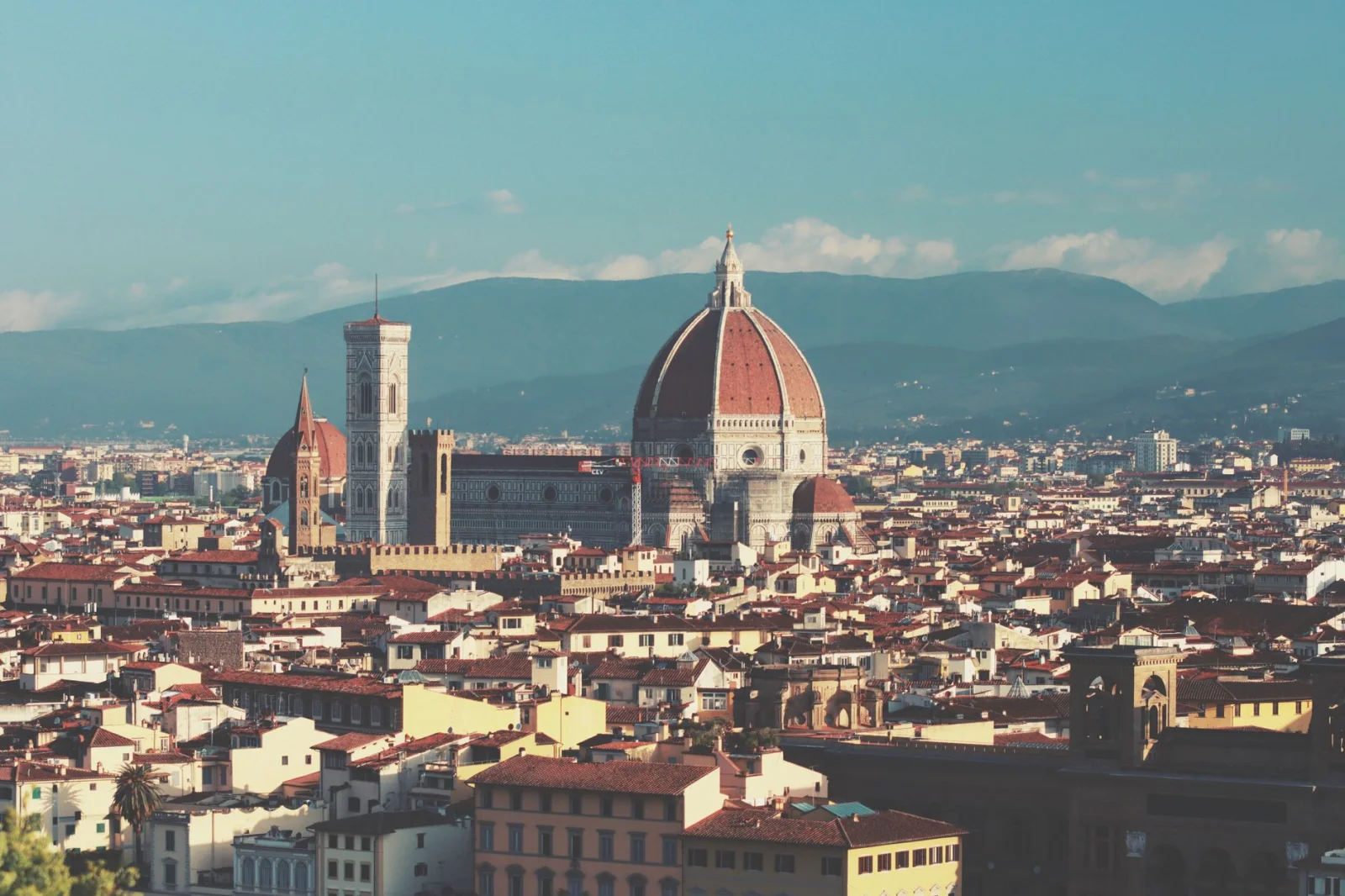
Florence is so dense with art that walking can become a queue between masterpieces. The better route allows the historic centre to thin out, crosses the Arno and keeps going until the city begins to resemble the landscape in its paintings.
Start with the central sequence when the streets are still quiet, then cross into Oltrarno. Workshops, small squares and the Santo Spirito area provide a more lived-in counterweight to the monumental core. Continue uphill toward Piazzale Michelangelo or take one of the roads and paths that link the city with its surrounding hills, villas, olive trees and cypresses.
Florence’s official ‘Walking City’ project contains eighteen circular routes, from the banks of the Arno to the hills around the urban edge. That network is important because it changes the idea of Florence from an outdoor museum into a city placed within a wider Tuscan landscape. The river can also carry a flatter day westward when the central streets feel too crowded.
The historic centre is compact, but it can be exhausting in peak heat and visitor density. Begin early, reserve indoor sights rather than queueing for them and save the hill for late afternoon. A bus downhill is useful after sunset, especially when tired legs and traffic make the return less appealing than the outward walk.
Florence: The Walking City ↗ · Florence itineraries ↗
07 · Porticoes · ItalyBologna, Italy
A Roof Over the Walk
Good Day: 10–15 km · Terrain: Flat + long climb · Days: 2–3 · Best Reset: City bus
Bologna solves one of the oldest problems of city walking: the weather. Its porticoes create a continuous intermediate space between street and building, offering shade in summer, cover in rain and a public room in which ordinary life keeps moving.
Begin at Piazza Maggiore, pass the university quarter and Santo Stefano, and allow the route to follow whichever portico looks most inviting. Bologna has more than 62 kilometres of arcades across the urban area. They are not a single attraction but the structure that links towers, markets, churches, libraries, apartments and bars.
The ambitious continuation follows the portico of San Luca. From Porta Saragozza, 666 arches climb for roughly 3.8 kilometres to the sanctuary above the city. The route is protected from sun and rain, but the roof does not remove the gradient. It is a sustained urban ascent and a fitting end to a city day that began almost entirely level.
Bologna is easy to underestimate because the centre appears compact. The kilometres arrive through repetition: another arcade, another square, another food market, another street worth entering. The main decision is whether to save San Luca for a separate morning. Doing so leaves more time for the neighbourhoods beneath the porticoes instead of turning the entire day into preparation for the climb.
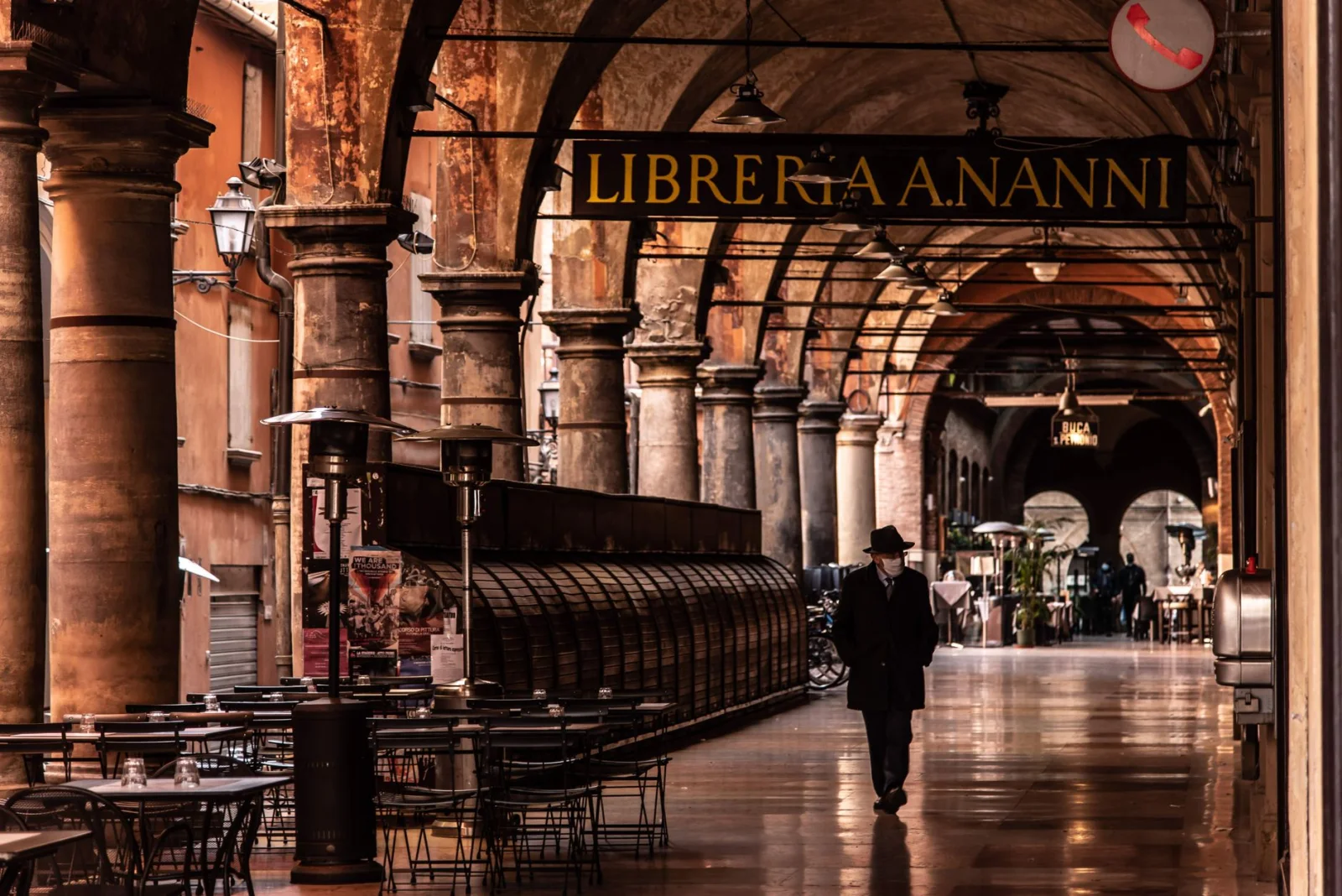
UNESCO Porticoes of Bologna ↗ · The 12 UNESCO stretches ↗ · City walking itineraries ↗
08 · Harbour Circle · DenmarkCopenhagen, Denmark
Thirteen Kilometres Around the Water
Good Day: 13 km · Terrain: Flat · Days: 3 · Best Reset: Harbour bus
Copenhagen’s centre is small enough for an effortless first morning. The more interesting walk begins when the familiar royal streets reach the harbour and the water becomes a route rather than a boundary.
The Harbour Circle is a 13-kilometre walking and cycling path linking Nyhavn with Christianshavn, Islands Brygge, Sydhavn, Vesterbro and newer waterfront districts. Along the way, the city moves from palaces and church domes to houseboats, swim zones, bridges, construction sites, green edges and rawer stretches of harbour.
The route is designed to be shortened. Bridges create two-, four- and seven-kilometre versions, while the harbour bus can convert the final section into a public-transport boat ride. This flexibility makes Copenhagen one of the easiest cities in which to walk beyond the centre without committing to an inconvenient return.
Flat does not mean neutral. Wind can turn an exposed waterfront into the hardest part of the day, and long, open sections offer less shelter than the old streets suggest. Copenhagen is at its best when the route alternates between water and neighbourhoods. Do not remain on the harbour edge merely to complete a circle; leave it for a bakery, market or side street, then find the water again.
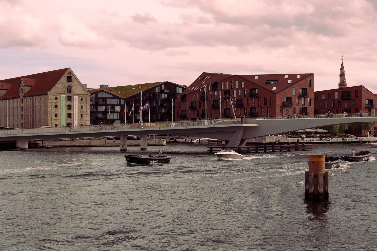
The Harbour Circle ↗ · Copenhagen city centre guide ↗ · Local city walks ↗
09 · River & parks · SloveniaLjubljana, Slovenia
The Small City That Keeps Going
Good Day: 8–12 km · Terrain: Mostly flat · Days: 2–3 · Best Reset: Bus / Kavalir
Ljubljana’s centre is so compact that a visitor can reach the river, market, cathedral, castle funicular and main squares before lunch. That efficiency is useful, but it can create the false impression that the city has already ended.
Continue along the Ljubljanica, cross repeatedly rather than treating one bank as the route, then move toward Trnovo and Krakovo or north toward Tabor and Metelkova. The old centre changes gradually into residential streets, cultural spaces and quieter river edges. A separate branch leads west into Tivoli, the city’s largest park, whose maintained paths and wooded slopes begin close to the centre.
Ljubljana’s large pedestrian zone makes the central walk unusually calm. The official tourism guidance describes the centre as designed for people and notes that Tivoli reaches almost into the city itself. The castle provides the one obvious climb; everything else can remain gentle unless the walk continues into Rožnik’s forest trails.
The drawback is scale. Ljubljana cannot provide the endless urban variety of Budapest or Vienna. Its strength is the ease with which one day can contain a historic centre, park, river, market and neighbourhood life without transport. It is a city for wandering slowly, not collecting distance for its own sake.
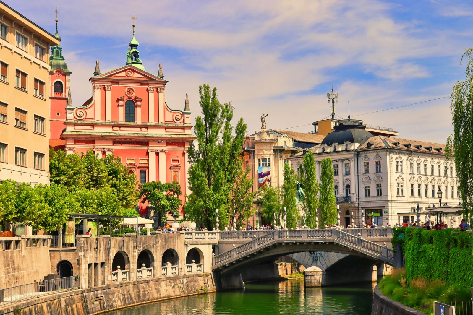
Ljubljana green guidance ↗ · Gardens and parks ↗ · Active Ljubljana ↗
10 · City mountains · AustriaSalzburg, Austria
Two Mountains Before Dinner
Good Day: 8–12 km · Terrain: Two steep climbs · Days: 2–3 · Best Reset: Lift / bus
Salzburg places its old town between a river and two wooded city mountains. The result is a rare city walk in which baroque streets, fortress walls and forest paths can belong to the same afternoon.
The official route over Mönchsberg covers about 4.8 kilometres and takes roughly ninety minutes, beginning near Mozartplatz and climbing through Nonntal toward the ridge. Paths pass the fortress area, meadows, woodland, viewpoints and the Museum of Modern Art before descending toward Mülln. On the opposite bank, a four-kilometre route circles Kapuzinerberg along old fortifications and viewpoints above the old town.
Together, the two hills create a full city hike without requiring transport to an outlying trailhead. Between them lie the Salzach, Mirabell, Getreidegasse and enough cafés and museums to divide the climbing. The most successful plan uses one hill in the morning and the other late in the day rather than treating both as a single test.
The distances are short, but steps, wet leaves and forest paths make them more demanding than the numbers suggest. Mönchsberg can be shortened with the lift; Kapuzinerberg has steeper approaches and rougher sections. Salzburg’s compactness makes retreat easy, which is exactly why the hills can remain part of a city break rather than becoming a separate excursion.
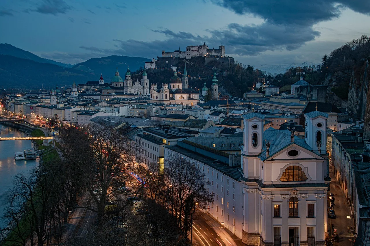
Salzburg city mountains ↗ · Hiking in Salzburg ↗ · Salzburg city walks ↗
Which City Should You Choose?
For the most varied single day
Budapest combines a major river, bridges, monumental avenues, a real climb and neighbourhood nightlife. It asks for more distance than the compact cities, but the route keeps changing.
For easy, elegant walking
Vienna and Copenhagen offer the least friction. Both have excellent public transport, mostly level ground and neighbourhoods that connect naturally to the centre.
For a city walk that becomes a hike
Edinburgh and Salzburg place rougher or wooded high ground inside the urban journey. Proper shoes and weather judgement matter more than in the other cities.
For streets that reward getting lost
Lisbon and Prague are strongest when the route stops being efficient. Hills, alleys and unexpected viewpoints matter more than completing a perfect loop.
For walking under cover
Bologna’s porticoes make it the best choice in uncertain rain or summer sun, although the San Luca climb still demands effort.
For a shorter, calmer break
Ljubljana offers the easiest combination of old town, river, park and local districts without a long itinerary or constant transit decisions.
For art that opens into landscape
Florence is most rewarding when the museum route crosses the Arno and continues into the hills rather than ending at the last major church.
How Far Should a City Day Go?
A sightseeing day and a walking day are not the same. Ten kilometres with museum visits, queues, stairs and long periods of standing can be more tiring than fifteen kilometres on a continuous trail. A route should therefore be planned around hours and changes of terrain, not a target step count.
For most travellers, eight to twelve kilometres leaves enough energy to enter buildings and remain curious in the evening. Twelve to sixteen can work in flat cities or when the day contains long riverfront and park sections. Beyond that, the walk often begins to consume the visit instead of revealing it.
The easiest way to preserve a long day is to remove the return. Walk outward through the interesting sequence, finish in a neighbourhood with dinner and use public transport back to the hotel. A circular route is elegant on a map but rarely necessary in a city.
Use Public Transport as Punctuation
Walkability does not require refusing every tram. The most useful transport ride is the one that separates two strong walking sections or removes a repetitive return. Budapest’s tram 2, Copenhagen’s harbour bus, Lisbon’s funiculars and Vienna’s U-Bahn can make an ambitious day better rather than less authentic.
- Ride uphill and walk down when heat, wet stone or knees make the climb the least enjoyable part.
- Use transit after dinner instead of leaving enough energy for a dull return to the hotel.
- Start one district beyond the famous centre, then walk back through the city as it grows more familiar.
- Save offline maps and the local transport app before the first long day.
- Do not build a route around the last service of the night without checking the current timetable.
The Best Seasons for Long Urban Walks
| City | Best walking season | What to watch |
|---|---|---|
| Budapest | April–May; September–October | Summer heat on exposed riverfronts; winter can be rewarding but cold beside the Danube |
| Vienna | April–June; September–October | Autumn is especially comfortable for long city and neighbourhood walks |
| Prague | April–May; September–October | Early mornings help around the historic core in peak season |
| Edinburgh | May–September | Wind and rain remain possible in every month |
| Lisbon | March–May; October–November | Summer hills can be hot; rain makes calçada paving slippery |
| Florence | March–May; October–November | Avoid the hottest part of summer for hill routes |
| Bologna | March–May; September–November | Porticoes help in heat and rain, but San Luca remains exposed to effort |
| Copenhagen | May–September | Long light helps; waterfront wind can be cold outside summer |
| Ljubljana | April–June; September–October | Summer is manageable with park and riverside breaks |
| Salzburg | May–October | Forest paths may be muddy after rain; winter requires shorter daylight planning |
What to Carry for a Full Day on Foot
- Comfortable shoes already tested on hard pavement. Trail shoes help in Edinburgh and Salzburg, but heavy hiking boots are unnecessary for most routes.
- A light waterproof layer. Riverfronts and city hills are often windier than sheltered streets.
- Water, especially in Lisbon, Florence, Bologna and Budapest during warm weather. Refill where official drinking water is clearly available.
- A small power bank. Navigation, transport tickets, opening hours and photography compete for the same battery.
- One light layer for churches, museums, cool interiors and evening returns.
- Offline maps with the hotel, final neighbourhood and nearest practical transit stops saved in advance.
Historic Streets Are Not Equally Accessible
The phrase ‘walkable city’ can hide important exclusions. Cobbles, steep steps, missing kerbs, crowded lanes and rough park paths may make a route difficult or impossible for travellers with reduced mobility, wheelchairs, pushchairs or balance concerns.
Prague, Lisbon and Edinburgh require the most caution. Salzburg’s city mountains and Florence’s hill routes also need alternatives. Official tourism sites increasingly publish accessible routes and transport information, but individual street works, lift closures and weather can change conditions. A shorter central route with public transport is often more useful than trying to adapt a scenic route designed around stairs.
Walkability should be understood as choice: the ability to move comfortably, pause often and leave the route when necessary. It is not a demand that every visitor cover the same distance.
Frequently Asked Questions
What is the most walkable city in this article?
Copenhagen is the easiest physically because it is flat, compact and well connected. Ljubljana is the simplest for a short break. Budapest may provide the most varied full walking day, although it requires more distance and a climb.
Is Budapest really walkable?
Central Budapest is very rewarding on foot, especially along the Danube and between the main Pest districts. The city is larger than it first appears, so public transport is useful for City Park, outer baths, Margaret Island or the return from a long cross-river day.
Which city is best for walking in rain?
Bologna is the strongest choice because its extensive porticoes provide real cover. Vienna and Copenhagen are easy to navigate in rain, while Lisbon’s polished paving and Edinburgh’s stone and hill paths require more caution.
Which cities are best without hills?
Copenhagen, Vienna and central Ljubljana are mostly flat. Bologna’s centre is easy, but the walk to San Luca climbs steadily. Budapest’s Pest side is flat; Buda is not.
How many kilometres should I plan each day?
Eight to twelve kilometres is a useful range when the day also includes museums, meals and standing. Strong walkers may enjoy twelve to sixteen in Budapest, Vienna or Copenhagen, but the terrain matters more than the number.
Do I need hiking shoes for city walking?
Usually not. Supportive walking shoes or trail shoes are enough. Grippier soles are helpful for wet cobbles in Lisbon and Prague and for rough paths in Edinburgh and Salzburg.
Is it better to follow a fixed route?
Use a route to connect districts, not to control every turn. The strongest city walks leave room for markets, courtyards, cafés and streets that were not part of the plan.
Where should I stay for a walking city break?
Choose a neighbourhood near the centre but also near a direct transit line. A hotel exactly beside the main landmark may be noisy and expensive, while a base one or two stops away can create a more interesting daily walk.
Which city works best for only two days?
Ljubljana, Bologna and Salzburg fit especially well into two full days. Copenhagen can also work, though its neighbourhoods reward a longer stay.
Should I rely on step-count estimates?
No. Phones and watches measure movement differently, and stairs, museum time and hard paving change fatigue. Plan around the route, weather and places to stop.
“The landmark tells you where to go. The street between landmarks tells you where you are.”
Final Thoughts
The best city walks do not feel like a chain of errands between landmarks. They create a sequence: river to hill, market to residential street, old centre to park, monument to an ordinary corner where the city becomes less performative.
Budapest demonstrates the idea clearly. The Parliament, Castle and bridges are essential, but the memory of the trip often belongs to the hours between them — the changing view across the Danube, the street chosen by accident and the evening return through a district that looked different in daylight.
A good walking plan should therefore be ambitious about experience and modest about completion. Walk until the city has changed several times. Stop before distance becomes the only thing left to notice.