
Trail running does not need an aid station, a race number or an elevation profile that looks like broken glass.
Sometimes it begins behind a railway station, crosses a quiet forest and returns to town before breakfast ends. The runner may walk every climb, stop to read a sign and finish with less distance than an ordinary road session. The point is not to reproduce an ultramarathon. It is to let the surface, gradient and landscape change the way a run feels.
That makes the base almost as important as the trail. A useful trail-running town offers several routes rather than one famous course, a short option for tired legs, public transport or a walkable start, food after the run and enough ordinary life to rescue a day of rain.
The ten places below are not ranked. They range from Finnish sports cities and Scandinavian forests to Mediterranean hills and Alpine towns. Each includes a conservative first route: short enough to understand, easy to retreat from and close enough to services that a visitor does not need race-day logistics.
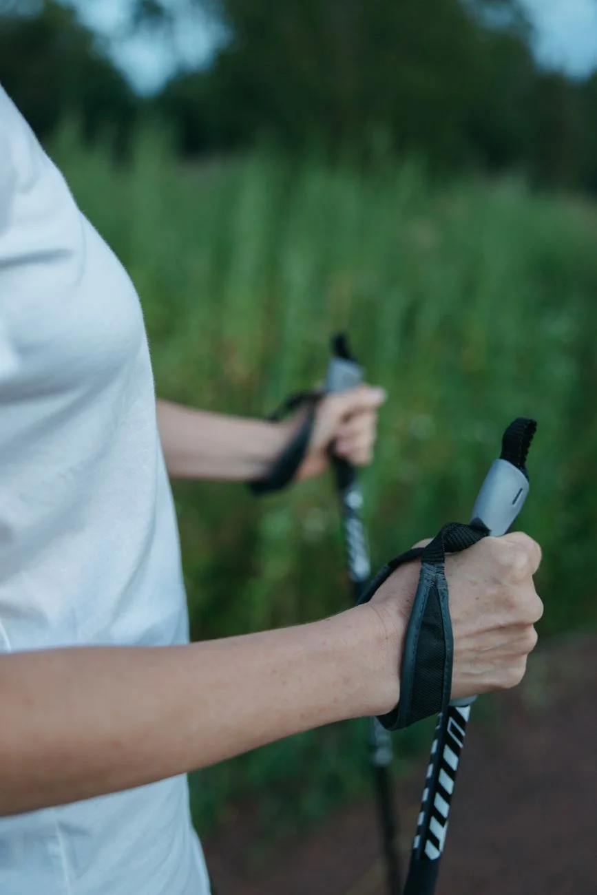
"A good trail-running destination is not the place with the hardest race. It is the place where several useful runs begin before breakfast."
Trail-Running Bases in Europe at a Glance
| Base | First route | Character | Main trade-off |
|---|---|---|---|
| Lahti, Finland | Salpausselkä or Lehmusreitti | Forest ridges and urban nature | Winter ski use and mosquitoes |
| Åre, Sweden | Solstigen, 3.9 km | A mountain village with real beginner options | Fell weather and muddy ground |
| Stockholm, Sweden | Nacka Reserve from Hammarbyhöjden | Granite, pine forest and metro access | Wet rock is more technical than it looks |
| Tallinn, Estonia | Pirita Great Circle, 7.2 km | Lit forest tracks close to the centre | Some paths are shared and seasonal |
| Innsbruck, Austria | Sill Gorge Trail, 6 km | A gorge inside an Alpine city | Steep alternatives begin nearby |
| Ljubljana, Slovenia | Tivoli–Rožnik, 2.7 km | Wooded hills from the city centre | Busy local paths and muddy shortcuts |
| Girona, Spain | Devesa first, Sant Miquel next | Greenways, oak forest and a long season | Heat and dry, loose surfaces |
| Cascais, Portugal | Marina to Guincho, 8.8 km | Atlantic running with a winter-friendly climate | Wind and a paved first section |
| Annecy, France | Les Puisots loop, 11 km | Lake views and woodland from town | Mountain weather beyond the lower forest |
| Freiburg, Germany | Schlossberg Fortress Tour, 4.6 km | Black Forest terrain behind the old town | Short climbs arrive immediately |
01 · Lahti · FinlandLahti

The Forest Behind the Stadium
Lahti is a sports city whose most useful trail-running terrain does not require leaving the urban area. The Salpausselkä ridge rises beside the sports centre in a landscape shaped by glacial water, with forest roads, jogging tracks and smaller paths spreading behind the ski jumps. The official tourism information describes about 30 kilometres of waymarked trails in the Salpausselkä area, broad enough for an easy first loop, a longer steady run or several days of exploring without repeating exactly the same route.
Begin at the Lahti Sports Centre and build a five- to ten-kilometre loop on the marked Salpausselkä tracks. Staying inside the signed network matters more than the exact distance for a first outing. For a more urban day, use part of Lehmusreitti, the Tilia Trail, which circles the centre of Lahti without moving more than two kilometres from the market square, passing forest, parks, cliff-top viewpoints and the shore of Lake Vesijärvi.
Why It Works, and the Catch
Lahti does not force a choice between a city run and a wilderness day. Services remain close, public transport is simple and the route can be shortened without turning around on an exposed mountain.
02 · Åre · SwedenÅre

A Ski Village That Keeps Running After the Snow
Åre is best known for winter sport and ambitious mountain races, but its summer trail network also contains short, realistic introductions. The village sits directly beneath forest and open fell, so a runner can choose between a controlled lower route and a day that enters serious mountain weather.
Solstigen is the cleanest introduction: 3.9 kilometres with about 160 metres of elevation, beginning near the upper station of the Bergbanan funicular at Fjällgården, crossing the wooded slope of Totthummeln and descending back toward Åre Square. For something flatter, the Åtorpsrundan loop at nearby Fröå Gruva is 4.2 kilometres with roughly 90 metres of elevation — a better choice for children, first-time trail runners or a day when the higher slopes are wet and windy.
Why It Works, and the Catch
The lift removes part of the climb on Solstigen, but the route still includes uneven trail and a real downhill. New trail runners should shorten the stride, let faster runners pass and avoid treating the descent as free speed.
03 · Stockholm · SwedenStockholm

A Capital With Granite Underfoot
Stockholm's trail running begins before the city has completely disappeared. South and east of the centre, pine forest, lakes and exposed granite form the Nacka Reserve, while metro and bus connections remove the need for a rental car. Take the metro to Hammarbyhöjden and enter the Nacka Reserve toward Hellasgården, building a short loop on the marked outdoor tracks. Hellasgården provides the most useful anchor: paths, water, changing facilities, food and a clear place to stop.
A five- to eight-kilometre first loop is enough to understand the surface before extending deeper into the reserve. The annual Stockholm Trail uses the reserve and offers several distances, confirming how easily the area can be adapted to different levels.
Why It Works, and the Catch
The elevation is modest, but Scandinavian granite changes the rhythm. Smooth rock, short steps and roots require more attention than a gravel park path — the difficulty arrives through footing rather than sustained climbing.
04 · Tallinn · EstoniaTallinn
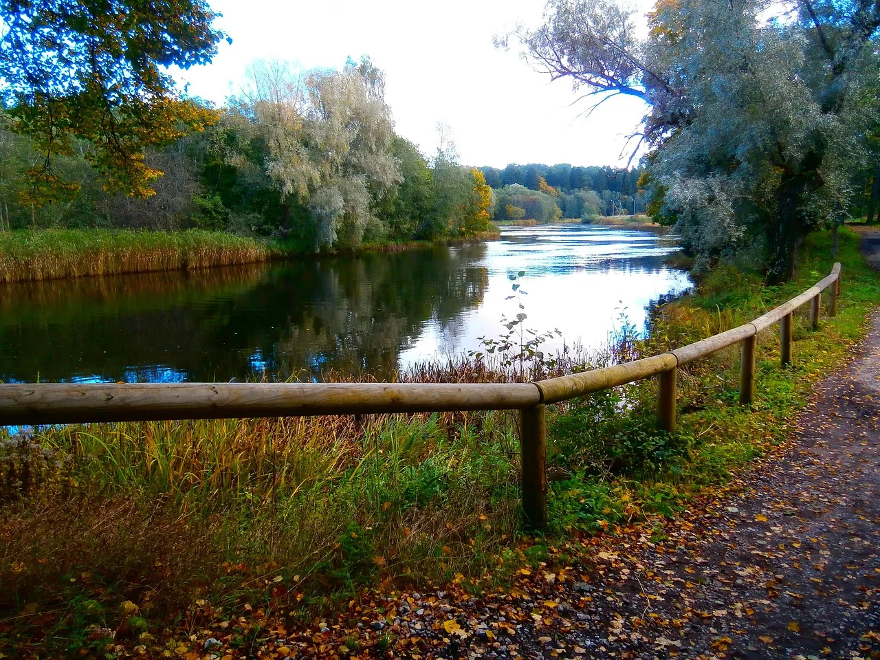
The Forest Tracks Stay Lit After Dark
Tallinn provides a Nordic running landscape without requiring a long journey into the countryside. Pirita combines riverbank paths, pine forest, beach and established health tracks only a short ride from the old town. The Pirita Great Circle is 7.2 kilometres, assembled from several sections of the local health-track network, free to use and illuminated until 11 p.m. — especially useful during the shorter days of spring and autumn.
The distance can be reduced by using one of the shorter Lillepi Park tracks, a better first choice when arriving late, running with children or learning how the local surface behaves after rain.
Why It Works, and the Catch
The route feels like a proper forest run, yet buses, sports facilities and the coast remain close. Tallinn also provides low-gradient alternatives for runners who want natural ground without an Alpine profile.
05 · Innsbruck · AustriaInnsbruck

The Gorge Begins Before the City Ends
Innsbruck can move a runner from pavement to high Alpine terrain faster than almost any European city. That speed is an advantage only when the first route remains deliberately low. The Sill Gorge Trail is the conservative introduction: 6 kilometres with about 197 metres of ascent, passing bridges, viewing platforms and the river gorge close to the centre. It is part of the Innsbruck Alpine Trailrun Festival network, but does not require festival fitness.
The official time of roughly forty minutes reflects running rather than sightseeing. A new trail runner should allow longer, walk steeper or uneven sections and stop where the path becomes busy or narrow.
Why It Works, and the Catch
The route provides real trail texture and a sense of enclosure without beginning at a remote lift station. Innsbruck also has lower running routes along the Inn and additional forest options, so poor visibility above the city does not end the running day.
06 · Ljubljana · SloveniaLjubljana

A Forest Hill From the End of Tivoli Park
Ljubljana places wooded hills inside the city rather than around it. Tivoli Park leads directly toward Rožnik and Šišenski hrib, where a dense network of broad gravel roads and narrower forest paths is used daily by walkers and runners. The official Tivoli-to-Rožnik route covers about 2.7 kilometres, gains 94 metres and is rated easy, beginning near Tivoli Castle, climbing gently on a broad macadam path and reaching Cankarjev vrh at 394 metres.
For a first trail run, go out and back on the broad route. On another day, extend toward Mostec or use the wider paths across Šišenski hrib. The number of junctions makes exploration easy, but it also makes an offline map useful.
Why It Works, and the Catch
The trail is close enough for a run before breakfast, but the canopy quickly hides most of the city. Cafés, public transport and the centre remain within walking distance, making Ljubljana one of the easiest bases in Europe for combining trail running with an ordinary city break.
07 · Girona · SpainGirona
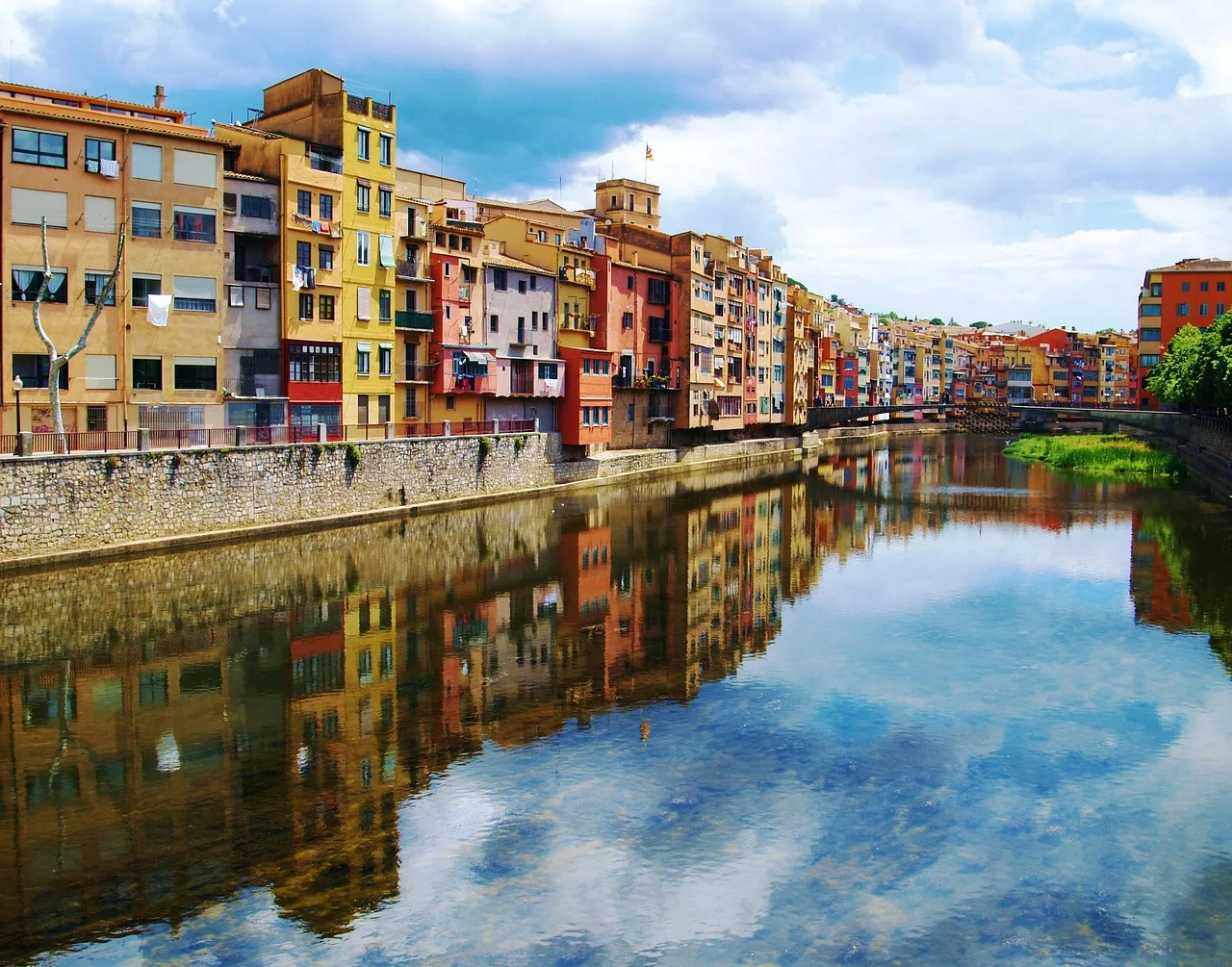
Old Stone, Oak Forest and a Long Running Season
Girona is famous for cycling, but the same geography creates a strong running base. The old town opens toward the Sant Daniel Valley and the Gavarres Massif, while flat greenways and riverside parks provide an easier first day. Use La Devesa, the Ribes del Ter and a short out-and-back on the Girona greenway for the first run — broad, non-motorised old railway corridors that are easy to follow after travel or before entering rougher terrain.
The Sant Miquel route leaves close to the historic centre, follows the Galligants River through the Sant Daniel Valley and climbs into the protected Gavarres landscape toward the remains of Sant Miquel Castle: city walls and cafés at one end, oak forest and a real climb at the other.
Why It Works, and the Catch
The contrast between the flat greenway and the Gavarres climb is what best explains why Girona works as a base for a full running holiday, not just a single route.
08 · Cascais · PortugalCascais

The Atlantic Is the Warm-Up
Cascais is not a pure trail-running town in the way Åre or Innsbruck is. Its advantage is progression: a runner can begin beside the marina on an easy coastal path, reach the edge of the Sintra-Cascais Natural Park and use a second day for forest and farm tracks farther inland. The path from Cascais Marina to Guincho Beach is approximately 8.8 kilometres, suitable for walking, jogging, cycling and skating, with a taxi or bus returning from Guincho if the wind is unfavourable.
For natural ground, move to Quinta do Pisão inside the Sintra-Cascais Natural Park, where walking and cycling trails cross fields, woodland and meadows in a managed landscape — a safer introduction than improvising on exposed cliffs or obscure forest tracks.
Why It Works, and the Catch
Cascais gives European runners a mild-season alternative when northern paths are dark, snowy or saturated. The town also makes rest days easy, which matters more on a running holiday than a perfectly isolated trailhead.
09 · Annecy · FranceAnnecy
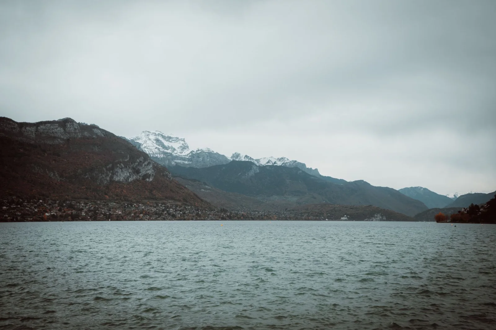
From the Tourist Office Into the Forest
Annecy is often reduced to the lake promenade or the high mountains that surround it. The useful trail-running base lies between those two extremes: wooded slopes that begin in town and provide real elevation without requiring a summit. The Annecy–Les Puisots–Annecy loop begins at the tourist office and covers 11 kilometres, rated medium, mainly woodland and accessible year-round when weather permits, with a short detour reaching a viewpoint over the lake.
For runners, the route is long enough to feel like a trail day but close enough to town that it does not need race equipment. Walk the steeper climbs, carry water because the route has no water points and use the official signs rather than creating a shorter line through the forest.
Why It Works, and the Catch
The run starts without a lift, rental car or early transfer. Annecy also offers a flat lakeside option for recovery, so the same base supports both a woodland trail and an easy second day.
10 · Freiburg · GermanyFreiburg

The Black Forest Begins Behind the City Gate
Freiburg sits where the Rhine plain meets the first wooded slopes of the Black Forest. From the old town, Schwabentor and Stadtgarten lead directly toward the Schlossberg, where a signed network of forest paths climbs above the cathedral. The Schlossberg Fortress Tour covers 4.6 kilometres with about 182 metres of ascent and descent, beginning in the Stadtgarten, climbing on forest paths past former fortifications and reaching the Schlossberg tower before returning toward the city.
New trail runners can begin with the shorter 2.4-kilometre Mez'sche Adventure Loop, which gains about 88 metres. The longer fortress route is the better explanation of the base, but the shorter loop provides an honest test of the immediate climbing.
Why It Works, and the Catch
The transition from city to trail is almost literal. A run can start near the old town, enter dense forest within minutes and finish beside cafés and public transport. Longer Black Forest routes remain available by tram, bus or regional train after the local terrain is understood.
Which Trail-Running Base Should You Choose?
For a First Trail-Running Trip
Choose Lahti, Ljubljana or Tallinn. Each provides broad tracks, simple route choices and easy ways to shorten the run. They teach surface and elevation without making remote navigation part of the lesson.
For Mountain Atmosphere Without a Summit
Choose Innsbruck, Annecy or Freiburg. The lower routes provide forest, climbing and city views while remaining below the destinations' more serious mountain terrain.
For Scandinavian Forest and Rock
Choose Stockholm for granite and lake country, Lahti for smoother ridges and Åre for the transition from village forest to open fell.
For a Longer Season
Choose Girona or Cascais. Both work well outside midsummer, when cooler temperatures make running more realistic. Heat, wind and fire restrictions still decide the exact route.
For the Strongest City Break
Ljubljana, Freiburg, Girona and Stockholm combine trail access with enough food, culture and transport to make a non-running companion or wet day feel useful.
What Makes a Good Trail-Running Town?
More Than One Route
One famous race course does not create a useful holiday base. The destination should offer a short loop, a moderate run and a lower bad-weather option.
A Start You Can Reach Without Logistics
The best routes begin on foot, by local bus or at a metro stop. A one-hour taxi transfer turns a morning run into an expedition and makes changing the plan harder.
A Clear Way Back
Loops, out-and-back routes and frequent transport reduce the consequences of fatigue. Point-to-point mountain routes are less useful for a first visit, even when their photographs are better.
A Town Worth Returning To
Trail runners still need breakfast, laundry, a pharmacy and somewhere comfortable to spend a wet afternoon. The base should work on the day when no running happens.
How to Judge a Trail Before Running It
Distance Is the Least Complete Number
Ten kilometres on smooth forest road is different from ten kilometres of wet granite, roots and repeated short climbs. Read the surface and elevation as carefully as the distance.
Elevation Gain Changes the Pace
Road-running pace is not a useful target on steep trail. Walking climbs is normal and often faster over the full route because it preserves control for the descent.
Technicality Is Not the Same as Steepness
A nearly flat trail can still be difficult when the ground is rocky, wet or crossed by roots. Conversely, a steady climb on broad gravel may be physically hard but technically simple.
Exit Points Matter
A route close to a road, town or transit stop allows a tired runner to finish safely. A trail with no escape may require more food, clothing and planning even when the distance is similar.
The Return Can Be Harder
A long descent damages tired legs and increases the chance of a fall. Save concentration for the final kilometres rather than treating the summit or viewpoint as the end of the run.
The Best Season for Trail Running in Europe
Spring
Girona, Cascais, Ljubljana and Freiburg usually become attractive before high mountain routes. Northern forest can remain wet, snowy or vulnerable to thaw damage.
Summer
Lahti, Åre, Stockholm and Tallinn benefit from long daylight. Run early in Girona and Cascais, where heat can make afternoon trails unsuitable.
Autumn
This is often the strongest general season. Temperatures fall, towns remain active and forests change colour. Wet leaves, shorter daylight and hunting notices become more relevant.
Winter
Cascais and lower Girona routes provide the most reliable running. In Scandinavia and the Alps, many trails become ski tracks, icy paths or winter terrain. Use designated running routes and local information rather than forcing a summer trail.
A First Trail Run on Holiday
- Choose a route shorter than your normal road run.
- Begin with a loop or out-and-back close to town.
- Walk climbs before breathing becomes uncontrolled.
- Slow down before wet roots, rock and wooden surfaces.
- Carry the map even when the route is marked.
- Set a turnaround time, not only a distance goal.
- Finish while the legs still feel coordinated.
- Use the second day for recovery or an easier surface.
What to Carry
- Trail shoes with grip suited to the actual surface.
- Phone with the official route and offline map downloaded.
- Small amount of water, even when the run begins in town.
- Light windproof or waterproof layer for exposed or northern routes.
- Warm layer on longer mountain-town runs outside midsummer.
- A small snack for routes lasting more than about an hour.
- Basic blister and wound care.
- Headlamp when daylight or route time is uncertain.
- Public-transport information for the nearest exit point.
- Emergency contact information for the country and region.
Trail-Running Safety: Keep the Easy Day Easy
Do Not Upgrade the Route Mid-Run
A short forest loop can meet a sign for a summit, hut or race course. Continue only when that extension was part of the plan and matches the weather, time and equipment.
Yield Before Overtaking
Shared paths belong to walkers, children, dogs and cyclists as well as runners. Slow down, announce the pass and give animals more space than seems necessary.
Protect Wet Trails
Running around mud widens paths and damages roots. Use durable surfaces, accept wet shoes and avoid soft trails during thaw or after extreme rain when local guidance recommends closure.
Heat and Cold Change the Same Route
Girona can become unsafe through heat while Åre can become unsafe through wind, cold and low cloud. Difficulty labels do not replace an hourly forecast.
A Fall Is More Likely Late in the Run
Fatigue reduces foot placement and reaction time. Shorten the stride on descents and stop chasing pace when coordination begins to fade.
Frequently Asked Questions
What Is the Best Trail-Running Destination in Europe for Beginners?
Lahti, Ljubljana and Tallinn are the easiest starting points in this guide because they offer broad tracks, modest elevation and routes that remain close to the city.
Do I Need to Be a Fast Runner?
No. Trail running includes walking climbs, stopping for navigation and adjusting pace to the surface. Time and effort are more useful than road pace.
Can Road Runners Start Trail Running on Holiday?
Yes, provided the first route is shorter and less technical than the runner's normal road distance. Broad forest tracks are a better introduction than a mountain race course.
Which Base Has the Longest Season?
Girona and Cascais provide the broadest cool-season opportunities. Summer heat and wind still require early starts and route changes.
Which Scandinavian Base Is Best?
Choose Lahti for accessible forest tracks, Stockholm for granite and lake scenery, or Åre for a true mountain-village experience with beginner options.
Are Trail-Running Routes Safe in Rain?
Some remain usable, but wet roots, rock, leaves and wooden bridges can become much more slippery. Strong rain, flooding or official warnings are reasons to change the route.
Do I Need Special Trail-Running Shoes?
Road shoes can work on dry, smooth gravel. Trail shoes become more useful on mud, wet roots, rock and steeper descents. Grip matters more than the label.
How Far Should My First Trail Run Be?
Choose roughly half to two-thirds of a comfortable road distance, or plan by time. A 45- to 60-minute outing close to town is enough for the first day.
Can I Trail Run Alone?
Yes on straightforward, well-used routes when someone knows the plan and conditions are suitable. Remote mountain routes require a larger safety margin and may be better with company or local guidance.
What Should I Do if I Get Lost?
Stop running, return to the last confirmed point and use the official map. Do not continue downhill simply because it feels easier; the descent may lead away from town.
Final Thoughts
The best trail-running towns make the transition feel ordinary.
Lahti places forest tracks behind a stadium. Åre lets a short path descend through birch woods into the village square. Stockholm and Tallinn hide granite, pine forest and health tracks behind public transport, while Innsbruck places a river gorge inside an Alpine city.
Ljubljana turns Tivoli Park into the first kilometre of a woodland run. Girona moves from old stone into the Gavarres, and Cascais uses the Atlantic path as a bridge toward the natural park. Annecy and Freiburg prove that a tourist office or city gate can be a reasonable trailhead.
Start with the route that looks almost too easy. Learn the surface, the signs and the weather. The longer trail will still be there tomorrow.