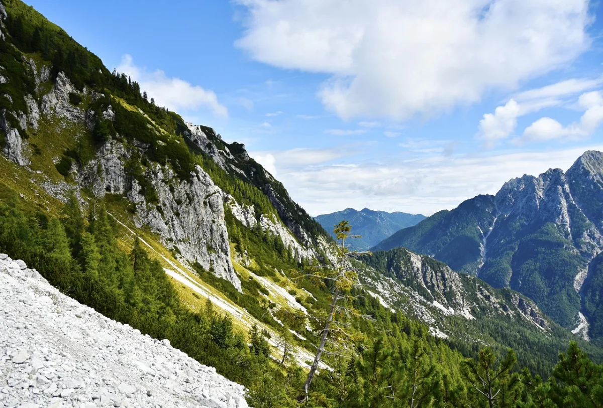
Slovenia may be small, but it offers an extraordinary variety of hiking landscapes. Within a few hours, you can walk beside an emerald river, cross a high Alpine plateau, explore a deep gorge or climb toward one of the most famous summits in the Julian Alps.
A dense network of marked trails and mountain huts makes it possible to plan everything from relaxed valley walks to exposed high-mountain routes.
This guide covers ten of the best hikes in Slovenia, including classic routes in Triglav National Park, the Soča Valley, Bohinj and the Kamnik–Savinja Alps.
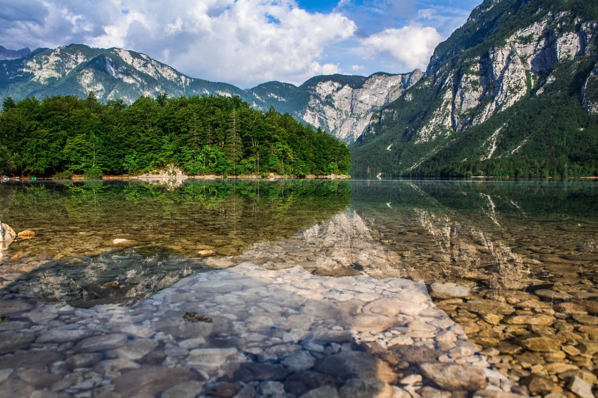
The best Slovenian hike is the one that matches your experience, the season and the mountain conditions—not simply the highest summit.
The shortlist below deliberately mixes valley paths, waterfalls, plateaus, Alpine lakes and serious high-mountain objectives. Use it to choose a landscape and level, then verify the exact route before setting out.
| Hike | Best for | Typical effort |
|---|---|---|
| Slemenova Špica | Short Alpine panorama | About 2.5–3 hours return |
| Viševnik | A first 2,000-metre summit | About 3.5–4.5 hours return |
| Seven Triglav Lakes | Classic Alpine lakes | Full day or overnight |
| Mount Triglav | Experienced mountaineers | Normally two days |
| Soča Trail | River scenery and flexible sections | Up to 25 km |
| Krn Lake | A substantial lake hike | About 5–6 hours return |
| Martuljek Waterfalls | Forest, gorge and waterfalls | About 2.5–4 hours |
| Mostnica and Voje | Families and valley walking | About 3–5 hours |
| Velika Planina | Pastoral culture and easy options | About 2–5 hours |
| Rinka and Okrešelj | Kamnik–Savinja scenery | About 2–3 hours return |
01 · VršičSlemenova Špica from Vršič Pass
Slemenova Špica is one of the most rewarding shorter hikes in the Julian Alps. The trail begins at Vršič Pass, Slovenia’s highest road pass, and quickly reaches open terrain with impressive views of the surrounding limestone peaks.
Why Hike Slemenova Špica?
The hike offers a genuine high-mountain atmosphere without requiring an extremely long ascent from the valley. From the grassy area below the summit, hikers can enjoy memorable views toward Jalovec, Mojstrovka, the Ponce mountain group, Planica and the Tamar Valley.
The combination of accessible starting elevation, open Alpine scenery and a relatively manageable route makes Slemenova Špica an excellent introduction to hiking in the Julian Alps.
- Starting point: Vršič Pass
- Walking time: Approximately 2.5–3 hours return
- Difficulty: Moderate
- Best for: Panoramic views and a shorter Alpine hike
- Best season: Late spring to autumn, depending on snow conditions
The first section climbs relatively steeply toward the junction for Mala Mojstrovka. The path then becomes gentler as it crosses forest, dwarf pine and open mountain terrain.
What to Expect
The summit itself is not the only highlight. The broad grassy area below Slemenova Špica is one of the most photogenic locations in this part of Slovenia.
Although the route is often described as suitable for families, it remains a mountain trail. Proper hiking shoes, suitable clothing and careful supervision of children are essential.
Official Slemenova Špica overview ↗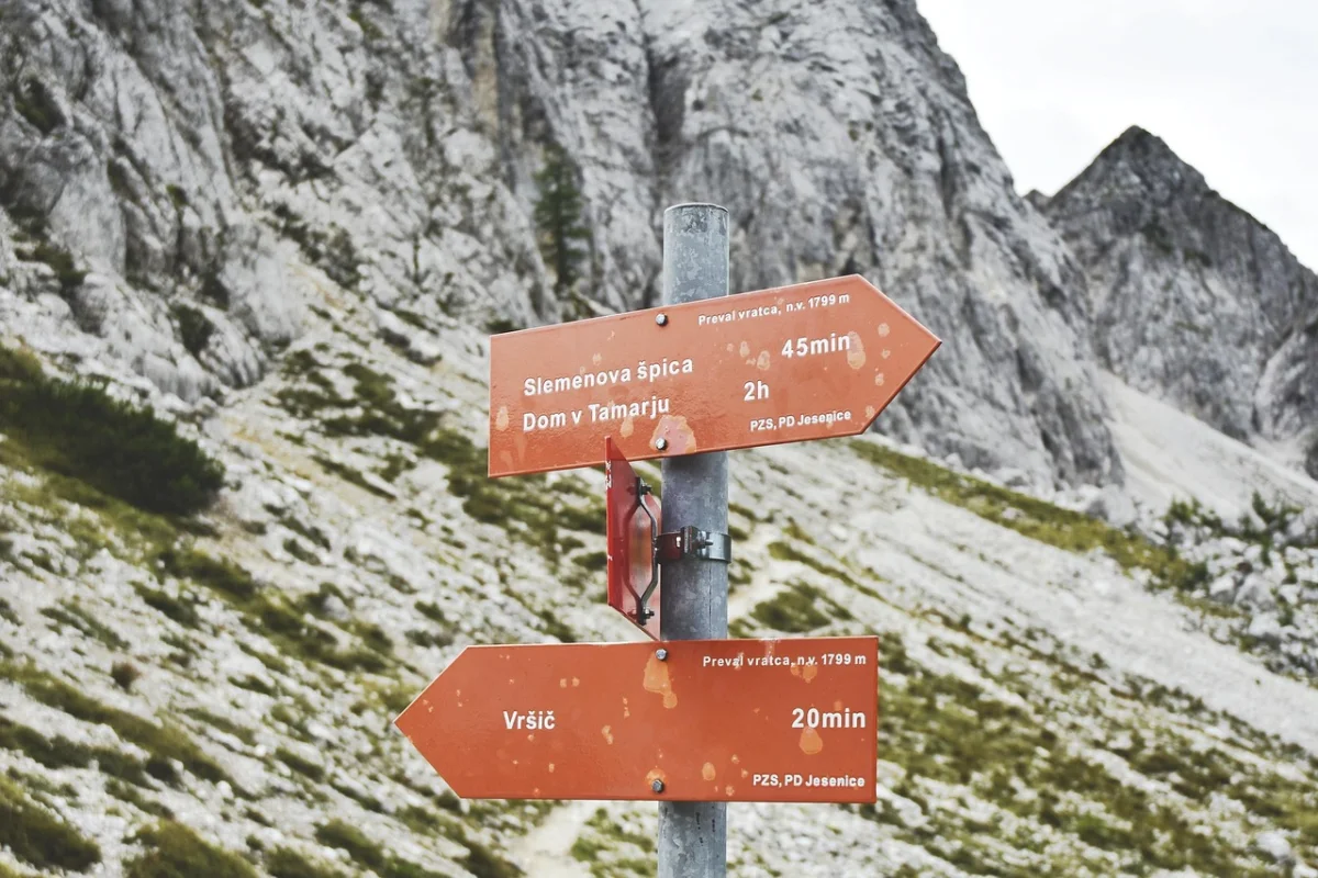
02 · PokljukaViševnik from Rudno Polje
Viševnik is a popular choice for hikers who want to climb above 2,000 metres without attempting one of Slovenia’s most technically demanding mountains.
The hike begins at Rudno Polje on the Pokljuka Plateau, one of the main gateways to the high Julian Alps. Pokljuka is also an important starting area for routes toward Lipanca, Debela Peč and Triglav.
Why Hike Viševnik?
Viševnik provides a satisfying summit experience within a half-day hike. As you climb above the forest, views gradually open across Pokljuka, Bohinj and the central Julian Alps.
From the upper slopes and summit area, Triglav dominates the skyline. The hike is particularly attractive for visitors who already have some mountain experience but are not ready for protected climbing routes.
- Starting point: Rudno Polje, Pokljuka
- Walking time: Approximately 3.5–4.5 hours return
- Difficulty: Moderate
- Best for: A first summit above 2,000 metres
- Best season: Summer and early autumn
The ascent is sustained and can feel steep, especially in warm weather. However, the standard summer trail does not normally require specialised climbing equipment in dry conditions.
What to Expect
The lower route passes through forest and former ski terrain before reaching increasingly open slopes. The final section follows a mountain ridge toward the summit.
Viševnik is popular, so starting early provides a quieter experience and a better chance of finding parking at Rudno Polje.
Official Viševnik and Triglav guidance ↗03 · BohinjValley of the Seven Triglav Lakes
The Valley of the Seven Triglav Lakes is one of Slovenia’s most celebrated high-mountain landscapes. It combines forests, rocky terrain, mountain huts and a chain of glacial lakes beneath the peaks of the Julian Alps.
Why Hike the Seven Lakes Valley?
This is the classic choice for hikers looking for a full-day or overnight journey into Triglav National Park.
The landscape changes continuously. Lower sections pass through forest and Alpine pastures, while the upper valley becomes increasingly rocky and dramatic. Depending on the route, reaching the central part of the valley usually takes around five hours.
Choosing a Route
Several routes lead into the valley.
A popular approach begins above Stara Fužina and passes through the Bohinj mountain pastures. Another route starts near Savica Waterfall and approaches through Komna. The best option depends on your experience, available time and transport arrangements.
- Starting points: Planina Blato area, Stara Fužina, Savica or Komna
- Walking time: Full-day hike or two-day trip
- Difficulty: Moderate to challenging
- Best for: Alpine lakes and a classic Julian Alps experience
- Best season: Summer and early autumn
What to Expect
Many hikers walk only as far as the Double Lake and the nearby mountain hut. Stronger hikers can continue deeper into the valley, but the additional distance and elevation should not be underestimated.
An overnight stay allows you to explore the area at a slower pace. Accommodation in mountain huts should be arranged in advance during the busiest summer weeks.
Official Seven Triglav Lakes information ↗04 · Julian AlpsMount Triglav
At 2,864 metres, Triglav is Slovenia’s highest mountain and the country’s most symbolic summit. Climbing it is a major mountaineering objective rather than an ordinary day hike.
Why Climb Triglav?
Triglav stands at the centre of Slovenia’s Alpine identity. Reaching the summit offers enormous views across the Julian Alps and, in clear conditions, far beyond Slovenia’s borders.
However, popularity should not be confused with simplicity. The final ascent is exposed, protected with steel cables and classified as very difficult.
Official guidance states that routes to Triglav are demanding or very demanding. The final section from Kredarica requires appropriate mountaineering equipment, including a helmet, harness and self-belaying set. Most approaches require at least six hours of walking in each direction.
- Common starting areas: Krma Valley, Pokljuka, Bohinj and Vrata Valley
- Recommended duration: Two days
- Difficulty: Very difficult
- Best for: Experienced and properly equipped mountaineers
- Best season: Stable summer conditions
What to Expect
Most hikers divide the ascent over two days and spend the night in a mountain hut. The second day includes the protected and exposed climb to the summit, followed by a long descent.
Anyone without experience using a via ferrata set should consider hiring a licensed mountain guide. Triglav is not a suitable first high-mountain hike.
05 · TrentaThe Soča Trail
The Soča Trail follows one of Europe’s most recognisable Alpine rivers through the Trenta Valley and Triglav National Park.
Instead of focusing on a summit, this route leads hikers through forests, across suspension bridges and beside the turquoise pools and rocky gorges of the Soča River.
Why Hike the Soča Trail?
This is one of the best hikes in Slovenia for visitors who prefer rivers and valleys to exposed mountain ridges.
The complete trail is approximately 25 kilometres long and connects the upper Soča Valley with the Bovec area. It can be completed as a long one-way hike or divided into shorter sections.
- Starting area: Source of the Soča or Trenta
- Finishing area: Bovec
- Walking time: Full day for the complete route
- Difficulty: Easy to moderate
- Best for: River scenery, bridges and flexible day hikes
- Best season: Spring to autumn
What to Expect
The trail passes through some of the most attractive scenery in the Soča Valley. Expect clear pools, white limestone, narrow river channels and constant views toward the surrounding mountains.
You do not need to walk the entire trail. Shorter sections around Trenta, the Great Soča Gorge or the Lepena junction provide excellent alternatives.
Some viewpoints beside the gorges can become slippery in wet, cold or icy conditions. Exposed areas should be approached cautiously.
Official Triglav National Park Soča Trail guide ↗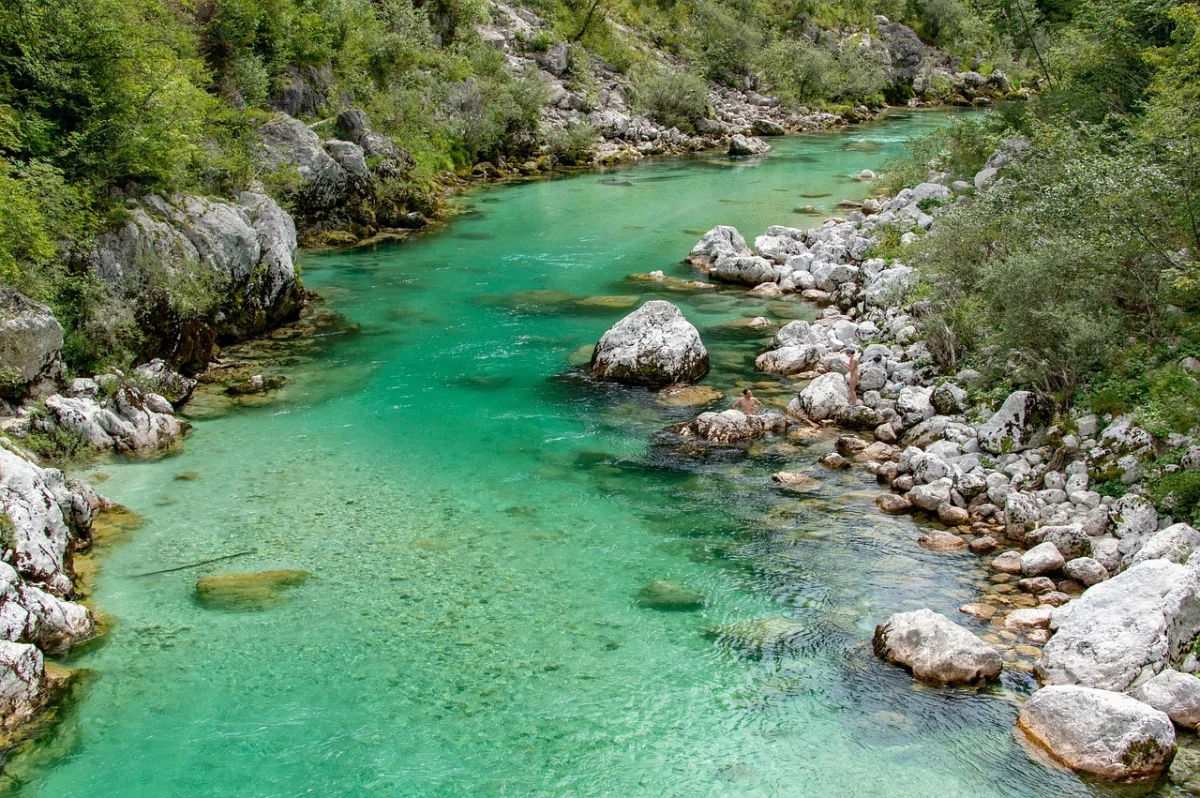
06 · LepenaKrn Lake from Lepena Valley
Krn Lake is the largest high-mountain lake in the Julian Alps and one of the finest hiking destinations in the Soča Valley.
The standard route begins at the upper end of the peaceful Lepena Valley and climbs through forest toward the mountain hut and lake.
Why Hike to Krn Lake?
The route provides access to a beautiful Alpine lake without requiring exposed climbing. It is therefore a good option for hikers who want a substantial mountain day but prefer to avoid difficult protected sections.
The official route from the Dr. Klement Jug mountain hut in Lepena takes approximately two and a half hours in one direction. It gains around 691 metres and is classified as an easy marked mountain trail.
- Starting point: Dom dr. Klementa Juga, Lepena
- Walking time: Approximately 5–6 hours return
- Difficulty: Moderate due to length and elevation
- Best for: Alpine lake scenery
- Best season: Late spring to autumn, depending on snow
What to Expect
Much of the ascent passes through forest, making it a reasonable option on warmer days. Near the hut, the landscape opens and the route continues toward the lake beneath the slopes of Krn.
The lake lies in a protected Alpine environment. Swimming, camping and leaving marked trails should be avoided.
Experienced hikers can continue toward Mount Krn, but this transforms the outing into a much longer and more demanding mountain tour.
Official Slovenia lake overview ↗07 · Kranjska GoraMartuljek Waterfalls
The Martuljek Waterfalls rise beneath the dramatic Špik mountain group near Gozd Martuljek. The route combines a forest walk, a narrow gorge, wooden bridges and views of one of the most impressive mountain walls in Slovenia.
Why Hike to the Martuljek Waterfalls?
Few short hikes offer such a varied landscape. The first section follows the Martuljek stream through a shaded gorge before climbing toward the first waterfall and the Jasenje Alpine pasture.
The official route can begin near the Gozd Martuljek bus stop or from the parking area near the village. It crosses several small bridges and continues through the gorge toward the first waterfall.
- Starting point: Gozd Martuljek
- Walking time: Approximately 2.5–4 hours, depending on the route
- Difficulty: Moderate
- Best for: Waterfalls, forest and gorge scenery
- Best season: Late spring to autumn
First or Second Waterfall?
The first Martuljek Waterfall is the more accessible destination and can be combined with a stop at the Jasenje Alpine pasture.
The route toward the upper waterfall is considerably more demanding. Official local information warns that the final approach is suitable only for properly equipped mountaineers.
Do not continue beyond your ability level simply because the lower part of the hike felt easy.
Official Martuljek Waterfalls information ↗08 · BohinjMostnica Gorge and Voje Valley
The route through Mostnica Gorge and the Voje Valley is one of the best hikes near Lake Bohinj. It is suitable for visitors who want a longer nature walk without climbing into exposed high-mountain terrain.
Why Hike Through Mostnica Gorge?
The trail follows a clear mountain stream past narrow rock formations, pools and small waterfalls. It then climbs toward the Voje mountain hut and continues through a peaceful Alpine valley.
The complete walk from Stara Fužina to the waterfall at the end of Voje Valley takes approximately two and a half hours in one direction. The route is well marked and classified as easy to moderate.
- Starting point: Stara Fužina
- Walking time: Approximately 3 hours for the gorge or 5 hours for the longer route
- Difficulty: Easy to moderate
- Best for: Families, gorges and valley scenery
- Best season: Spring to autumn
What to Expect
The shorter option explores Mostnica Gorge and returns from the Voje mountain hut. The longer option continues through meadows and forest to the waterfall at the end of the valley.
There are a few short climbs, but the route is significantly less demanding than the high-mountain trails above Bohinj.
Stay on the marked path, especially around the gorge, where wet rocks and steep edges require attention.
Official Mostnica Gorge and Voje guide ↗09 · KamnikVelika Planina
Velika Planina is one of Slovenia’s most distinctive cultural landscapes. The broad mountain plateau is known for traditional herdsmen’s huts, rolling pastures and views across the Kamnik–Savinja Alps.
Why Hike on Velika Planina?
Velika Planina combines hiking with local history and pastoral culture. Instead of following a single fixed route, visitors can create walks of different lengths across the plateau.
The easiest access is by cable car from Kamniška Bistrica, followed by a chairlift or an uphill walk. Marked hiking paths also reach the plateau from several lower starting points.
- Starting options: Cable car station, Stahovica, Kranjski Rak or nearby mountain roads
- Walking time: Approximately 2–5 hours
- Difficulty: Easy to moderate
- Best for: Culture, families and open mountain scenery
- Best season: Late spring to autumn
What to Expect
The traditional settlement is the main attraction, but the surrounding trails are equally enjoyable. Paths cross open grassland, pass small chapels and connect several huts and viewpoints.
A marked heritage trail around the plateau is approximately 6.7 kilometres long and takes a little over two hours, although many visitors spend much longer exploring the area.
Velika Planina is an active grazing area. Respect private huts, close gates and keep dogs under control near livestock.
Official Velika Planina overview ↗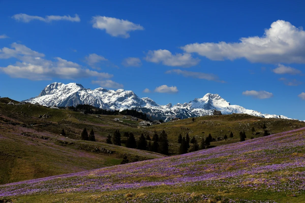
10 · Logar ValleyRinka Waterfall and Okrešelj
The hike from Rinka Waterfall to Okrešelj introduces visitors to the wild scenery of the Kamnik–Savinja Alps.
It begins at the end of the Logar Valley, passes one of Slovenia’s highest free-falling waterfalls and climbs into a spectacular glacial cirque surrounded by steep mountain walls.
Why Hike to Okrešelj?
The route is relatively short but feels distinctly Alpine. After visiting Rinka Waterfall, the path climbs through forest and beside the young Savinja River toward Okrešelj.
A marked trail leads from the parking area near the waterfall to the mountain hut at Okrešelj in approximately one hour. The standard approach is classified as an easy mountain trail.
- Starting point: Rinka Waterfall parking area
- Walking time: Approximately 2–3 hours return
- Difficulty: Easy to moderate
- Best for: Waterfalls and Kamnik–Savinja Alps scenery
- Best season: Late spring to autumn
What to Expect
The trail becomes steeper after the waterfall but remains manageable for reasonably fit hikers in dry summer conditions.
Okrešelj itself is worth exploring slowly. More difficult routes continue toward peaks such as Brana, Turska Gora, Skuta and the Rinkas, but these are serious mountaineering objectives and should not be added casually to the basic hike.
Official Logar Valley waterfall information ↗Best Time for Hiking in Slovenia
The best hiking season depends on elevation.
Spring
Lower valleys, gorges and waterfall trails are often excellent in spring. Water levels are usually higher, forests are green and temperatures are comfortable.
Snow can remain in the high mountains well into late spring or early summer. High-altitude routes may still require winter equipment even when conditions in the valleys feel warm.
Summer
Summer provides the widest selection of open trails and operating mountain huts. It is the main season for routes such as the Seven Lakes Valley, Viševnik and Triglav.
Begin early to avoid afternoon heat, crowds and thunderstorms.
Autumn
Early autumn can provide stable weather, clear views and quieter trails. Shorter days and colder mornings must be considered when planning longer hikes.
Winter
Winter hiking in the Slovenian Alps requires additional knowledge and equipment. Trails that are moderate in summer can become technically demanding or exposed to avalanche danger.
Official safety guidance warns that mountain weather can change rapidly and that winter conditions at higher elevations can continue into June or appear again surprisingly early in autumn.
Essential Hiking Safety in Slovenia
Slovenia’s mountains are compact but should never be underestimated. Deep valleys often create ascents of more than 1,000 vertical metres, while the limestone terrain can be loose and unpredictable.
Before starting a hike:
- Check the current mountain weather forecast.
- Check trail conditions and closures.
- Choose a route appropriate for your experience.
- Wear proper hiking footwear.
- Carry water, food and an extra warm layer.
- Start longer hikes early.
- Turn back when conditions deteriorate.
- Use a helmet and climbing equipment on protected routes.
- Consider hiring a licensed guide for Triglav and other exposed ascents.
Slovenian mountain trails are officially divided into easy, difficult and very difficult categories. Difficult trails may require the use of hands and a helmet. Very difficult trails require a helmet, climbing harness and self-belaying set.
Frequently Asked Questions
What Is the Most Beautiful Hike in Slovenia?
The answer depends on the type of landscape you prefer. Slemenova Špica offers some of the best views for a relatively short hike, while the Valley of the Seven Triglav Lakes provides the most complete high-mountain experience.
For river scenery, the Soča Trail is difficult to beat.
What Is the Best Easy Hike in Slovenia?
Velika Planina is one of the best options for an easier Alpine day, especially when using the cable car.
Mostnica Gorge, the lower Martuljek route and shorter sections of the Soča Trail are also suitable for less experienced hikers.
Can Beginners Climb Triglav?
The final ascent of Triglav is not suitable for complete beginners travelling independently. It is exposed, protected with steel cables and requires specialised equipment.
Beginners determined to climb Triglav should train in advance and complete the route with a licensed mountain guide.
Are Slovenia’s Hiking Trails Well Marked?
Most established mountain routes are marked with red-and-white trail symbols. Long-distance routes such as the Juliana Trail also have their own signs and route information.
The Juliana Trail forms a 270-kilometre circuit around the Julian Alps and is divided into 16 main stages averaging approximately 17.5 kilometres.
Navigation should still include a reliable map or offline route. Phone signal and battery life should never be treated as guaranteed.
How Many Days Do You Need for Hiking in Slovenia?
Three to five days are enough to experience several different regions.
A good itinerary could include:
- One hike around Kranjska Gora or Vršič
- One day in the Soča Valley
- One hike near Bohinj
- One day on Velika Planina or in the Logar Valley
A week allows time for weather changes and at least one longer high-mountain route.
Final Thoughts
The best hikes in Slovenia are not limited to its highest summits. Some of the country’s most memorable experiences take place beside rivers, inside forested gorges, across Alpine pastures and beneath dramatic mountain walls.
Slemenova Špica and Viševnik provide accessible summit experiences. The Seven Lakes Valley represents classic Julian Alps hiking, while the Soča Trail and Krn Lake reveal the quieter side of western Slovenia. Velika Planina and the Logar Valley demonstrate that the landscapes beyond Triglav National Park can be equally impressive.
Choose routes that match your experience, check current conditions and leave enough time to enjoy the landscape. In Slovenia, even a relatively short trail can lead into a landscape that feels far larger and wilder than expected.